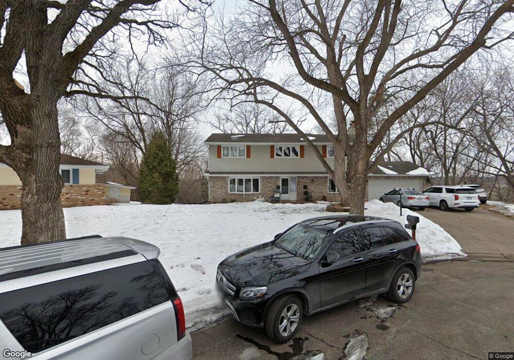
10911 River Ct Burnsville, MN 55337
Estimated Value: $434,025 - $448,000
5
Beds
4
Baths
2,672
Sq Ft
$166/Sq Ft
Est. Value
About This Home
This home is located at 10911 River Ct, Burnsville, MN 55337 and is currently estimated at $443,256, approximately $165 per square foot. 10911 River Ct is a home located in Dakota County with nearby schools including Burnsville High School, Gateway STEM Academy, and Sunrise International Montessori School.
Ownership History
Date
Name
Owned For
Owner Type
Purchase Details
Closed on
Jan 3, 2022
Sold by
Bello Anthony Akinyemi and Bello Brooke Alexandra
Bought by
Bello Anthony Akinyemi and Bello Brooke Alexandra
Current Estimated Value
Home Financials for this Owner
Home Financials are based on the most recent Mortgage that was taken out on this home.
Original Mortgage
$359,958
Outstanding Balance
$331,746
Interest Rate
3.11%
Mortgage Type
VA
Estimated Equity
$111,510
Purchase Details
Closed on
Oct 28, 2016
Sold by
Brakemeier Darrick P and Brakemeier Tracy L
Bought by
Bello Anthony Akinyemi
Home Financials for this Owner
Home Financials are based on the most recent Mortgage that was taken out on this home.
Original Mortgage
$286,000
Interest Rate
3.42%
Mortgage Type
VA
Create a Home Valuation Report for This Property
The Home Valuation Report is an in-depth analysis detailing your home's value as well as a comparison with similar homes in the area
Home Values in the Area
Average Home Value in this Area
Purchase History
| Date | Buyer | Sale Price | Title Company |
|---|---|---|---|
| Bello Anthony Akinyemi | -- | Ancona Title & Escrow | |
| Bello Anthony Akinyemi | $286,000 | Trademark Title Services Inc |
Source: Public Records
Mortgage History
| Date | Status | Borrower | Loan Amount |
|---|---|---|---|
| Open | Bello Anthony Akinyemi | $359,958 | |
| Closed | Bello Anthony Akinyemi | $286,000 |
Source: Public Records
Tax History Compared to Growth
Tax History
| Year | Tax Paid | Tax Assessment Tax Assessment Total Assessment is a certain percentage of the fair market value that is determined by local assessors to be the total taxable value of land and additions on the property. | Land | Improvement |
|---|---|---|---|---|
| 2024 | $4,678 | $447,700 | $96,400 | $351,300 |
| 2023 | $4,678 | $441,600 | $96,500 | $345,100 |
| 2022 | $3,912 | $429,700 | $96,300 | $333,400 |
| 2021 | $3,854 | $365,100 | $83,700 | $281,400 |
| 2020 | $3,834 | $342,500 | $79,500 | $263,000 |
| 2019 | $3,592 | $329,400 | $75,700 | $253,700 |
| 2018 | $3,550 | $295,900 | $72,100 | $223,800 |
| 2017 | $3,355 | $284,600 | $68,600 | $216,000 |
| 2016 | $3,510 | $266,000 | $65,400 | $200,600 |
| 2015 | $3,302 | $253,681 | $60,355 | $193,326 |
| 2014 | -- | $249,212 | $59,079 | $190,133 |
| 2013 | -- | $228,938 | $53,438 | $175,500 |
Source: Public Records
Map
Nearby Homes
- 11115 Carver Ct
- 2001 Woods Ln
- 11017 27th Ave S
- 11311 W River Hills Dr
- 11036 27th Ave S
- 2329 Explorer Ct
- 1601 Raleigh Dr
- 3108 Foxpoint Cir
- 10934 Southview Dr
- 3113 Chandler Ct
- 4165 Old Sibley Hwy
- 2247 Liberty Ln
- 11459 Galtier Dr
- 3017 Mcleod St
- 10325 10th Avenue Cir S
- 2177 Cool Stream Cir
- 2200 Horizon Rd
- 4413 Slater Rd
- 1800 Riverwood Dr Unit 110
- 1800 Riverwood Dr Unit 323
- 10913 River Ct
- 10909 River Ct
- 10915 Territorial Dr
- 10907 River Ct
- 10917 Territorial Dr
- 10903 River Ct
- 10905 River Ct
- 10904 Territorial Dr
- 10908 Territorial Dr
- 10919 Territorial Dr
- 10900 Radisson Dr
- 10912 Territorial Dr
- 10905 Radisson Dr
- 10916 Territorial Dr
- 10921 Territorial Dr
- 10902 Dakota Ct
- 10904 Dakota Ct
- 10909 Radisson Dr
- 10908 Dakota Ct
- 10906 Dakota Ct