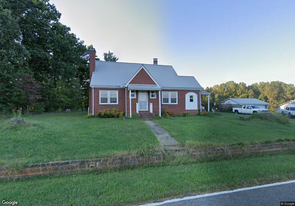
1092 Norman Rd Mount Airy, NC 27030
Estimated Value: $263,000 - $322,000
3
Beds
1
Bath
1,832
Sq Ft
$155/Sq Ft
Est. Value
About This Home
This home is located at 1092 Norman Rd, Mount Airy, NC 27030 and is currently estimated at $283,382, approximately $154 per square foot. 1092 Norman Rd is a home with nearby schools including Westfield Elementary School, Pilot Mountain Middle School, and East Surry High School.
Ownership History
Date
Name
Owned For
Owner Type
Purchase Details
Closed on
Apr 30, 2013
Sold by
Howes Robin D
Bought by
Howes Lois G
Current Estimated Value
Purchase Details
Closed on
Feb 2, 2010
Sold by
Chilton Mitchell Grey and Chilton Kristina F
Bought by
Howes Robin D and Howes Lois G
Purchase Details
Closed on
Jan 1, 1997
Purchase Details
Closed on
Jan 1, 1951
Create a Home Valuation Report for This Property
The Home Valuation Report is an in-depth analysis detailing your home's value as well as a comparison with similar homes in the area
Home Values in the Area
Average Home Value in this Area
Purchase History
| Date | Buyer | Sale Price | Title Company |
|---|---|---|---|
| Howes Lois G | -- | None Available | |
| Howes Robin D | $138,500 | Chicago Title Insurance Comp | |
| -- | -- | -- | |
| -- | -- | -- |
Source: Public Records
Tax History Compared to Growth
Tax History
| Year | Tax Paid | Tax Assessment Tax Assessment Total Assessment is a certain percentage of the fair market value that is determined by local assessors to be the total taxable value of land and additions on the property. | Land | Improvement |
|---|---|---|---|---|
| 2025 | $1,167 | $189,400 | $27,330 | $162,070 |
| 2024 | $1,038 | $152,010 | $28,730 | $123,280 |
| 2023 | $1,021 | $152,010 | $28,730 | $123,280 |
| 2022 | $1,021 | $152,010 | $28,730 | $123,280 |
| 2021 | $986 | $144,030 | $28,730 | $115,300 |
| 2020 | $947 | $133,760 | $28,730 | $105,030 |
| 2019 | $944 | $133,760 | $0 | $0 |
| 2018 | $908 | $133,760 | $0 | $0 |
| 2017 | $894 | $133,760 | $0 | $0 |
| 2016 | $894 | $133,760 | $0 | $0 |
| 2013 | -- | $127,230 | $0 | $0 |
Source: Public Records
Map
Nearby Homes
- 733 Slate Mountain Rd
- 140 Daniels Dell Ln
- 0 Norman Rd
- 7.8ac Norman Rd
- 107 Cory Trail
- Lot 4,5,6 Sideview Ln
- 00 Blue Hollow Rd Unit 5
- 583 Snody Rd
- 0 Blue Hollow Rd Unit 33 1176021
- 0 Blue Hollow Rd Unit 23105199
- 000 Blue Hollow Rd Unit 27
- 731 Indian Grove Church Rd
- 00 Albion Church Rd
- 1305 Brim Rd
- 759 Cameron Ln
- 0 NE Pine St
- Lot 5 Howell Rd
- 1507 Rogers Rd
- 1970 Mcbride Rd
- 200 Englewood Trail
- 1041 Norman Rd
- 1041 Norman Rd
- 1041 Norman Rd
- 600 Slate Mountain Rd
- 947 Norman Rd
- 711 Slate Mountain Rd
- 772 Slate Mountain Rd
- 999 Norman Rd
- 110 Bear Paw Trail
- 743 Slate Mountain Rd
- 935 NW Norman Rd Unit 935
- 935 Norman Rd
- 140 Bear Paw Trail
- 920 Norman Rd
- 485 Slate Mountain Rd
- 800 Slate Mountain Rd
- 714 Norman Rd
- 372 Slate Mountain Rd
- 854 Slate Mountain Rd
- 868 Slate Mountain Rd