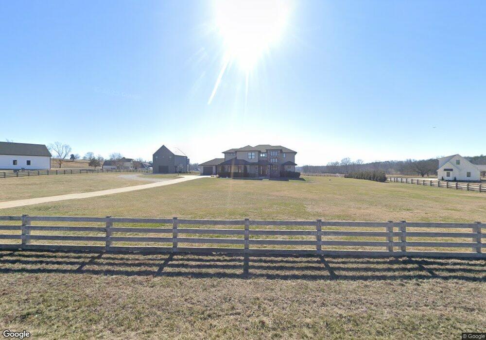
10929 Mill Dam Rd Bentonville, AR 72713
Estimated Value: $694,000 - $1,363,000
--
Bed
2
Baths
4,834
Sq Ft
$235/Sq Ft
Est. Value
About This Home
This home is located at 10929 Mill Dam Rd, Bentonville, AR 72713 and is currently estimated at $1,137,756, approximately $235 per square foot. 10929 Mill Dam Rd is a home with nearby schools including Evening Star Elementary School, Creekside Middle School, and Grimsley Junior High School.
Ownership History
Date
Name
Owned For
Owner Type
Purchase Details
Closed on
Apr 5, 2021
Sold by
Epps Jason Matthew and Epps Jessica Lynn
Bought by
Epps Jessica Lynn and Epps Jason Matthew
Current Estimated Value
Home Financials for this Owner
Home Financials are based on the most recent Mortgage that was taken out on this home.
Original Mortgage
$762,850
Interest Rate
2.9%
Mortgage Type
New Conventional
Purchase Details
Closed on
May 11, 2018
Sold by
Epps Jason Matthew and Epps Jessica Lynn
Bought by
Jessica Lynn Epps And Jason Matthew Epps Livi and Epps
Create a Home Valuation Report for This Property
The Home Valuation Report is an in-depth analysis detailing your home's value as well as a comparison with similar homes in the area
Home Values in the Area
Average Home Value in this Area
Purchase History
| Date | Buyer | Sale Price | Title Company |
|---|---|---|---|
| Epps Jessica Lynn | -- | Amrock Inc | |
| Epps Jason Matw | -- | Amrock | |
| Jessica Lynn Epps And Jason Matthew Epps Livi | -- | Amrock |
Source: Public Records
Mortgage History
| Date | Status | Borrower | Loan Amount |
|---|---|---|---|
| Previous Owner | Epps Jason Matw | $762,850 |
Source: Public Records
Tax History Compared to Growth
Tax History
| Year | Tax Paid | Tax Assessment Tax Assessment Total Assessment is a certain percentage of the fair market value that is determined by local assessors to be the total taxable value of land and additions on the property. | Land | Improvement |
|---|---|---|---|---|
| 2025 | $10,860 | $221,802 | $67,200 | $154,602 |
| 2024 | $10,414 | $221,802 | $67,200 | $154,602 |
| 2023 | $9,969 | $189,270 | $21,960 | $167,310 |
| 2022 | $9,347 | $189,270 | $21,960 | $167,310 |
| 2021 | $8,827 | $189,270 | $21,960 | $167,310 |
| 2020 | $8,798 | $138,120 | $22,000 | $116,120 |
| 2019 | $1,401 | $22,000 | $22,000 | $0 |
| 2018 | $0 | $0 | $0 | $0 |
Source: Public Records
Map
Nearby Homes
- 11134 Mill Dam Rd
- 10912 Cooperage Dr
- 0 Phillips Cemetary
- 0 Phillips Cemetary Unit 1307926
- Lot 31 Healing Springs Phase 2
- 2609 NE Waterfall Ave
- 2604 NE Waterfall Ave
- 10791 SW Grand Summit Ln
- 251 NE Meadowgreen St
- 309 NE Meadowgreen St
- 847 NE Brush Arbor Rd
- 302 NE Healing Springs St
- 0 Arkansas 264
- 9739 Soaring Hawk Dr
- 200 NE Healing Springs St
- TBD NE Healing Springs St
- 6612 NW Kathleen St
- 6506 NW Kathleen St
- 6614 NW Kathleen St
- 6504 NW Kathleen St
- 10917 Mill Dam Rd
- 11075 Mill Dam Rd
- 10941 Mill Dam Rd
- 11063 Mill Dam Rd
- 11006 Mill Dam Rd
- 11133 Mill Dam Rd
- 11101 Mill Dam Rd
- 11010 Mill Dam Rd
- 11134 Mill Dam Rd
- 11134 Mill Dam Rd
- 11165 Mill Dam Rd
- 4.67 Acres Mill Dam Rd
- 11224 Stillhouse Springs Dr
- 10723 Mill Dam Rd
- 11260 Stillhouse Springs Dr
- 10787 Mill Dam Rd
- 11291 Mill Dam Rd
- 0 Mill Dam & Phillpot Rd Unit 1201292
- 10771 Mill Dam Rd
- 11272 Stillhouse Springs