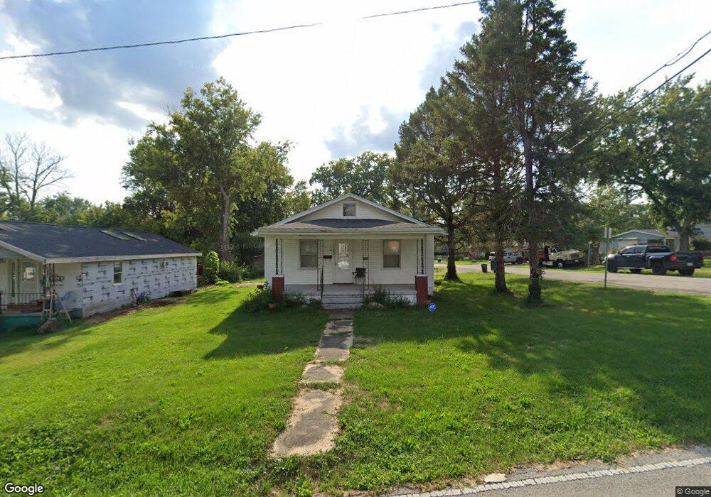
1093 N Oakdale Ave Decatur, IL 62522
Fairlawn NeighborhoodEstimated Value: $54,000 - $64,000
2
Beds
1
Bath
2,096
Sq Ft
$28/Sq Ft
Est. Value
About This Home
This home is located at 1093 N Oakdale Ave, Decatur, IL 62522 and is currently estimated at $58,606, approximately $27 per square foot. 1093 N Oakdale Ave is a home located in Macon County with nearby schools including Stephen Decatur Middle School and Northwest Christian Campus.
Ownership History
Date
Name
Owned For
Owner Type
Purchase Details
Closed on
Jun 11, 2021
Sold by
Binge Danny
Bought by
Peck Tiffany
Current Estimated Value
Home Financials for this Owner
Home Financials are based on the most recent Mortgage that was taken out on this home.
Original Mortgage
$28,000
Outstanding Balance
$25,487
Interest Rate
3.25%
Mortgage Type
New Conventional
Estimated Equity
$33,119
Purchase Details
Closed on
May 23, 2015
Sold by
Bruso Elmer J and Bruso Harold J
Bought by
Binge Danny
Create a Home Valuation Report for This Property
The Home Valuation Report is an in-depth analysis detailing your home's value as well as a comparison with similar homes in the area
Home Values in the Area
Average Home Value in this Area
Purchase History
| Date | Buyer | Sale Price | Title Company |
|---|---|---|---|
| Peck Tiffany | $35,000 | None Available | |
| Binge Danny | $45,000 | None Available |
Source: Public Records
Mortgage History
| Date | Status | Borrower | Loan Amount |
|---|---|---|---|
| Open | Peck Tiffany | $28,000 |
Source: Public Records
Tax History Compared to Growth
Tax History
| Year | Tax Paid | Tax Assessment Tax Assessment Total Assessment is a certain percentage of the fair market value that is determined by local assessors to be the total taxable value of land and additions on the property. | Land | Improvement |
|---|---|---|---|---|
| 2024 | $651 | $12,727 | $2,002 | $10,725 |
| 2023 | $625 | $12,276 | $1,931 | $10,345 |
| 2022 | $529 | $11,171 | $1,787 | $9,384 |
| 2021 | $1,074 | $10,433 | $1,669 | $8,764 |
| 2020 | $1,058 | $9,948 | $1,591 | $8,357 |
| 2019 | $1,058 | $9,948 | $1,591 | $8,357 |
| 2018 | $1,141 | $10,858 | $1,754 | $9,104 |
| 2017 | $1,168 | $11,148 | $1,801 | $9,347 |
| 2016 | $1,190 | $11,261 | $1,819 | $9,442 |
| 2015 | $1,114 | $10,899 | $1,787 | $9,112 |
| 2014 | $1,034 | $10,791 | $1,769 | $9,022 |
| 2013 | -- | $11,196 | $1,835 | $9,361 |
Source: Public Records
Map
Nearby Homes
- 1415 N Dennis Ave
- 1451 W Marietta St
- 1675 W Center St
- 1645 W Center St
- 1524 N Summit Ave
- 1319 W Waggoner St
- 2201 W Packard St
- 1530 W Cushing St
- 1706 W Division St
- 1535 N Mcclellan Ave
- 2195 W Center St
- 0 Valley View Place
- 917 N Wilder Ave
- 435 N Summit Ave
- 415 N Summit Ave
- 1625 W Garfield Ave
- 2125 Clearmont Ave
- 266 Cobb Ave
- 165 N Oakcrest Ave
- 2121 Barding Ave
- 1091 N Oakdale Ave
- 1087 N Oakdale Ave
- 1098 N Oakdale Ave
- 1073 N Oakdale Ave
- 1755 W Packard St
- 1710 W Packard St
- 1076 N Oakdale Ave
- 1080 N Oakdale Ave
- 1078 N Oakdale Ave
- 1070 N Oakdale Ave
- 1063 N Oakdale Ave
- 1763 W Packard St
- 1700 W Packard St
- 1716 W Packard St
- 1760 W Packard St
- 1680 W Packard St
- 1048 N Dennis Ave
- 1650 W Packard St
- 1044 N Dennis Ave
- 1773 W Packard St