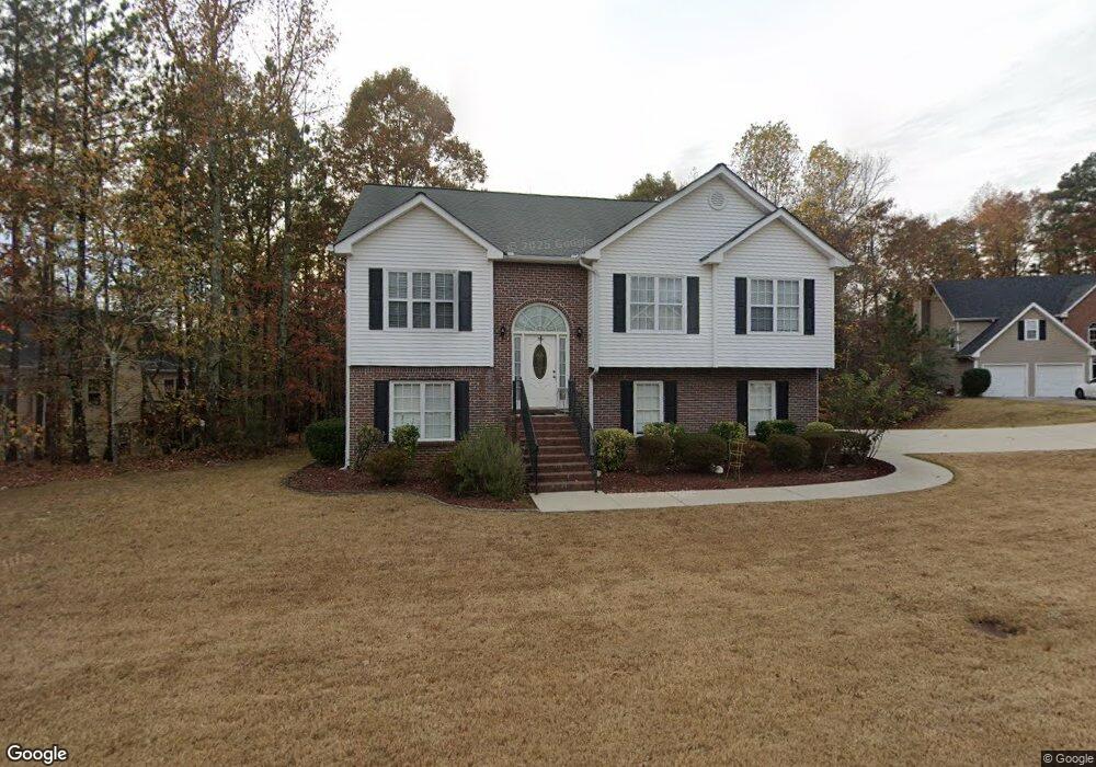
1094 Nickel Plate Ct Lawrenceville, GA 30043
Estimated Value: $394,424 - $446,000
4
Beds
3
Baths
2,240
Sq Ft
$185/Sq Ft
Est. Value
About This Home
This home is located at 1094 Nickel Plate Ct, Lawrenceville, GA 30043 and is currently estimated at $413,356, approximately $184 per square foot. 1094 Nickel Plate Ct is a home located in Gwinnett County with nearby schools including Taylor Elementary School, Creekland Middle School, and Collins Hill High School.
Ownership History
Date
Name
Owned For
Owner Type
Purchase Details
Closed on
Apr 20, 2011
Sold by
Federal Natl Mtg Assn Fnma
Bought by
Basulto Ruben S
Current Estimated Value
Home Financials for this Owner
Home Financials are based on the most recent Mortgage that was taken out on this home.
Original Mortgage
$128,900
Outstanding Balance
$88,680
Interest Rate
4.74%
Mortgage Type
New Conventional
Estimated Equity
$324,676
Purchase Details
Closed on
Aug 24, 2007
Sold by
Garner Dennis R
Bought by
Larios Homer
Home Financials for this Owner
Home Financials are based on the most recent Mortgage that was taken out on this home.
Original Mortgage
$40,580
Interest Rate
6.3%
Mortgage Type
Unknown
Purchase Details
Closed on
Nov 20, 1998
Sold by
95-1 Touchstone
Bought by
Garner Dennis Roger
Home Financials for this Owner
Home Financials are based on the most recent Mortgage that was taken out on this home.
Original Mortgage
$147,700
Interest Rate
6.49%
Mortgage Type
New Conventional
Create a Home Valuation Report for This Property
The Home Valuation Report is an in-depth analysis detailing your home's value as well as a comparison with similar homes in the area
Home Values in the Area
Average Home Value in this Area
Purchase History
| Date | Buyer | Sale Price | Title Company |
|---|---|---|---|
| Basulto Ruben S | $128,900 | -- | |
| Larios Homer | $202,900 | -- | |
| Garner Dennis Roger | $155,600 | -- |
Source: Public Records
Mortgage History
| Date | Status | Borrower | Loan Amount |
|---|---|---|---|
| Open | Basulto Ruben S | $128,900 | |
| Previous Owner | Larios Homer | $40,580 | |
| Previous Owner | Larios Homer | $162,320 | |
| Previous Owner | Garner Dennis Roger | $147,700 |
Source: Public Records
Tax History Compared to Growth
Tax History
| Year | Tax Paid | Tax Assessment Tax Assessment Total Assessment is a certain percentage of the fair market value that is determined by local assessors to be the total taxable value of land and additions on the property. | Land | Improvement |
|---|---|---|---|---|
| 2024 | -- | $149,360 | $28,000 | $121,360 |
| 2023 | $3,591 | $149,360 | $28,000 | $121,360 |
| 2022 | $0 | $131,720 | $25,200 | $106,520 |
| 2021 | $3,053 | $99,320 | $19,600 | $79,720 |
| 2020 | $2,963 | $94,120 | $19,600 | $74,520 |
| 2019 | $2,799 | $89,760 | $17,440 | $72,320 |
| 2018 | $2,604 | $80,720 | $13,600 | $67,120 |
| 2016 | $2,269 | $64,240 | $12,640 | $51,600 |
| 2015 | $2,103 | $56,000 | $10,000 | $46,000 |
| 2014 | $2,174 | $56,000 | $10,000 | $46,000 |
Source: Public Records
Map
Nearby Homes
- 1201 Brook Knoll Place
- 134 Waterloch Ct
- 154 Waterloch Ct
- 221 Larkshyre Trail
- 937 Sonny Boy Ln Unit 1
- 1230 Rivershyre Pkwy
- 531 Shyrewood Dr
- 662 Sunstone Ln
- 660 Sunstone Ln
- 664 Sunstone Ln
- 658 Sunstone Ln
- 1244 Riverloch Way
- Bryson Plan at River Walk Place
- Brooks Plan at River Walk Place
- 687 Sunstone Ln
- 693 Sunstone Ln
- 689 Sunstone Ln
- 695 Sunstone Ln
- 699 Sunstone Ln
- 1825 Villageside Ct
- 1054 Nickel Plate Ct
- 110 Victoria Station Blvd NE
- 110 Victoria Station Blvd
- 1104 Nickel Plate Ct
- 90 Victoria Station Blvd
- 90 Victoria Station Blvd Unit V
- 1097 Nickel Plate Ct
- 1087 Nickel Plate Ct
- 1114 Nickel Plate Ct Unit V
- 1117 Nickel Plate Ct
- 1077 Nickel Plate Ct
- 1067 Nickel Plate Ct
- 1107 Nickel Plate Ct Unit V
- 1057 Nickel Plate Ct
- 80 Victoria Station Blvd
- 115 Victoria Station Blvd
- 135 Victoria Station Blvd
- 105 Victoria Station Blvd
- 125 Victoria Station Blvd
- 145 Victoria Station Blvd