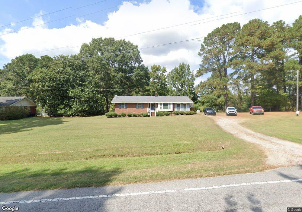
1097 Nc 561 Hwy Louisburg, NC 27549
Estimated Value: $252,000 - $299,000
3
Beds
2
Baths
1,665
Sq Ft
$166/Sq Ft
Est. Value
About This Home
This home is located at 1097 Nc 561 Hwy, Louisburg, NC 27549 and is currently estimated at $276,314, approximately $165 per square foot. 1097 Nc 561 Hwy is a home located in Franklin County with nearby schools including Louisburg Elementary School, Terrell Lane Middle School, and Louisburg High School.
Ownership History
Date
Name
Owned For
Owner Type
Purchase Details
Closed on
Dec 16, 2016
Sold by
Harper Marie J
Bought by
Arnold Lisa and Arnold William
Current Estimated Value
Home Financials for this Owner
Home Financials are based on the most recent Mortgage that was taken out on this home.
Original Mortgage
$90,000
Outstanding Balance
$71,864
Interest Rate
3.25%
Mortgage Type
Adjustable Rate Mortgage/ARM
Estimated Equity
$204,450
Create a Home Valuation Report for This Property
The Home Valuation Report is an in-depth analysis detailing your home's value as well as a comparison with similar homes in the area
Home Values in the Area
Average Home Value in this Area
Purchase History
| Date | Buyer | Sale Price | Title Company |
|---|---|---|---|
| Arnold Lisa | $126,000 | Attorney |
Source: Public Records
Mortgage History
| Date | Status | Borrower | Loan Amount |
|---|---|---|---|
| Open | Arnold Lisa | $90,000 |
Source: Public Records
Tax History Compared to Growth
Tax History
| Year | Tax Paid | Tax Assessment Tax Assessment Total Assessment is a certain percentage of the fair market value that is determined by local assessors to be the total taxable value of land and additions on the property. | Land | Improvement |
|---|---|---|---|---|
| 2025 | $1,385 | $211,580 | $38,340 | $173,240 |
| 2024 | $1,385 | $211,580 | $38,340 | $173,240 |
| 2023 | $1,180 | $121,200 | $17,810 | $103,390 |
| 2022 | $1,170 | $121,200 | $17,810 | $103,390 |
| 2021 | $1,182 | $121,200 | $17,810 | $103,390 |
| 2020 | $1,176 | $121,200 | $17,810 | $103,390 |
| 2019 | $1,163 | $121,200 | $17,810 | $103,390 |
| 2018 | $1,161 | $121,200 | $17,810 | $103,390 |
| 2017 | $1,254 | $120,070 | $14,840 | $105,230 |
| 2016 | $874 | $78,390 | $14,840 | $63,550 |
| 2015 | $870 | $78,390 | $14,840 | $63,550 |
| 2014 | $804 | $78,390 | $14,840 | $63,550 |
Source: Public Records
Map
Nearby Homes
- 376 T K Allen Rd
- 45 Leisure Ln
- 55 Leisure Ln
- 70 Leisure Ln
- 109 Drew St
- 592 Perdues Rd
- 7.69 Acres N Carolina 561
- 23.20 Acre N Carolina 561
- 10.26 Acre N Carolina 561
- 0-0 Halifax Rd
- 491 Nc 56 Hwy E
- 0 Zinnia Ct Unit 10129898
- 126 Person St
- 311 Nc 56 Hwy E
- 125 Davis St
- 101 Briarwood Ct
- 612 N Main St
- 604 N Main St
- 2329 N Carolina 561
- 121 Tanglewood Dr
- 1081 Nc 561 Hwy
- 1117 Nc 561 Hwy
- 1096 Nc 561 Hwy
- 1071 Nc 561 Hwy
- 1066 Nc 561 Hwy
- 1064 Nc 561 Hwy
- 1064 Nc 561 Hwy
- 1138 Nc 561 Hwy
- 1033 Nc 561 Hwy
- 1020 Nc 561 Hwy
- 130 T K Allen Rd
- 132 T K Allen Rd
- 90 T K Allen Rd
- 52 T K Allen Rd
- 34 T K Allen Rd
- 952 Nc 561 Hwy
- 164 T K Allen Rd
- 160 Robyns Ridge Dr
- 160 Robyns Ridge Dr Unit Lot 15
- 160 Robyn's Ridge Dr Unit Lot 15