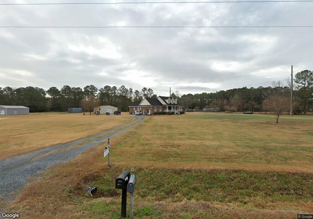
1099 Hewett Rd SW Supply, NC 28462
Estimated Value: $468,000 - $520,000
2
Beds
3
Baths
2,506
Sq Ft
$199/Sq Ft
Est. Value
About This Home
This home is located at 1099 Hewett Rd SW, Supply, NC 28462 and is currently estimated at $499,584, approximately $199 per square foot. 1099 Hewett Rd SW is a home located in Brunswick County with nearby schools including Virginia Williamson Elementary School, Cedar Grove Middle School, and West Brunswick High School.
Ownership History
Date
Name
Owned For
Owner Type
Purchase Details
Closed on
May 21, 2024
Sold by
Nelson Carlisle James and Robinson Carol
Bought by
Carlisle James Nelson and Carlisle Carol Robinson
Current Estimated Value
Purchase Details
Closed on
Jul 1, 2002
Bought by
Carlisle James Et Carol R
Create a Home Valuation Report for This Property
The Home Valuation Report is an in-depth analysis detailing your home's value as well as a comparison with similar homes in the area
Home Values in the Area
Average Home Value in this Area
Purchase History
| Date | Buyer | Sale Price | Title Company |
|---|---|---|---|
| Carlisle James Nelson | -- | None Listed On Document | |
| Carlisle James Nelson | -- | None Listed On Document | |
| Carlisle James Et Carol R | $28,000 | -- |
Source: Public Records
Tax History Compared to Growth
Tax History
| Year | Tax Paid | Tax Assessment Tax Assessment Total Assessment is a certain percentage of the fair market value that is determined by local assessors to be the total taxable value of land and additions on the property. | Land | Improvement |
|---|---|---|---|---|
| 2025 | $1,781 | $403,830 | $78,980 | $324,850 |
| 2024 | $1,781 | $403,830 | $78,980 | $324,850 |
| 2023 | $1,886 | $403,830 | $78,980 | $324,850 |
| 2022 | $1,886 | $306,360 | $63,180 | $243,180 |
| 2021 | $1,886 | $306,360 | $63,180 | $243,180 |
| 2020 | $1,820 | $292,860 | $63,180 | $229,680 |
| 2019 | $1,745 | $65,100 | $63,180 | $1,920 |
| 2018 | $1,545 | $57,600 | $55,280 | $2,320 |
| 2017 | $1,545 | $57,600 | $55,280 | $2,320 |
| 2016 | $1,495 | $57,600 | $55,280 | $2,320 |
| 2015 | $1,495 | $267,010 | $55,280 | $211,730 |
| 2014 | $1,571 | $309,760 | $114,080 | $195,680 |
Source: Public Records
Map
Nearby Homes
- 2.25 Ac Taft Rd SW
- 1645 Shelby Ln SW
- 665 Pelican Roost Dr SW
- 712 Sand Castle Dr SW
- 398 Doe Run Dr SW
- 1251 Black Bear SW
- 1024 SW Maple View Rd
- 1071 Windward Dr N
- 1355 Sweetwater Ln SW
- 1360 Sweetwater Ln SW
- Midland_2 Plan at Ruffins River Landing
- Cotswold_3 Plan at Ruffins River Landing
- Bailey Plan at Ruffins River Landing
- Pembroke_3 Plan at Ruffins River Landing
- Cameron Plan at Ruffins River Landing
- Somerset_3 Plan at Ruffins River Landing
- Stoddard Plan at Ruffins River Landing
- Southport Plan at Ruffins River Landing
- Richmond Plan at Ruffins River Landing
- Seagrove Plan at Ruffins River Landing
- 1079 Hewett Rd SW
- 1146 Hewett Rd SW
- 1110 Hewett Rd SW
- 1061 Hewett Rd SW
- 1058 Hewett Rd SW
- 1045 Hewett Rd SW
- 820 Stanley Rd SW
- 1040 Hewett Rd SW
- 789 Stanley Rd SW
- 834 Mistletoe Ln SW
- 998 Hewett Rd SW
- 982 Hewett Rd SW
- 1096 Haven Trail SW
- 875 Mistletoe Ln SW
- 530 Mount Pisgah Rd SW
- 950 Hewett Rd SW
- 916 Stanley Rd SW
- 580 Mt Pisgah Rd SW
- 684 Mount Pisgah Rd SW
- 512 Mount Pisgah Rd SW