Estimated Value: $902,000 - $1,135,000
4
Beds
3
Baths
2,180
Sq Ft
$455/Sq Ft
Est. Value
About This Home
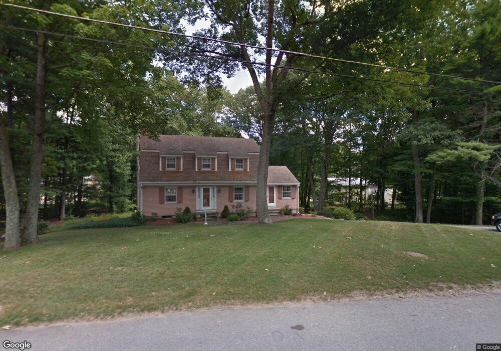
This home is located at 11 Captain Forbush Ln, Acton, MA 01720 and is currently estimated at $991,512, approximately $454 per square foot. 11 Captain Forbush Ln is a home located in Middlesex County with nearby schools including Acton-Boxborough Regional High School and The Imago School.
Ownership History
Date
Name
Owned For
Owner Type
Purchase Details
Closed on
Oct 19, 2020
Sold by
Beavers Nancy S
Bought by
2018 Nancy S Beavers Ret
Current Estimated Value
Purchase Details
Closed on
Aug 25, 2020
Sold by
2018 Nancy S Beavers Ret
Bought by
Beavers Nancy S
Purchase Details
Closed on
Jan 22, 2018
Sold by
Beavers Nancy S
Bought by
2018 Nancy S Beavers R
Purchase Details
Closed on
Feb 20, 1987
Sold by
Peabody Ronald B
Bought by
Beavers Willet I
Home Financials for this Owner
Home Financials are based on the most recent Mortgage that was taken out on this home.
Original Mortgage
$150,000
Interest Rate
9.24%
Mortgage Type
Purchase Money Mortgage
Create a Home Valuation Report for This Property
The Home Valuation Report is an in-depth analysis detailing your home's value as well as a comparison with similar homes in the area
Home Values in the Area
Average Home Value in this Area
Purchase History
| Date | Buyer | Sale Price | Title Company |
|---|---|---|---|
| 2018 Nancy S Beavers Ret | -- | None Available | |
| Beavers Nancy S | -- | None Available | |
| 2018 Nancy S Beavers R | -- | -- | |
| Beavers Willet I | $305,000 | -- |
Source: Public Records
Mortgage History
| Date | Status | Borrower | Loan Amount |
|---|---|---|---|
| Previous Owner | Beavers Willet I | $132,000 | |
| Previous Owner | Beavers Willet I | $136,400 | |
| Previous Owner | Beavers Willet I | $140,200 | |
| Previous Owner | Beavers Willet I | $150,000 |
Source: Public Records
Tax History Compared to Growth
Tax History
| Year | Tax Paid | Tax Assessment Tax Assessment Total Assessment is a certain percentage of the fair market value that is determined by local assessors to be the total taxable value of land and additions on the property. | Land | Improvement |
|---|---|---|---|---|
| 2025 | $14,236 | $830,100 | $371,700 | $458,400 |
| 2024 | $13,353 | $801,000 | $371,700 | $429,300 |
| 2023 | $13,210 | $752,300 | $338,100 | $414,200 |
| 2022 | $12,520 | $643,700 | $293,900 | $349,800 |
| 2021 | $12,209 | $603,500 | $272,100 | $331,400 |
| 2020 | $11,523 | $598,900 | $272,100 | $326,800 |
| 2019 | $10,977 | $566,700 | $272,100 | $294,600 |
| 2018 | $10,957 | $565,400 | $272,100 | $293,300 |
| 2017 | $10,687 | $560,700 | $272,100 | $288,600 |
| 2016 | $10,509 | $546,500 | $272,100 | $274,400 |
| 2015 | $10,304 | $540,900 | $272,100 | $268,800 |
| 2014 | $10,017 | $515,000 | $272,100 | $242,900 |
Source: Public Records
Map
Nearby Homes
- 285 Central St Unit 285
- 9 Elm St Unit 1
- 5 Elm St Unit 1
- 31 Mohawk Dr
- 89 Windsor Ave
- 4,7,8 Crestwood Ln
- 4 Huron Rd
- 92 Willow St Unit 3
- 92 Willow St Unit 2
- 90 Willow St Unit 1
- 169 Main St
- 23 John Swift Rd
- 19 Railroad St Unit C2
- 129 Main St Unit 129
- 129 Main St
- 131 Main St
- 5 Oakwood Rd
- 68 Macintosh Ln
- 8 Laurel Ct
- 134 Russet Ln
- 20 Captain Browns Ln
- 20 Captain Brown's Ln
- 13 Captain Forbush Ln
- 9 Captain Forbush Ln
- 12 Captain Forbush Ln
- 14 Captain Forbush Ln
- 15 Captain Forbush Ln
- 24 Captain Browns Ln
- 10 Captain Forbush Ln
- 16 Captain Brown's Ln
- 7 Captain Forbush Ln
- 16 Captain Browns Ln
- 16 Captain Forbush Ln
- 21 Captain Browns Ln
- 23 Captain Browns Ln
- 26 Captain Browns Ln
- 19 Captain Browns Ln
- 25 Captain Browns Ln
- 17 Captain Forbush Ln
- 8 Captain Forbush Ln