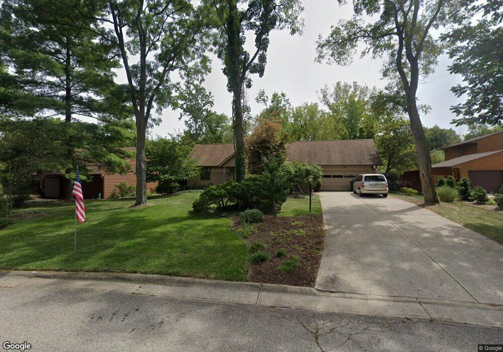
11 Carrie Cir Oxford, OH 45056
Estimated Value: $314,000 - $387,000
4
Beds
3
Baths
1,510
Sq Ft
$236/Sq Ft
Est. Value
About This Home
This home is located at 11 Carrie Cir, Oxford, OH 45056 and is currently estimated at $355,928, approximately $235 per square foot. 11 Carrie Cir is a home located in Butler County with nearby schools including Talawanda Middle School, Talawanda High School, and Mcguffey Montessori School.
Ownership History
Date
Name
Owned For
Owner Type
Purchase Details
Closed on
Jan 30, 2025
Sold by
Griffith Kay J
Bought by
Kay J Griffith Restatement Of Trust and Griffith
Current Estimated Value
Purchase Details
Closed on
Sep 17, 2013
Sold by
Griffith Kay J
Bought by
Griffith Michael J and Griffith Kay J
Create a Home Valuation Report for This Property
The Home Valuation Report is an in-depth analysis detailing your home's value as well as a comparison with similar homes in the area
Home Values in the Area
Average Home Value in this Area
Purchase History
| Date | Buyer | Sale Price | Title Company |
|---|---|---|---|
| Kay J Griffith Restatement Of Trust | -- | None Listed On Document | |
| Kay J Griffith Restatement Of Trust | -- | None Listed On Document | |
| Griffith Michael J | -- | None Available |
Source: Public Records
Tax History Compared to Growth
Tax History
| Year | Tax Paid | Tax Assessment Tax Assessment Total Assessment is a certain percentage of the fair market value that is determined by local assessors to be the total taxable value of land and additions on the property. | Land | Improvement |
|---|---|---|---|---|
| 2024 | $3,547 | $101,270 | $20,840 | $80,430 |
| 2023 | $3,258 | $101,270 | $20,840 | $80,430 |
| 2022 | $2,423 | $71,130 | $20,840 | $50,290 |
| 2021 | $2,307 | $71,130 | $20,840 | $50,290 |
| 2020 | $2,412 | $71,130 | $20,840 | $50,290 |
| 2019 | $4,362 | $57,750 | $18,720 | $39,030 |
| 2018 | $1,998 | $57,750 | $18,720 | $39,030 |
| 2017 | $1,796 | $57,750 | $18,720 | $39,030 |
| 2016 | $1,727 | $54,360 | $18,720 | $35,640 |
| 2015 | $1,758 | $54,360 | $18,720 | $35,640 |
| 2014 | $1,893 | $54,360 | $18,720 | $35,640 |
| 2013 | $1,893 | $56,990 | $18,720 | $38,270 |
Source: Public Records
Map
Nearby Homes
- 509 White Oak Dr
- 812 Winding Brook Dr
- 6 Autumn Dr
- 7 Robin Ct
- 60 Autumn Dr
- 1020 Tollgate Dr
- 715 W Chestnut St
- 446 Emerald Woods Dr
- 53 Great Horned Dr
- 59 Great Horned Dr
- 74 Great Horned Dr
- 71 Great Horned Dr
- 80 Great Horned Dr
- 626 W Chestnut St
- 40 Charleston Dr Unit 4
- 6135 Fairfield Rd
- 620 Brill Dr
- Chatham Plan at Owls' Landing
- Newcastle Plan at Owls' Landing
- 9 Carrie Cir
- 13 Carrie Cir
- 506 White Oak Dr
- 15 Carrie Cir
- 8 Quail Ridge Dr
- 9 Quail Ridge Dr
- 9 Quail Ridge Dr Unit 4
- 502 White Oak Dr
- 10 Quail Ridge Dr
- 7 Quail Ridge Dr
- 510 White Oak Dr
- 17 Carrie Cir
- 6 Quail Ridge Dr
- 14 Carrie Cir
- 11 Quail Ridge Dr
- 16 Carrie Cir
- 514 White Oak Dr
- 498 White Oak Dr
- 12 Lantern Ridge Rd
- 501 White Oak Dr