Estimated Value: $1,129,531 - $1,437,000
4
Beds
3
Baths
2,473
Sq Ft
$513/Sq Ft
Est. Value
About This Home
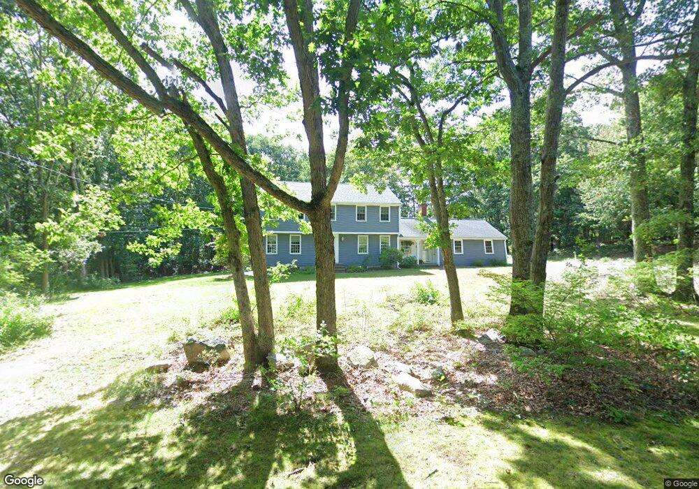
This home is located at 11 Hilltop Rd, Dover, MA 02030 and is currently estimated at $1,267,633, approximately $512 per square foot. 11 Hilltop Rd is a home located in Norfolk County with nearby schools including Chickering Elementary School, Dover-Sherborn Regional Middle School, and Dover-Sherborn Regional High School.
Ownership History
Date
Name
Owned For
Owner Type
Purchase Details
Closed on
May 18, 1993
Sold by
Devlin Patricia S
Bought by
Howard Martin J and Howard Elizabeth P
Current Estimated Value
Home Financials for this Owner
Home Financials are based on the most recent Mortgage that was taken out on this home.
Original Mortgage
$95,000
Interest Rate
7.47%
Mortgage Type
Purchase Money Mortgage
Create a Home Valuation Report for This Property
The Home Valuation Report is an in-depth analysis detailing your home's value as well as a comparison with similar homes in the area
Home Values in the Area
Average Home Value in this Area
Purchase History
| Date | Buyer | Sale Price | Title Company |
|---|---|---|---|
| Howard Martin J | $332,500 | -- |
Source: Public Records
Mortgage History
| Date | Status | Borrower | Loan Amount |
|---|---|---|---|
| Open | Howard Martin J | $89,500 | |
| Closed | Howard Martin J | $95,000 |
Source: Public Records
Tax History Compared to Growth
Tax History
| Year | Tax Paid | Tax Assessment Tax Assessment Total Assessment is a certain percentage of the fair market value that is determined by local assessors to be the total taxable value of land and additions on the property. | Land | Improvement |
|---|---|---|---|---|
| 2025 | $11,472 | $1,017,900 | $599,400 | $418,500 |
| 2024 | $10,868 | $991,600 | $599,400 | $392,200 |
| 2023 | $10,500 | $861,400 | $523,000 | $338,400 |
| 2022 | $9,669 | $778,500 | $479,500 | $299,000 |
| 2021 | $9,606 | $745,200 | $479,500 | $265,700 |
| 2020 | $9,568 | $745,200 | $479,500 | $265,700 |
| 2019 | $9,635 | $745,200 | $479,500 | $265,700 |
| 2018 | $8,834 | $688,000 | $435,900 | $252,100 |
| 2017 | $9,074 | $695,300 | $435,900 | $259,400 |
| 2016 | $8,554 | $664,100 | $414,100 | $250,000 |
| 2015 | $8,434 | $664,100 | $414,100 | $250,000 |
Source: Public Records
Map
Nearby Homes
- 1 Crest Dr W
- 9 Stonegate Dr
- 11 Stonegate Dr
- 14 Ruel Dr
- 145 Walpole St
- 90 Blueberry Ln
- 29 Hartford St
- 18 Tisdale Dr Unit 18
- 9 Schaffner Ln
- 140 Burgess Ave
- 23 Bubbling Brook Rd
- 36 Kingswood Rd
- 1080 North St
- 95 Arcadia Rd
- 151 Arcadia Rd
- 303 Oak St
- 49 Powisset St
- 48 Lakeshore Dr
- 60 Warwick Dr
- 4 Shoestring Ln