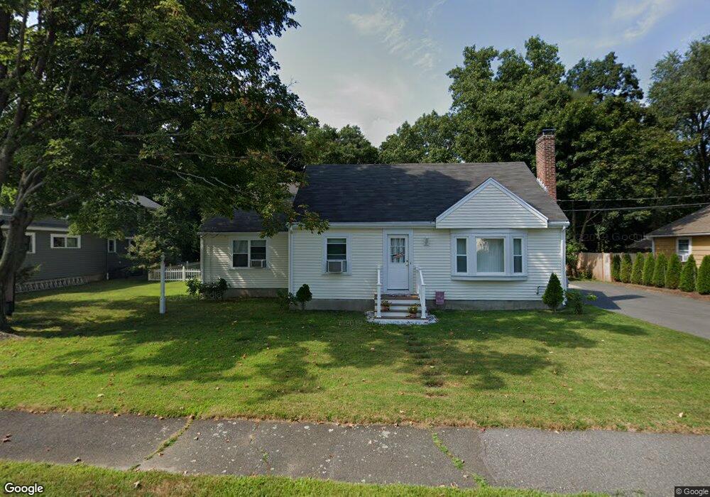
11 Lake Shore Rd Natick, MA 01760
Estimated Value: $823,593 - $1,129,000
4
Beds
3
Baths
1,702
Sq Ft
$560/Sq Ft
Est. Value
About This Home
This home is located at 11 Lake Shore Rd, Natick, MA 01760 and is currently estimated at $953,898, approximately $560 per square foot. 11 Lake Shore Rd is a home located in Middlesex County with nearby schools including Natick High School, Wilson Middle School, and Bennett-Hemenway (Ben-Hem) Elementary School.
Ownership History
Date
Name
Owned For
Owner Type
Purchase Details
Closed on
Sep 6, 2016
Sold by
Barros Timothy
Bought by
Barros Timothy and Barros Joanne T
Current Estimated Value
Purchase Details
Closed on
Feb 25, 2010
Sold by
Barros Timothy and Barros Joanne T
Bought by
Barros Timothy
Home Financials for this Owner
Home Financials are based on the most recent Mortgage that was taken out on this home.
Original Mortgage
$424,297
Interest Rate
5.5%
Mortgage Type
FHA
Create a Home Valuation Report for This Property
The Home Valuation Report is an in-depth analysis detailing your home's value as well as a comparison with similar homes in the area
Home Values in the Area
Average Home Value in this Area
Purchase History
| Date | Buyer | Sale Price | Title Company |
|---|---|---|---|
| Barros Timothy | -- | -- | |
| Barros Timothy | -- | -- |
Source: Public Records
Mortgage History
| Date | Status | Borrower | Loan Amount |
|---|---|---|---|
| Previous Owner | Barros Timothy | $424,297 |
Source: Public Records
Tax History Compared to Growth
Tax History
| Year | Tax Paid | Tax Assessment Tax Assessment Total Assessment is a certain percentage of the fair market value that is determined by local assessors to be the total taxable value of land and additions on the property. | Land | Improvement |
|---|---|---|---|---|
| 2025 | $8,177 | $683,700 | $412,100 | $271,600 |
| 2024 | $7,967 | $649,800 | $396,700 | $253,100 |
| 2023 | $7,774 | $615,000 | $375,000 | $240,000 |
| 2022 | $7,541 | $565,300 | $343,100 | $222,200 |
| 2021 | $8,716 | $531,300 | $322,600 | $208,700 |
| 2020 | $7,023 | $516,000 | $307,300 | $208,700 |
| 2019 | $4,613 | $516,000 | $307,300 | $208,700 |
| 2018 | $6,294 | $482,300 | $307,300 | $175,000 |
| 2017 | $7,199 | $405,500 | $264,100 | $141,400 |
| 2016 | $5,201 | $383,300 | $243,100 | $140,200 |
| 2015 | $5,142 | $372,100 | $243,100 | $129,000 |
Source: Public Records
Map
Nearby Homes
- 293 Bacon St Unit A
- 287 Bacon St
- 7 Jackson Ct Unit B
- 12 Linden St
- 8 Flynn St
- 8 Stanley St
- 278 N Main St
- 39 Evergreen Rd
- 13 Sheffield Rd
- 18 Magnolia Rd
- 7 Sheffield Rd
- 22 Magnolia Rd
- 38 Westlake Rd
- 8 Hartford St
- 4 Richard Rd
- 3 Ferndale Rd
- 14 Ferndale Rd
- 58 N Main St Unit 304
- 8 Liberty St
- 10 Nouvelle Way Unit 803
- 11 Lakeshore Rd
- 7 Lake Shore Rd
- 15 Lake Shore Rd
- 5 Lake Shore Rd
- 14 Lake Shore Rd
- 12 Lake Shore Rd
- 17 Lake Shore Rd
- 18 Lake Shore Rd
- 8 Lake Shore Rd
- 212 N Main St
- 20 Lake Shore Rd
- 23 Lake Shore Rd
- 915 Worcester St
- 208 N Main St
- 1 Lake Shore Rd
- 24 Lake Shore Rd
- 214 N Main St
- 214 N Main St Unit 209
- 25 Lake Shore Rd
- 204 N Main St