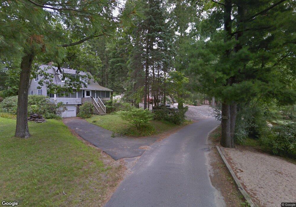
11 Nokomis Rd Wilbraham, MA 01095
Estimated Value: $418,360 - $442,000
3
Beds
2
Baths
1,885
Sq Ft
$227/Sq Ft
Est. Value
About This Home
This home is located at 11 Nokomis Rd, Wilbraham, MA 01095 and is currently estimated at $427,090, approximately $226 per square foot. 11 Nokomis Rd is a home located in Hampden County with nearby schools including Minnechaug Regional High School, St. John the Baptist School, and Wilbraham & Monson Academy.
Ownership History
Date
Name
Owned For
Owner Type
Purchase Details
Closed on
Nov 28, 2022
Sold by
Mccarthy Veronica C Est
Bought by
Farr John C and Farr Cynthia S
Current Estimated Value
Purchase Details
Closed on
Nov 20, 2006
Sold by
Mccarthy Veronica C
Bought by
Mccarthy John W and Mccarthy Veronica C
Home Financials for this Owner
Home Financials are based on the most recent Mortgage that was taken out on this home.
Original Mortgage
$58,155
Interest Rate
6.33%
Create a Home Valuation Report for This Property
The Home Valuation Report is an in-depth analysis detailing your home's value as well as a comparison with similar homes in the area
Home Values in the Area
Average Home Value in this Area
Purchase History
| Date | Buyer | Sale Price | Title Company |
|---|---|---|---|
| Farr John C | $365,000 | None Available | |
| Mccarthy John W | -- | -- |
Source: Public Records
Mortgage History
| Date | Status | Borrower | Loan Amount |
|---|---|---|---|
| Previous Owner | Mccarthy John W | $58,155 |
Source: Public Records
Tax History Compared to Growth
Tax History
| Year | Tax Paid | Tax Assessment Tax Assessment Total Assessment is a certain percentage of the fair market value that is determined by local assessors to be the total taxable value of land and additions on the property. | Land | Improvement |
|---|---|---|---|---|
| 2025 | $6,229 | $348,400 | $113,400 | $235,000 |
| 2024 | $6,146 | $332,200 | $113,400 | $218,800 |
| 2023 | $53 | $295,100 | $113,400 | $181,700 |
| 2022 | $5,254 | $256,400 | $110,800 | $145,600 |
| 2021 | $5,053 | $220,100 | $116,400 | $103,700 |
| 2020 | $4,926 | $220,100 | $116,400 | $103,700 |
| 2019 | $4,798 | $220,100 | $116,400 | $103,700 |
| 2018 | $4,603 | $203,300 | $116,400 | $86,900 |
| 2017 | $4,473 | $203,300 | $116,400 | $86,900 |
| 2016 | $4,795 | $222,000 | $129,300 | $92,700 |
| 2015 | $4,635 | $222,000 | $129,300 | $92,700 |
Source: Public Records
Map
Nearby Homes
- 35 Lake Dr
- 2 Vista Rd
- 4 Hillcrest Dr
- 54 High Pine Cir
- 69 High Pine Cir
- 46 Washington Rd
- 88-90 Miller St
- 182 Mountain Rd
- 28 Decorie Dr
- 229 Miller St Unit F-13
- 229 Miller St Unit C-1
- 229 Miller St Unit B2
- 20 Old Orchard Rd
- 19 Linwood Dr
- 2 Bayberry Dr Unit 51
- 38 King Dr
- 22 Balsam Hill Rd
- 474-480 Mountain Rd
- 51 Newcrest St
- 319 Ventura St