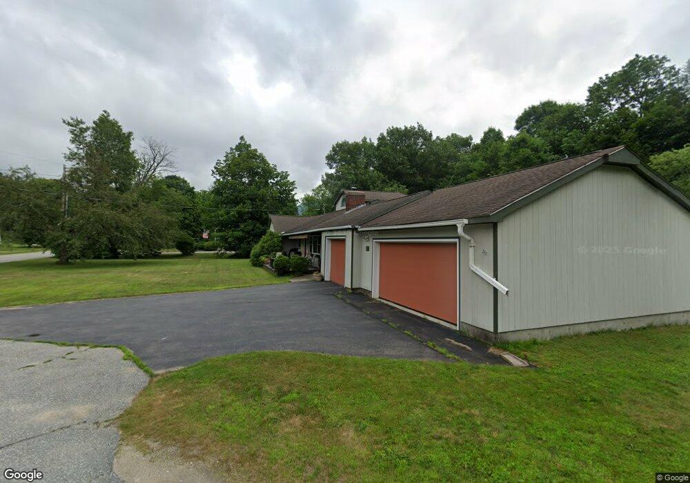
11 O'Brien Lincoln, NH 03251
Estimated Value: $1,282,672 - $1,494,000
4
Beds
4
Baths
3,100
Sq Ft
$433/Sq Ft
Est. Value
About This Home
This home is located at 11 O'Brien, Lincoln, NH 03251 and is currently estimated at $1,341,418, approximately $432 per square foot. 11 O'Brien is a home located in Grafton County with nearby schools including Lin-Wood Public Elementary School.
Ownership History
Date
Name
Owned For
Owner Type
Purchase Details
Closed on
Sep 3, 2025
Sold by
Moran Levitsky Ret and Moran
Bought by
R M Obrien Llc
Current Estimated Value
Home Financials for this Owner
Home Financials are based on the most recent Mortgage that was taken out on this home.
Original Mortgage
$375,000
Outstanding Balance
$374,351
Interest Rate
6.74%
Mortgage Type
New Conventional
Estimated Equity
$967,067
Purchase Details
Closed on
Feb 8, 2021
Sold by
Thomas P Tremblay Ret and Tremblay
Bought by
Moran Levitsky Ret and Moran
Create a Home Valuation Report for This Property
The Home Valuation Report is an in-depth analysis detailing your home's value as well as a comparison with similar homes in the area
Home Values in the Area
Average Home Value in this Area
Purchase History
| Date | Buyer | Sale Price | Title Company |
|---|---|---|---|
| R M Obrien Llc | $1,300,000 | -- | |
| R M Obrien Llc | $1,300,000 | -- | |
| Moran Levitsky Ret | -- | None Available | |
| Moran Levitsky Ret | -- | None Available |
Source: Public Records
Mortgage History
| Date | Status | Borrower | Loan Amount |
|---|---|---|---|
| Open | R M Obrien Llc | $375,000 | |
| Closed | R M Obrien Llc | $375,000 |
Source: Public Records
Tax History Compared to Growth
Tax History
| Year | Tax Paid | Tax Assessment Tax Assessment Total Assessment is a certain percentage of the fair market value that is determined by local assessors to be the total taxable value of land and additions on the property. | Land | Improvement |
|---|---|---|---|---|
| 2024 | $8,670 | $742,300 | $158,100 | $584,200 |
| 2023 | $8,670 | $742,300 | $158,100 | $584,200 |
| 2022 | $7,831 | $742,300 | $158,100 | $584,200 |
| 2021 | $7,824 | $742,300 | $158,100 | $584,200 |
| 2018 | $8,795 | $621,100 | $91,900 | $529,200 |
| 2016 | $8,192 | $621,100 | $91,900 | $529,200 |
| 2015 | $7,046 | $511,300 | $106,700 | $404,600 |
| 2014 | $7,056 | $511,300 | $106,700 | $404,600 |
| 2009 | $4,841 | $531,360 | $105,540 | $425,820 |
Source: Public Records
Map
Nearby Homes
- 164 Pollard Rd
- 13 Maple St
- 11 Church St
- 158 Pollard Rd
- 0 Pleasant St Unit 87
- 10 Bunker Ln Unit 114
- 52 Bunker Ln Unit 2
- 130 Woodland Loop
- 16 Twin Tip Terrace Unit 2
- 12 Twin Tip Terrace Unit 10
- 20 Twin Tip Terrace Unit 10
- 20 Twin Tip Terrace Unit 5
- 20 Twin Tip Terrace Unit 2
- 42 Forest Dr
- 58 Bunker Ln Unit 3
- 4 Twin Tip Terrace Unit 4
- 48 Cooper Memorial Dr Unit 111
- 48 Cooper Memorial Dr Unit 415
- 48 Cooper Memorial Dr Unit 405
- 51 Pollard Rd Unit 1
- 0 O'Brien Ave
- 127 Pollard Rd
- 30 Maple St
- 34 Maple St
- 34 Maple St Unit A
- 34 Maple St Unit B
- 28 Maple St
- 30 O' Brien Ave
- 137 Pollard Rd
- 35 Meadow Ln
- 24 Maple St
- 30 O'Brien Ave
- 121 Pollard Rd
- 22 Maple St
- 22 Maple St Unit Upstairs
- 22 Maple St Unit Downstairs
- 40 Maple St
- 31 Maple St
- 33 Maple St
- 27 Maple St