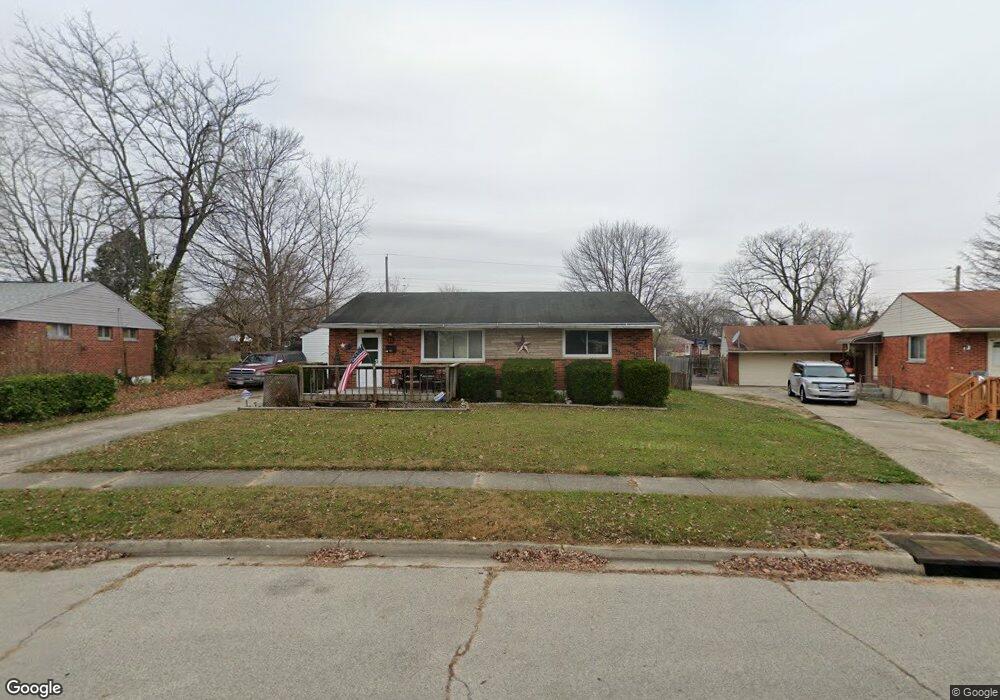
11 Stubbs Dr Dayton, OH 45426
Estimated Value: $132,000 - $153,306
3
Beds
2
Baths
1,100
Sq Ft
$132/Sq Ft
Est. Value
About This Home
This home is located at 11 Stubbs Dr, Dayton, OH 45426 and is currently estimated at $144,769, approximately $131 per square foot. 11 Stubbs Dr is a home located in Montgomery County with nearby schools including Trotwood-Madison Middle School, Trotwood-Madison High School, and Trotwood Preparatory & Fitness Academy.
Ownership History
Date
Name
Owned For
Owner Type
Purchase Details
Closed on
Jul 12, 2002
Sold by
Goines Michael B
Bought by
Goines Michael B and Goines Pamela L
Current Estimated Value
Home Financials for this Owner
Home Financials are based on the most recent Mortgage that was taken out on this home.
Original Mortgage
$103,500
Outstanding Balance
$44,156
Interest Rate
6.8%
Estimated Equity
$100,613
Purchase Details
Closed on
Feb 12, 1999
Sold by
Woodward Evelyn S
Bought by
Goines Michael B
Home Financials for this Owner
Home Financials are based on the most recent Mortgage that was taken out on this home.
Original Mortgage
$69,000
Interest Rate
6.92%
Create a Home Valuation Report for This Property
The Home Valuation Report is an in-depth analysis detailing your home's value as well as a comparison with similar homes in the area
Home Values in the Area
Average Home Value in this Area
Purchase History
| Date | Buyer | Sale Price | Title Company |
|---|---|---|---|
| Goines Michael B | -- | Premier Land Title Service | |
| Goines Michael B | $69,000 | Equity Land Title Agency Inc |
Source: Public Records
Mortgage History
| Date | Status | Borrower | Loan Amount |
|---|---|---|---|
| Open | Goines Michael B | $103,500 | |
| Previous Owner | Goines Michael B | $69,000 |
Source: Public Records
Tax History Compared to Growth
Tax History
| Year | Tax Paid | Tax Assessment Tax Assessment Total Assessment is a certain percentage of the fair market value that is determined by local assessors to be the total taxable value of land and additions on the property. | Land | Improvement |
|---|---|---|---|---|
| 2024 | $1,807 | $27,750 | $4,480 | $23,270 |
| 2023 | $1,807 | $27,750 | $4,480 | $23,270 |
| 2022 | $1,815 | $21,710 | $3,500 | $18,210 |
| 2021 | $1,818 | $21,710 | $3,500 | $18,210 |
| 2020 | $1,818 | $21,710 | $3,500 | $18,210 |
| 2019 | $1,556 | $16,610 | $2,450 | $14,160 |
| 2018 | $1,558 | $16,610 | $2,450 | $14,160 |
| 2017 | $1,548 | $16,610 | $2,450 | $14,160 |
| 2016 | $1,599 | $17,170 | $3,500 | $13,670 |
| 2015 | $1,573 | $17,170 | $3,500 | $13,670 |
| 2014 | $1,573 | $17,170 | $3,500 | $13,670 |
| 2012 | -- | $21,650 | $5,430 | $16,220 |
Source: Public Records
Map
Nearby Homes
- 33 Mario Dr
- 204 E Main St
- 4 Pleasant Ave
- 17 Grand Ave
- 103 E Worley Ave
- 1 E Worley Ave
- 301 Beardsley Rd
- 208 E Sunrise Ave
- 0 Main
- 209 W Main St
- 385 Blairwood Dr
- 208 E Eppington Dr
- 717 Mapleside Dr
- 316 Skinner Dr
- 800 Chandler Dr
- 512 N Sherry Dr
- 7540 Tuscola Dr
- 4051 Belmore Trace
- 6899 Little Richmond Rd
- 0 Little Richmond Rd