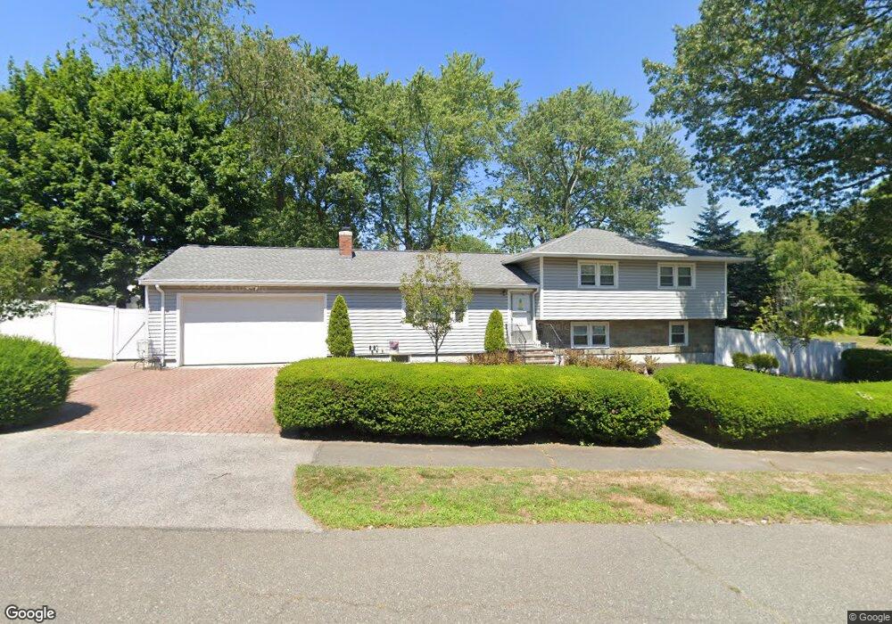
11 Wheatland St Peabody, MA 01960
Estimated Value: $738,000 - $779,000
4
Beds
3
Baths
1,848
Sq Ft
$412/Sq Ft
Est. Value
About This Home
This home is located at 11 Wheatland St, Peabody, MA 01960 and is currently estimated at $760,783, approximately $411 per square foot. 11 Wheatland St is a home located in Essex County with nearby schools including Peabody Veterans Memorial High School, St John The Baptist School, and St. Mary of the Annunciation School.
Create a Home Valuation Report for This Property
The Home Valuation Report is an in-depth analysis detailing your home's value as well as a comparison with similar homes in the area
Home Values in the Area
Average Home Value in this Area
Tax History Compared to Growth
Tax History
| Year | Tax Paid | Tax Assessment Tax Assessment Total Assessment is a certain percentage of the fair market value that is determined by local assessors to be the total taxable value of land and additions on the property. | Land | Improvement |
|---|---|---|---|---|
| 2025 | $6,264 | $676,500 | $318,800 | $357,700 |
| 2024 | $5,975 | $655,100 | $318,800 | $336,300 |
| 2023 | $5,507 | $578,500 | $265,700 | $312,800 |
| 2022 | $4,979 | $493,000 | $231,100 | $261,900 |
| 2021 | $4,943 | $471,200 | $210,000 | $261,200 |
| 2020 | $4,964 | $462,200 | $210,000 | $252,200 |
| 2019 | $4,750 | $431,400 | $210,000 | $221,400 |
| 2018 | $4,479 | $390,800 | $187,500 | $203,300 |
| 2017 | $4,676 | $397,600 | $187,500 | $210,100 |
| 2016 | $4,173 | $350,100 | $187,500 | $162,600 |
| 2015 | $4,096 | $333,000 | $187,500 | $145,500 |
Source: Public Records
Map
Nearby Homes
- 2 & 2R Prospect St
- 1 Reed Rd
- 351 Lowell St
- 17 Trask Rd
- 4 Price Rd
- 58 Trask Rd
- 21 Hawthorne Cir
- 68 Prospect St Unit 14
- 0 Willowdale Ave Unit 73387007
- 2 Crestwood Ln
- 14 Raylen Ave
- 36 Forest St
- 19 Arnold Ave
- 4R Forest St
- 29 Reynolds Rd
- 50 Village Post Rd Unit 50
- 8 Ledgewood Way Unit 20
- 8 Ledgewood Way Unit 17
- 12 Ledgewood Way Unit 26
- 152 Endicott St