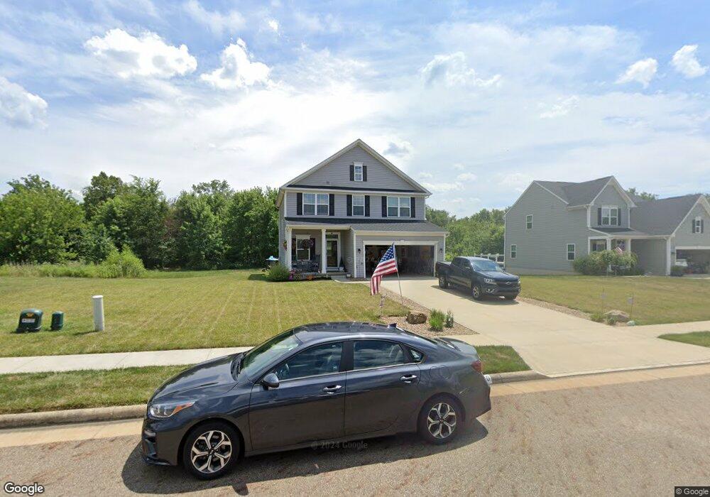
1100 Woodmore St Louisville, OH 44641
Estimated Value: $313,000 - $360,000
4
Beds
3
Baths
1,872
Sq Ft
$183/Sq Ft
Est. Value
About This Home
This home is located at 1100 Woodmore St, Louisville, OH 44641 and is currently estimated at $342,521, approximately $182 per square foot. 1100 Woodmore St is a home with nearby schools including Louisville High School and St. Thomas Aquinas High School & Middle School.
Ownership History
Date
Name
Owned For
Owner Type
Purchase Details
Closed on
Dec 13, 2018
Sold by
Nvr Inc
Bought by
Riffle Andrew L and Riffle Genia M
Current Estimated Value
Home Financials for this Owner
Home Financials are based on the most recent Mortgage that was taken out on this home.
Original Mortgage
$215,847
Outstanding Balance
$190,166
Interest Rate
4.8%
Mortgage Type
FHA
Estimated Equity
$152,355
Purchase Details
Closed on
Oct 3, 2018
Sold by
Mckinney Devlopmnt Co
Bought by
Nvr Inc and Ryan Homes
Create a Home Valuation Report for This Property
The Home Valuation Report is an in-depth analysis detailing your home's value as well as a comparison with similar homes in the area
Home Values in the Area
Average Home Value in this Area
Purchase History
| Date | Buyer | Sale Price | Title Company |
|---|---|---|---|
| Riffle Andrew L | $219,900 | Nvr Title Agency Llc | |
| Nvr Inc | $39,500 | Nvr Title Agency Llc |
Source: Public Records
Mortgage History
| Date | Status | Borrower | Loan Amount |
|---|---|---|---|
| Open | Riffle Andrew L | $215,847 |
Source: Public Records
Tax History Compared to Growth
Tax History
| Year | Tax Paid | Tax Assessment Tax Assessment Total Assessment is a certain percentage of the fair market value that is determined by local assessors to be the total taxable value of land and additions on the property. | Land | Improvement |
|---|---|---|---|---|
| 2025 | -- | $106,120 | $31,570 | $74,550 |
| 2024 | -- | $106,120 | $31,570 | $74,550 |
| 2023 | $3,421 | $79,630 | $18,690 | $60,940 |
| 2022 | $3,428 | $79,630 | $18,690 | $60,940 |
| 2021 | $3,437 | $79,630 | $18,690 | $60,940 |
| 2020 | $2,814 | $70,810 | $16,840 | $53,970 |
| 2019 | $2,900 | $4,170 | $4,170 | $0 |
| 2018 | $170 | $4,170 | $4,170 | $0 |
| 2017 | $138 | $3,260 | $3,260 | $0 |
| 2016 | $141 | $3,260 | $3,260 | $0 |
| 2015 | $141 | $3,260 | $3,260 | $0 |
| 2014 | $137 | $2,940 | $2,940 | $0 |
| 2013 | $68 | $2,940 | $2,940 | $0 |
Source: Public Records
Map
Nearby Homes
- 1170 Winding Ridge Ave
- 910 Crosswyck Cir
- 0 Michigan Blvd
- 325 Lincoln Ave
- 316 E Reno Dr
- 428 Honeycrisp Dr NE
- 3047 Mcintosh Dr NE
- 432 Honeycrisp Dr NE
- 2962 Mcintosh Dr NE
- 2963 Mcintosh Dr NE
- 430 Honeycrisp Dr NE
- 2957 Mcintosh Dr NE
- 308 Superior St
- 5474 Ravenna Ave
- 300 Kennedy St
- 728 E Broad St
- 520 S Silver St
- 2015 E Main St
- 641 S Nickelplate St
- 524 Glenbar St
- 1020 Woodmore St
- 0 Woodmore Unit 3293557
- 1010 Woodmore St
- 113 Cheverton Ave
- 113 S/L Cheverton Ave
- 109 Woodmore St
- 1023 Woodmoor St
- 1021 Woodmore St
- 916 Woodmore St
- 916 Woodmore St
- 1150 Cheverton Ave
- 100 S/L Cheverton Ave
- 0 Woodmore Unit 3293654
- 1164 Cheverton Ave
- 1173 Cheverton Ave
- 910 Woodmore St
- 0 Cheverton Unit 3293713
- 1170 Cheverton Ave
- 1181 Cheverton Ave
- 0 Woodmore St Unit 3293723