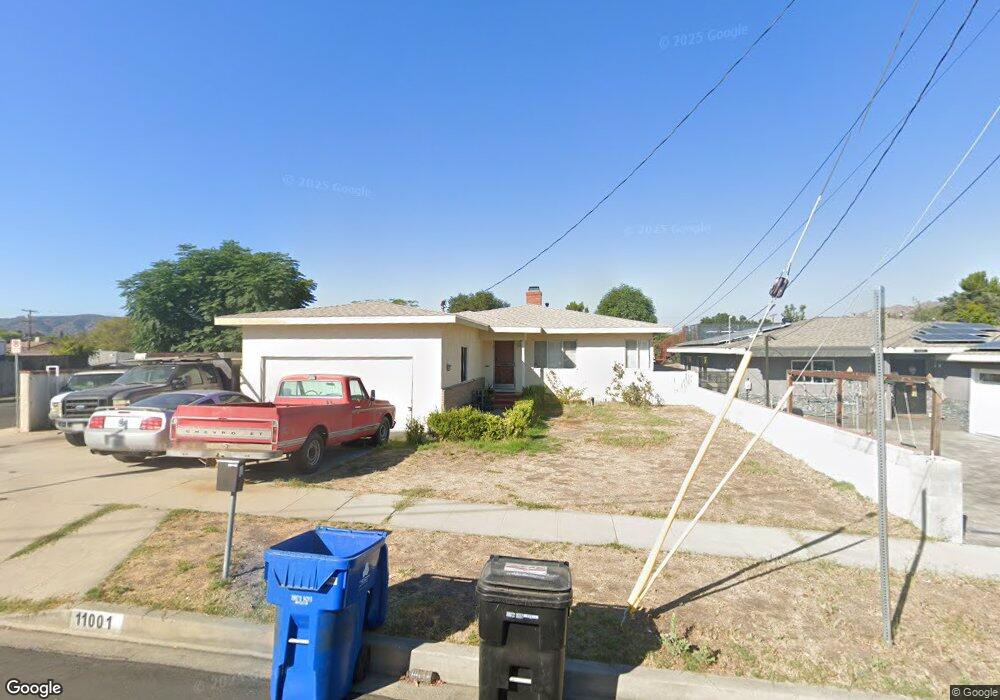
11001 Nassau Ave Sunland, CA 91040
Sunland NeighborhoodEstimated Value: $794,923 - $895,000
2
Beds
2
Baths
1,229
Sq Ft
$695/Sq Ft
Est. Value
About This Home
This home is located at 11001 Nassau Ave, Sunland, CA 91040 and is currently estimated at $853,731, approximately $694 per square foot. 11001 Nassau Ave is a home located in Los Angeles County with nearby schools including Sunland Elementary School, Mt. Gleason Middle School, and Verdugo Hills Senior High School.
Ownership History
Date
Name
Owned For
Owner Type
Purchase Details
Closed on
Apr 24, 2014
Sold by
Stuber Lamar Wayne and Stuber Lamar W
Bought by
Stuber Lamar Wayne and Lamar Wayne Stuber Living Trus
Current Estimated Value
Purchase Details
Closed on
Apr 25, 2013
Sold by
Stuber Lamar and Stuber Erin
Bought by
Stuber Lamar W
Home Financials for this Owner
Home Financials are based on the most recent Mortgage that was taken out on this home.
Original Mortgage
$187,500
Interest Rate
3.54%
Mortgage Type
New Conventional
Create a Home Valuation Report for This Property
The Home Valuation Report is an in-depth analysis detailing your home's value as well as a comparison with similar homes in the area
Home Values in the Area
Average Home Value in this Area
Purchase History
| Date | Buyer | Sale Price | Title Company |
|---|---|---|---|
| Stuber Lamar Wayne | -- | None Available | |
| Stuber Lamar W | -- | Ticor Title Co | |
| Stuber Lamar W | -- | Ticor Title Co |
Source: Public Records
Mortgage History
| Date | Status | Borrower | Loan Amount |
|---|---|---|---|
| Closed | Stuber Lamar W | $187,500 |
Source: Public Records
Tax History Compared to Growth
Tax History
| Year | Tax Paid | Tax Assessment Tax Assessment Total Assessment is a certain percentage of the fair market value that is determined by local assessors to be the total taxable value of land and additions on the property. | Land | Improvement |
|---|---|---|---|---|
| 2025 | $4,717 | $384,660 | $222,917 | $161,743 |
| 2024 | $4,717 | $377,119 | $218,547 | $158,572 |
| 2023 | $4,628 | $369,725 | $214,262 | $155,463 |
| 2022 | $4,415 | $362,476 | $210,061 | $152,415 |
| 2021 | $4,356 | $355,370 | $205,943 | $149,427 |
| 2019 | $4,226 | $344,832 | $199,836 | $144,996 |
| 2018 | $4,118 | $338,071 | $195,918 | $142,153 |
| 2016 | $3,926 | $324,945 | $188,311 | $136,634 |
| 2015 | $3,868 | $320,065 | $185,483 | $134,582 |
| 2014 | $3,887 | $313,796 | $181,850 | $131,946 |
Source: Public Records
Map
Nearby Homes
- 8110 Brownstone St
- 11034 Scoville Ave
- 12159 Oro Vista Ave
- 11009 Quill Ave
- 8230 Hillrose St
- 7848 Forsythe St
- 0 Rim Canyon Rd Unit SR25228396
- 10704 Oro Vista Ave
- 7844 Rim Canyon Rd
- 8545 Forsythe St
- 10623 Woodward Ave
- 7815 Denivelle Rd
- 7755 Forsythe St
- 10799 Sherman Grove Ave
- 10799 Sherman Grove Ave Unit 18
- 10799 Sherman Grove Ave Unit 61
- 7851 Fenwick St
- 10711 Sherman Grove Ave Unit 26
- 10711 Sherman Grove Ave Unit 13
- 10711 Sherman Grove Ave Unit 36
- 11007 Nassau Ave
- 11000 Mcvine Ave
- 10960 Mcvine Ave
- 11013 Nassau Ave
- 11008 Mcvine Ave
- 10951 Nassau Ave
- 11014 Mcvine Ave
- 8135 Graystone St
- 8138 Graystone St
- 11019 Nassau Ave
- 11014 Nassau Ave
- 8160 Graystone St
- 10950 Nassau Ave
- 10947 Nassau Ave
- 11022 Mcvine Ave
- 11025 Nassau Ave
- 11018 Nassau Ave
- 10943 Nassau Ave
- 10942 Mcvine Ave
- 10944 Nassau Ave