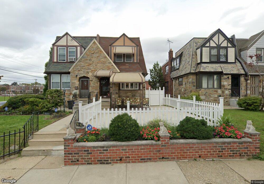
1103 Kenwyn St Philadelphia, PA 19124
Frankford NeighborhoodEstimated Value: $260,000 - $315,906
4
Beds
3
Baths
1,632
Sq Ft
$183/Sq Ft
Est. Value
About This Home
This home is located at 1103 Kenwyn St, Philadelphia, PA 19124 and is currently estimated at $298,727, approximately $183 per square foot. 1103 Kenwyn St is a home with nearby schools including Frankford High School, The Philadelphia Charter School for the Arts & Sciences, and Northwood Academy Charter School.
Ownership History
Date
Name
Owned For
Owner Type
Purchase Details
Closed on
Nov 18, 2004
Sold by
Stokes Loretta J
Bought by
Sewell Donna
Current Estimated Value
Home Financials for this Owner
Home Financials are based on the most recent Mortgage that was taken out on this home.
Original Mortgage
$164,250
Outstanding Balance
$79,869
Interest Rate
5.5%
Mortgage Type
Purchase Money Mortgage
Estimated Equity
$218,858
Create a Home Valuation Report for This Property
The Home Valuation Report is an in-depth analysis detailing your home's value as well as a comparison with similar homes in the area
Home Values in the Area
Average Home Value in this Area
Purchase History
| Date | Buyer | Sale Price | Title Company |
|---|---|---|---|
| Sewell Donna | $175,000 | -- |
Source: Public Records
Mortgage History
| Date | Status | Borrower | Loan Amount |
|---|---|---|---|
| Open | Sewell Donna | $164,250 |
Source: Public Records
Tax History Compared to Growth
Tax History
| Year | Tax Paid | Tax Assessment Tax Assessment Total Assessment is a certain percentage of the fair market value that is determined by local assessors to be the total taxable value of land and additions on the property. | Land | Improvement |
|---|---|---|---|---|
| 2026 | $3,760 | $290,200 | $58,040 | $232,160 |
| 2025 | $3,760 | $290,200 | $58,040 | $232,160 |
| 2024 | $3,760 | $290,200 | $58,040 | $232,160 |
| 2023 | $3,760 | $268,600 | $53,720 | $214,880 |
| 2022 | $2,342 | $223,600 | $53,720 | $169,880 |
| 2021 | $2,972 | $0 | $0 | $0 |
| 2020 | $2,972 | $0 | $0 | $0 |
| 2019 | $2,357 | $0 | $0 | $0 |
| 2018 | $2,241 | $0 | $0 | $0 |
| 2017 | $2,241 | $0 | $0 | $0 |
| 2016 | $1,821 | $0 | $0 | $0 |
| 2015 | $1,743 | $0 | $0 | $0 |
| 2014 | -- | $160,100 | $42,075 | $118,025 |
| 2012 | -- | $21,248 | $2,215 | $19,033 |
Source: Public Records
Map
Nearby Homes
- 1204 Pratt St
- 1218 Pratt St
- 1220 Pratt St
- 1137 Bridge St
- 5118 Oakland St
- 1048 Bridge St
- 1208 Haworth St
- 1214 Haworth St
- 1052 Allengrove St
- 5033 Akron St
- 5241 Akron St
- 5347 Sylvester St
- 5304 Akron St
- 1244 E Sanger St
- 5244 Saul St
- 1359 Dyre St
- 5300 Saul St
- 1859 Harrison St
- 5345 Akron St
- 1300 Harrison St