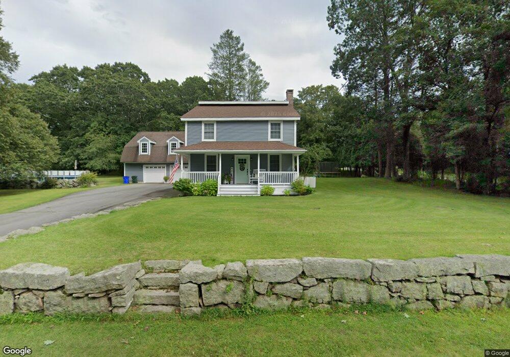
1105 Blossom Rd Westport, MA 02790
Estimated Value: $586,509 - $695,000
3
Beds
3
Baths
2,106
Sq Ft
$301/Sq Ft
Est. Value
About This Home
This home is located at 1105 Blossom Rd, Westport, MA 02790 and is currently estimated at $634,627, approximately $301 per square foot. 1105 Blossom Rd is a home located in Bristol County with nearby schools including North End Elementary School, Talbot Innovation School, and B M C Durfee High School.
Ownership History
Date
Name
Owned For
Owner Type
Purchase Details
Closed on
Apr 10, 2009
Sold by
Pickering Ft
Bought by
Pickering Kevin G and Pickering Melissa
Current Estimated Value
Home Financials for this Owner
Home Financials are based on the most recent Mortgage that was taken out on this home.
Original Mortgage
$258,400
Outstanding Balance
$163,350
Interest Rate
4.94%
Mortgage Type
Purchase Money Mortgage
Estimated Equity
$471,277
Purchase Details
Closed on
Nov 14, 2006
Sold by
Pickering George Earl
Bought by
Pickering Ft
Create a Home Valuation Report for This Property
The Home Valuation Report is an in-depth analysis detailing your home's value as well as a comparison with similar homes in the area
Home Values in the Area
Average Home Value in this Area
Purchase History
| Date | Buyer | Sale Price | Title Company |
|---|---|---|---|
| Pickering Kevin G | $323,000 | -- | |
| Pickering Ft | -- | -- |
Source: Public Records
Mortgage History
| Date | Status | Borrower | Loan Amount |
|---|---|---|---|
| Open | Pickering Kevin G | $258,400 |
Source: Public Records
Tax History Compared to Growth
Tax History
| Year | Tax Paid | Tax Assessment Tax Assessment Total Assessment is a certain percentage of the fair market value that is determined by local assessors to be the total taxable value of land and additions on the property. | Land | Improvement |
|---|---|---|---|---|
| 2025 | $5,175 | $452,000 | $158,500 | $293,500 |
| 2024 | $4,897 | $426,200 | $152,400 | $273,800 |
| 2023 | $4,841 | $394,500 | $131,800 | $262,700 |
| 2022 | $4,446 | $352,300 | $123,200 | $229,100 |
| 2021 | $4,405 | $318,500 | $123,600 | $194,900 |
| 2020 | $4,495 | $311,100 | $123,900 | $187,200 |
| 2019 | $4,478 | $307,100 | $125,800 | $181,300 |
| 2018 | $4,278 | $292,600 | $125,800 | $166,800 |
| 2017 | $3,921 | $280,100 | $115,400 | $164,700 |
| 2016 | $3,724 | $273,200 | $115,400 | $157,800 |
| 2015 | $3,628 | $277,400 | $115,400 | $162,000 |
| 2014 | $3,392 | $269,600 | $107,600 | $162,000 |
Source: Public Records
Map
Nearby Homes
- 128 Old Bedford Rd
- 3 Diane Way
- 125 Angell St
- 85 Reney St
- 89 Lafayette St
- 34 Alsop St
- 219 Earle St Unit 3
- 217 Earle St Unit 2
- 215 Earle St Unit 1
- 44 Fenmore St
- 172 Earle St
- 0 Rich St
- 168 Windsor St
- 1796 Locust St
- 33 William St
- 37 Eaton St
- 6 Beaulieu St
- 25 Beaulieu St
- 1792 Pleasant St Unit 1808
- 10 Choate St
- 1135 Blossom Rd
- 1053 Blossom Rd
- 1205 Blossom Rd
- 1025 Blossom Rd
- 1000 Blossom Rd
- 995 Blossom Rd
- 1204 Blossom Rd
- 1204 Blossom Rd
- 982 Blossom Rd
- 1228 Blossom Rd
- 1187 Blossom Rd
- 937 Blossom Rd
- 193 Blossom Hill Dr
- 193 Blossom Hill Dr
- 193 Blossom Hill Dr Unit 1
- 192 Blossom Hill Dr
- 214 Blossom Hill Rd
- 932 Blossom Rd
- 921 Blossom Rd
- 215 Blossom Hill Dr