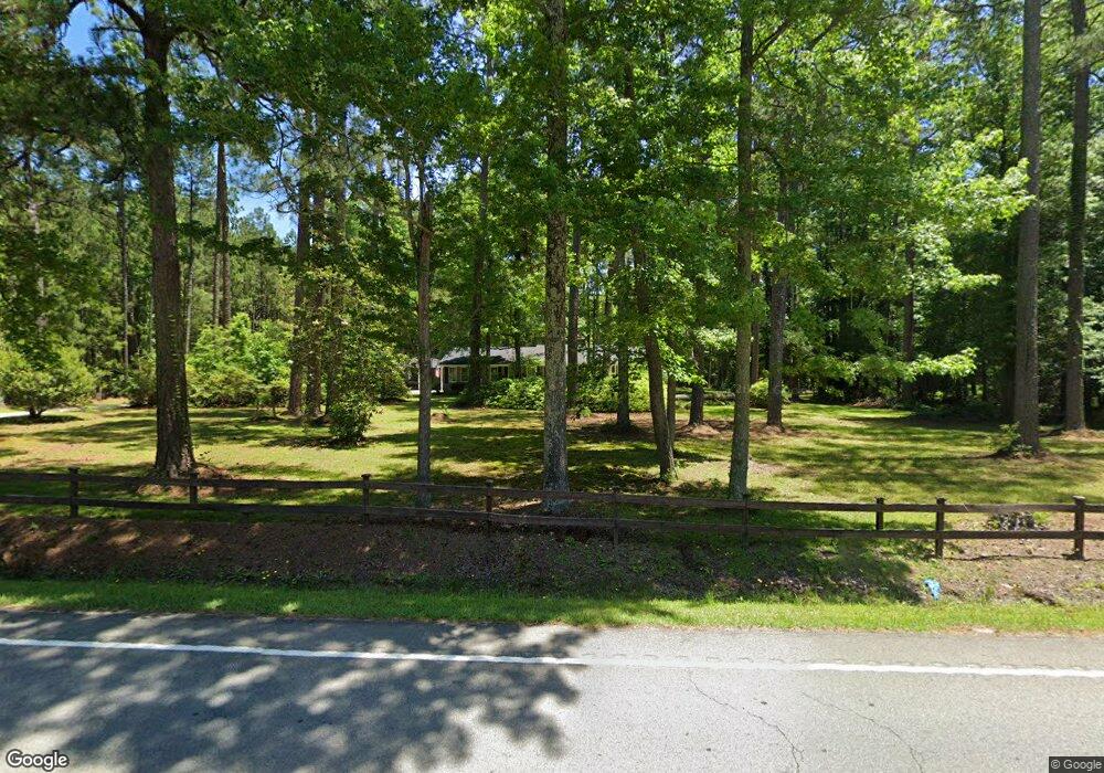
11056 Wilson Blvd Blythewood, SC 29016
Estimated Value: $283,000 - $414,000
4
Beds
2
Baths
2,474
Sq Ft
$139/Sq Ft
Est. Value
About This Home
This home is located at 11056 Wilson Blvd, Blythewood, SC 29016 and is currently estimated at $343,650, approximately $138 per square foot. 11056 Wilson Blvd is a home located in Richland County with nearby schools including Langford Elementary School, Muller Road Middle, and Blythewood High School.
Ownership History
Date
Name
Owned For
Owner Type
Purchase Details
Closed on
Sep 27, 2018
Sold by
Owens Donald R and Owens Robin C
Bought by
Rew William J and Rew Christy J
Current Estimated Value
Home Financials for this Owner
Home Financials are based on the most recent Mortgage that was taken out on this home.
Original Mortgage
$148,750
Outstanding Balance
$111,515
Interest Rate
4.5%
Mortgage Type
New Conventional
Estimated Equity
$232,135
Create a Home Valuation Report for This Property
The Home Valuation Report is an in-depth analysis detailing your home's value as well as a comparison with similar homes in the area
Home Values in the Area
Average Home Value in this Area
Purchase History
| Date | Buyer | Sale Price | Title Company |
|---|---|---|---|
| Rew William J | $190,000 | None Available |
Source: Public Records
Mortgage History
| Date | Status | Borrower | Loan Amount |
|---|---|---|---|
| Open | Rew William J | $148,750 |
Source: Public Records
Tax History Compared to Growth
Tax History
| Year | Tax Paid | Tax Assessment Tax Assessment Total Assessment is a certain percentage of the fair market value that is determined by local assessors to be the total taxable value of land and additions on the property. | Land | Improvement |
|---|---|---|---|---|
| 2024 | $1,543 | $145,800 | $28,400 | $117,400 |
| 2023 | $1,543 | $6,464 | $0 | $0 |
| 2022 | $1,671 | $161,600 | $28,400 | $133,200 |
| 2021 | $1,676 | $6,460 | $0 | $0 |
| 2020 | $1,700 | $6,460 | $0 | $0 |
| 2019 | $1,678 | $6,460 | $0 | $0 |
| 2018 | $1,726 | $6,660 | $0 | $0 |
| 2017 | $1,693 | $6,660 | $0 | $0 |
| 2016 | $1,687 | $6,660 | $0 | $0 |
| 2015 | $1,693 | $6,660 | $0 | $0 |
| 2014 | $1,690 | $166,500 | $0 | $0 |
| 2013 | -- | $6,660 | $0 | $0 |
Source: Public Records
Map
Nearby Homes
- 11033 Wilson Blvd
- 514 Cooley Farm Ct
- 0 Oakhurst Place Unit Lot 70
- 0 Oakhurst Place Unit Lot 73
- 0 Oakhurst Place Unit Lot 72
- 0 Oakhurst Place Unit Lot 71
- 0 Cross Ridge Rd Unit Lot 74
- 0 Cross Ridge Rd Unit Lot 75
- 0 Cross Ridge Rd Unit Lot 76
- 0 Cross Ridge Rd Unit Lot 77
- 204 Mcnulty St
- 138 Pineview Church Rd
- 791 Langford Rd
- NX 1057 Langford Rd
- 19 Fangango Ct
- 125 Blythewood Rd
- 1024 Beaufort Farm Rd
- 1034 Beaufort Farm Rd
- 1018 Beaufort Farm Rd
- 1025 Beaufort Farm Rd
- 11041 Wilson Blvd
- 11049 Wilson Blvd
- 11072 Wilson Blvd
- 11019 Wilson Blvd
- 252 Gunter Cir
- 11029 Wilson Blvd
- 11071 Wilson Blvd
- 11093 Wilson Blvd
- 1088 Frank Dale Rd
- 0 Frank Dale Rd
- 244 Gunter Cir
- 11016 Wilson Blvd
- 11017 Wilson Blvd
- 232 Gunter Cir
- 302 Sandfarm Trail
- 305 Sandfarm Trail
- 200 Gunter Cir
- 11089 Wilson Blvd
- 1056 Frank Dale Rd
- 240 Gunter Cir