Estimated payment $4,428/month
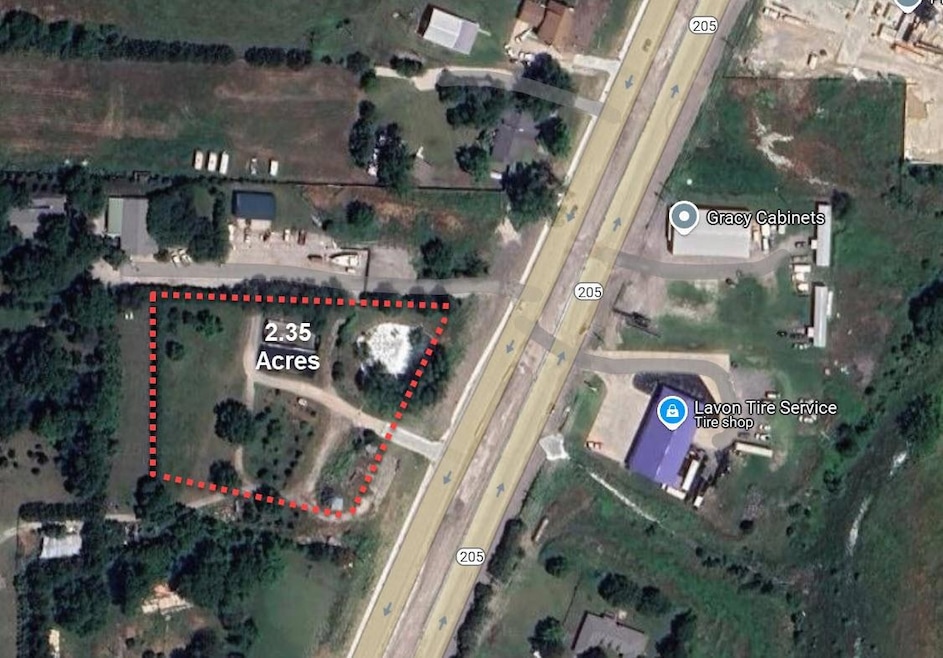
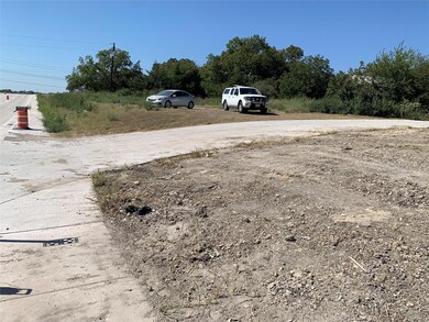
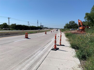
About This Lot
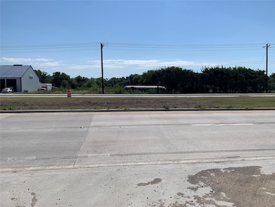
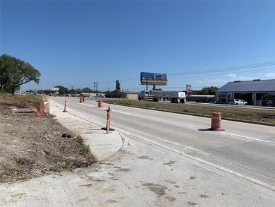
Vacant land with new concrete drive access from SH 205.
Listing Agent
BRG & Associates Brokerage Phone: 972-442-7508 License #0524162 Listed on: 04/09/2025
Property Details
Property Type
- Land
Est. Annual Taxes
- $25
Year Built
- Built in 2010
Lot Details
- 2.35 Acre Lot
- Property fronts a highway
- Sloped Lot
- Few Trees
- Zoning described as Ag
Schools
- Hartman Elementary School
- Mcmillan Middle School
- Davis Middle School
- Wylie East High School
Farming
- 1 Stock Tank or Pond
- Agricultural Exemption
Utilities
- Co-Op Electric
- Co-Op Water
Listing and Financial Details
- Assessor Parcel Number R677300004501
- $25 per year unexempt tax
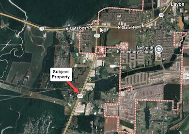
Map
Home Values in the Area
Average Home Value in this Area
Tax History
| Year | Tax Paid | Tax Assessment Tax Assessment Total Assessment is a certain percentage of the fair market value that is determined by local assessors to be the total taxable value of land and additions on the property. | Land | Improvement |
|---|---|---|---|---|
| 2023 | $25 | $2,472 | $233 | $2,239 |
| 2022 | $44 | $2,714 | $240 | $2,474 |
| 2021 | $51 | $108,505 | $105,791 | $2,714 |
| 2020 | $166 | $139,420 | $130,500 | $8,920 |
| 2019 | $196 | $10,298 | $130,500 | $9,979 |
| 2018 | $204 | $10,679 | $130,500 | $10,357 |
| 2017 | $216 | $126,985 | $0 | $126,985 |
| 2016 | $195 | $125,821 | $0 | $125,821 |
| 2015 | $146 | $123,056 | $116,000 | $7,056 |
Property History
| Date | Event | Price | Change | Sq Ft Price |
|---|---|---|---|---|
| 04/09/2025 04/09/25 | For Sale | $799,000 | -- | -- |
Purchase History
| Date | Type | Sale Price | Title Company |
|---|---|---|---|
| Warranty Deed | -- | None Available |
Source: North Texas Real Estate Information Systems (NTREIS)
MLS Number: 20898587
APN: R-6773-000-0450-1
Disclaimer: Certain information contained herein is derived from information provided by parties other than Homes.com. All information provided is deemed reliable, but is not guaranteed to be accurate and should be independently verified.
![]() Listing information provided in part by the North Texas Real Estate Information Systems, Inc, for personal, non-commercial use by viewers of this site and may not be reproduced or redistributed. All information is deemed reliable but not guaranteed. Copyright © NTREIS 2025. All rights reserved
Listing information provided in part by the North Texas Real Estate Information Systems, Inc, for personal, non-commercial use by viewers of this site and may not be reproduced or redistributed. All information is deemed reliable but not guaranteed. Copyright © NTREIS 2025. All rights reserved
- 14697 County Road 485
- 1731 Hillside Stroll Dr
- 825 Stone Grove Rd
- 827 Trailing Vine Way
- 827 Stone Grove Rd
- 813 Stone Grove Rd
- 825 Trailing Vine Way
- 805 Stone Grove Rd
- 815 Willow Stream Dr
- 829 Stone Grove Rd
- 1811 Hillside Stroll Dr
- 1811 Hillside Stroll Dr
- 1811 Hillside Stroll Dr
- 1811 Hillside Stroll Dr
- 1811 Hillside Stroll Dr
- 1811 Hillside Stroll Dr
- 1811 Hillside Stroll Dr
- 1811 Hillside Stroll Dr
- 1811 Hillside Stroll Dr
- 1811 Hillside Stroll Dr
- 794 Moonlight Place
- 904 Lakehaven Trail
- 916 Tulip Trail
- 902 Tulip Trail
- 383 Orbit Dr
- 746 Wilshire Dr
- 730 Wilshire Dr
- 796 Crestridge Dr
- 342 Schirra Ct
- 334 Armstrong Ln
- 557 London Dr
- 536 London Dr
- 534 Crestridge Dr
- 750 Lowell Dr
- 488 Crestridge Dr
- 786 Camden Dr
- 1030 Shepard Ln
- 629 Langdon St
- 702 Camden Dr
- 628 Cottage Place
