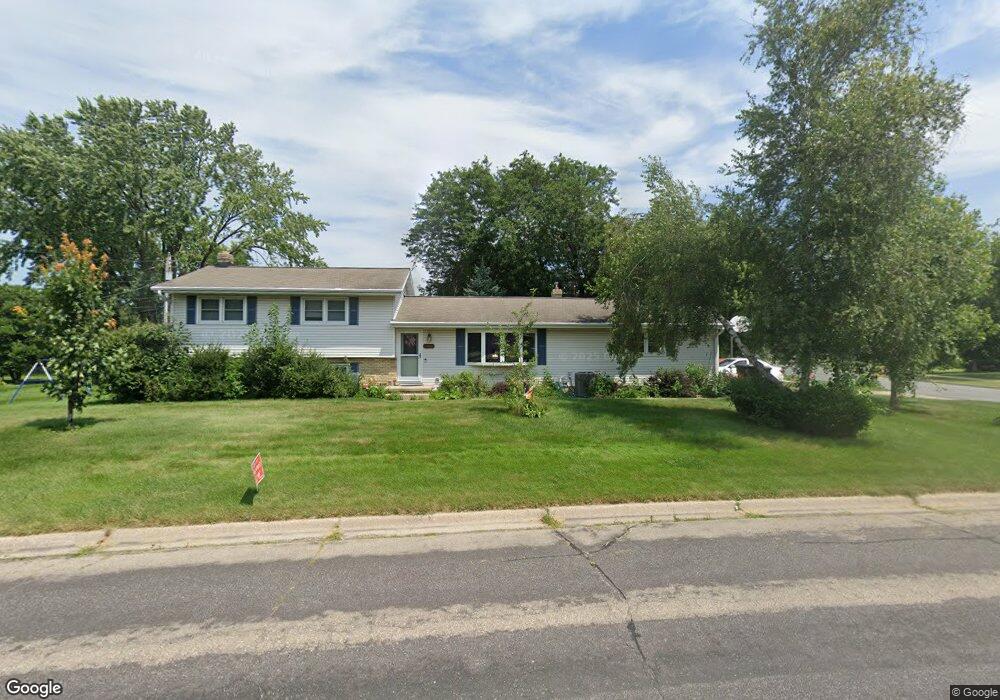
1110 Coral Dr Sun Prairie, WI 53590
Central Sun Prairie NeighborhoodEstimated Value: $342,000 - $367,000
4
Beds
2
Baths
1,721
Sq Ft
$206/Sq Ft
Est. Value
About This Home
This home is located at 1110 Coral Dr, Sun Prairie, WI 53590 and is currently estimated at $354,578, approximately $206 per square foot. 1110 Coral Dr is a home located in Dane County with nearby schools including Westside Elementary School, Prairie View Middle School, and Sacred Hearts School.
Ownership History
Date
Name
Owned For
Owner Type
Purchase Details
Closed on
Apr 23, 2025
Sold by
Baker Diane
Bought by
Baker Todd
Current Estimated Value
Home Financials for this Owner
Home Financials are based on the most recent Mortgage that was taken out on this home.
Original Mortgage
$286,020
Interest Rate
6.85%
Mortgage Type
VA
Create a Home Valuation Report for This Property
The Home Valuation Report is an in-depth analysis detailing your home's value as well as a comparison with similar homes in the area
Home Values in the Area
Average Home Value in this Area
Purchase History
| Date | Buyer | Sale Price | Title Company |
|---|---|---|---|
| Baker Todd | -- | None Listed On Document |
Source: Public Records
Mortgage History
| Date | Status | Borrower | Loan Amount |
|---|---|---|---|
| Previous Owner | Baker Todd | $286,020 |
Source: Public Records
Tax History Compared to Growth
Tax History
| Year | Tax Paid | Tax Assessment Tax Assessment Total Assessment is a certain percentage of the fair market value that is determined by local assessors to be the total taxable value of land and additions on the property. | Land | Improvement |
|---|---|---|---|---|
| 2024 | $5,605 | $299,700 | $70,600 | $229,100 |
| 2023 | $5,071 | $299,700 | $70,600 | $229,100 |
| 2021 | $4,435 | $216,200 | $66,000 | $150,200 |
| 2020 | $4,568 | $216,200 | $66,000 | $150,200 |
| 2019 | $4,666 | $196,300 | $52,900 | $143,400 |
| 2018 | $4,331 | $196,300 | $52,900 | $143,400 |
| 2017 | $4,173 | $196,300 | $52,900 | $143,400 |
| 2016 | $4,120 | $175,800 | $46,300 | $129,500 |
| 2015 | $4,006 | $175,800 | $46,300 | $129,500 |
| 2014 | $4,037 | $176,000 | $46,300 | $129,700 |
| 2013 | $4,146 | $176,000 | $46,300 | $129,700 |
Source: Public Records
Map
Nearby Homes
- 200 Queens St
- 1033 Lothe St
- 916 Ring St
- 3345 U S 151
- 1486 Ivory Dr
- 1443 Buena Vista Dr
- 530 W Main St
- 1500 Calico Ln
- 706 Woodland Dr
- 147 Flint St
- 600 Linnerud Dr
- 709 Linnerud Dr
- 921 Pine St
- 1013 Vandenburg St
- 1010 Andrews Dr
- 104 Waldorf Ct
- 933 Allison St
- 643 Eddington Dr
- 1926 Wyoming Ave
- 1402 Andaman St