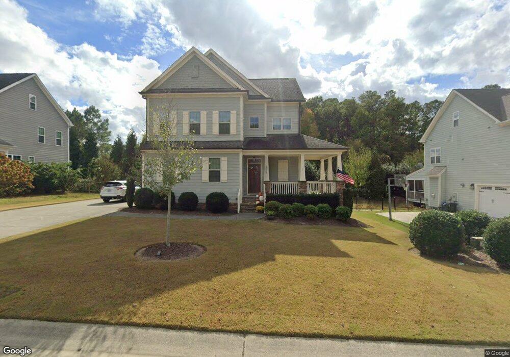
1115 Ambrose Dr Unit 3198 Rolesville, NC 27571
Estimated Value: $504,632 - $605,000
4
Beds
3
Baths
2,108
Sq Ft
$259/Sq Ft
Est. Value
About This Home
This home is located at 1115 Ambrose Dr Unit 3198, Rolesville, NC 27571 and is currently estimated at $545,408, approximately $258 per square foot. 1115 Ambrose Dr Unit 3198 is a home located in Wake County with nearby schools including Sanford Creek Elementary School, Rolesville Middle School, and Rolesville High School.
Ownership History
Date
Name
Owned For
Owner Type
Purchase Details
Closed on
Sep 30, 2014
Sold by
Capitol City Homes Llc
Bought by
Anweiler Robert B and Anweiler Lisa D
Current Estimated Value
Home Financials for this Owner
Home Financials are based on the most recent Mortgage that was taken out on this home.
Original Mortgage
$275,405
Outstanding Balance
$211,680
Interest Rate
4.17%
Mortgage Type
New Conventional
Estimated Equity
$333,728
Purchase Details
Closed on
Jan 14, 2014
Sold by
Heritage East Developers Inc
Bought by
Capitol City Homes Llc
Home Financials for this Owner
Home Financials are based on the most recent Mortgage that was taken out on this home.
Original Mortgage
$220,800
Interest Rate
4.48%
Mortgage Type
Future Advance Clause Open End Mortgage
Create a Home Valuation Report for This Property
The Home Valuation Report is an in-depth analysis detailing your home's value as well as a comparison with similar homes in the area
Home Values in the Area
Average Home Value in this Area
Purchase History
| Date | Buyer | Sale Price | Title Company |
|---|---|---|---|
| Anweiler Robert B | $290,000 | None Available | |
| Capitol City Homes Llc | $55,000 | None Available |
Source: Public Records
Mortgage History
| Date | Status | Borrower | Loan Amount |
|---|---|---|---|
| Open | Anweiler Robert B | $275,405 | |
| Previous Owner | Capitol City Homes Llc | $220,800 |
Source: Public Records
Tax History Compared to Growth
Tax History
| Year | Tax Paid | Tax Assessment Tax Assessment Total Assessment is a certain percentage of the fair market value that is determined by local assessors to be the total taxable value of land and additions on the property. | Land | Improvement |
|---|---|---|---|---|
| 2025 | $4,861 | $495,129 | $100,000 | $395,129 |
| 2024 | $4,843 | $495,129 | $100,000 | $395,129 |
| 2023 | $3,832 | $341,242 | $58,500 | $282,742 |
| 2022 | $3,704 | $341,242 | $58,500 | $282,742 |
| 2021 | $3,587 | $311,644 | $58,500 | $253,144 |
| 2020 | $3,323 | $311,644 | $58,500 | $253,144 |
| 2019 | $3,463 | $286,745 | $55,000 | $231,745 |
| 2018 | $3,273 | $286,745 | $55,000 | $231,745 |
| 2017 | $3,160 | $286,745 | $55,000 | $231,745 |
| 2016 | $3,118 | $286,745 | $55,000 | $231,745 |
| 2015 | $3,207 | $302,181 | $70,000 | $232,181 |
| 2014 | -- | $70,000 | $70,000 | $0 |
Source: Public Records
Map
Nearby Homes
- 1123 Ambrose Dr
- 4628 Rogers Rd
- 1001 Kennison Ct
- 3037 Freeman Farm Way
- 6205 Roles Saddle Dr
- 536 Adkins Ridge Rd
- 11249 Jeffreys Ln
- 5508 Massey Branch Dr
- 3004 Freeman Farm Way
- 1021 Smoke Willow Way Unit 130
- 5138 Corner Rock Dr
- 459 Granite Creek Dr
- 452 Granite Saddle Dr
- 821 Willow Tower Ct
- 1036 Smoke Willow Way
- 825 Willow Tower Ct
- 615 Misty Willow Way
- 824 Willow Tower Ct
- 917 Evening Snow St
- 418 Granite Creek Dr
- 1109 Ambrose Dr
- 1119 Ambrose Dr
- 0 Rogers Dr Unit TR2084605
- 1105 Ambrose Dr
- 1116 Ambrose Dr
- 1108 Ambrose Dr
- 1120 Ambrose Dr
- 1127 Ambrose Dr
- 1101 Ambrose Dr Unit 3201
- 1101 Ambrose Dr
- 1124 Ambrose Dr
- 1100 Ambrose Dr
- 1131 Ambrose Dr
- 2305 Mitchell Garden Dr
- 1128 Ambrose Dr
- 4806 Rogers Rd
- 0 Wellspring Farms Ln Unit 1684587
- 0 Wellspring Farms Ln Unit 1637652
- 0 Wellspring Farms Ln Unit 1629123
- 1 Rogers Rd