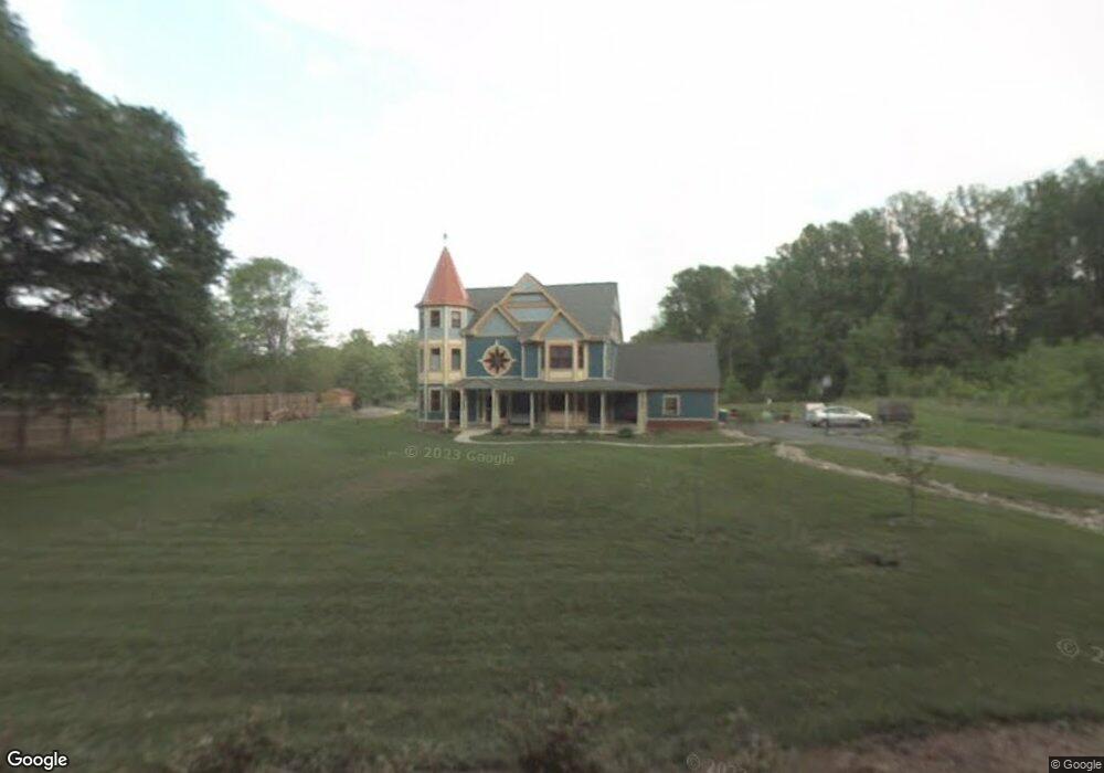
1115 Arundel Station Rd Millersville, MD 21108
Estimated Value: $764,000 - $1,450,000
--
Bed
3
Baths
4,425
Sq Ft
$255/Sq Ft
Est. Value
About This Home
This home is located at 1115 Arundel Station Rd, Millersville, MD 21108 and is currently estimated at $1,130,131, approximately $255 per square foot. 1115 Arundel Station Rd is a home located in Anne Arundel County with nearby schools including Millersville Elementary School, Old Mill High School, and Guidepost Montessori at Gambrills.
Ownership History
Date
Name
Owned For
Owner Type
Purchase Details
Closed on
Jul 16, 2001
Sold by
Judge Alfred H
Bought by
Brandt Theresa M P and Brandt William N
Current Estimated Value
Purchase Details
Closed on
Jan 7, 1998
Sold by
Lushbaugh Caroline V
Bought by
Judge Alfred H and Judge Carol S
Purchase Details
Closed on
Nov 17, 1997
Sold by
Callahan Shirley Mae L
Bought by
Lushbaugh Caroline
Create a Home Valuation Report for This Property
The Home Valuation Report is an in-depth analysis detailing your home's value as well as a comparison with similar homes in the area
Home Values in the Area
Average Home Value in this Area
Purchase History
| Date | Buyer | Sale Price | Title Company |
|---|---|---|---|
| Brandt Theresa M P | $162,000 | -- | |
| Judge Alfred H | -- | -- | |
| Lushbaugh Caroline | -- | -- |
Source: Public Records
Mortgage History
| Date | Status | Borrower | Loan Amount |
|---|---|---|---|
| Closed | Brandt Theresa M P | -- |
Source: Public Records
Tax History Compared to Growth
Tax History
| Year | Tax Paid | Tax Assessment Tax Assessment Total Assessment is a certain percentage of the fair market value that is determined by local assessors to be the total taxable value of land and additions on the property. | Land | Improvement |
|---|---|---|---|---|
| 2025 | $9,562 | $948,800 | $265,000 | $683,800 |
| 2024 | $9,562 | $897,200 | $0 | $0 |
| 2023 | $9,292 | $845,600 | $0 | $0 |
| 2022 | $8,672 | $794,000 | $255,000 | $539,000 |
| 2021 | $17,017 | $774,167 | $0 | $0 |
| 2020 | $8,312 | $754,333 | $0 | $0 |
| 2019 | $8,162 | $734,500 | $215,000 | $519,500 |
| 2018 | $7,318 | $721,733 | $0 | $0 |
| 2017 | $7,665 | $708,967 | $0 | $0 |
| 2016 | -- | $696,200 | $0 | $0 |
| 2015 | -- | $696,200 | $0 | $0 |
| 2014 | -- | $696,200 | $0 | $0 |
Source: Public Records
Map
Nearby Homes
- 1400 Lower View Ct
- 1184 Tanager Dr
- 30 Highland Dr
- 1759 Daisey Ct
- 1220 Indian Landing Rd
- 605, 607 Crain Hwy N
- 397 Charles Hall Dr
- 1080 Generals Hwy
- 771 Generals Hwy
- 1270 Dorothy Rd
- 1610 Hog Farm Rd
- 983 Wayside Dr
- 1013 Waterbury Heights Dr
- 1458 Wilderness Ridge Trail
- 1404 Cotton Ct
- 927 Heatherfield Ln
- 820 Annapolis Rd
- 1508 Cornerstone Ct
- 1160 Saint Stephens Church Rd
- 610 Echo Cove Dr
- 1011 Arundel Station Rd
- 1573 Millersville Rd
- 1007 Arundel Station Rd
- 1020 Arundel Station Rd
- 1119 Arundel Station Rd
- 1545 Waterbury Rd
- 1022 Arundel Station Rd
- 1575 Millersville Rd
- 1551 Millersville Rd
- 1539 Waterbury Rd
- 1535 Waterbury Rd
- 1580 Millersville Rd
- 1601 Misty Manor Way
- 1603 Misty Manor Way
- 1600 Misty Manor Way
- 1588 Millersville Rd
- 1218 Ringgold Ln
- 1554 Millersville Rd
- 1594 Millersville Rd
- 902 Misty Manor Ln