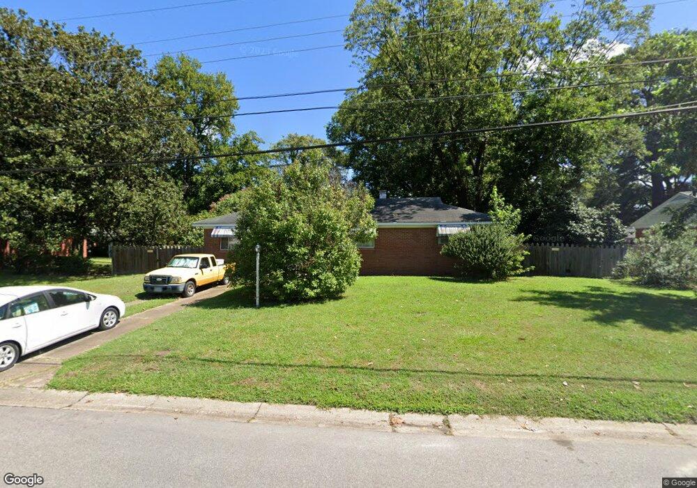
1116 Sanford Ave Virginia Beach, VA 23455
Bayside NeighborhoodEstimated Value: $267,000 - $345,000
3
Beds
1
Bath
1,325
Sq Ft
$236/Sq Ft
Est. Value
About This Home
This home is located at 1116 Sanford Ave, Virginia Beach, VA 23455 and is currently estimated at $312,761, approximately $236 per square foot. 1116 Sanford Ave is a home located in Virginia Beach City with nearby schools including Bayside Elementary School, Bayside 6th Grade Campus, and Bayside High School.
Ownership History
Date
Name
Owned For
Owner Type
Purchase Details
Closed on
Aug 24, 2000
Sold by
Hanna Shelly R
Bought by
Powell William C
Current Estimated Value
Home Financials for this Owner
Home Financials are based on the most recent Mortgage that was taken out on this home.
Original Mortgage
$75,000
Outstanding Balance
$26,887
Interest Rate
8.06%
Estimated Equity
$285,874
Create a Home Valuation Report for This Property
The Home Valuation Report is an in-depth analysis detailing your home's value as well as a comparison with similar homes in the area
Home Values in the Area
Average Home Value in this Area
Purchase History
| Date | Buyer | Sale Price | Title Company |
|---|---|---|---|
| Powell William C | $95,000 | -- |
Source: Public Records
Mortgage History
| Date | Status | Borrower | Loan Amount |
|---|---|---|---|
| Open | Powell William C | $75,000 |
Source: Public Records
Tax History Compared to Growth
Tax History
| Year | Tax Paid | Tax Assessment Tax Assessment Total Assessment is a certain percentage of the fair market value that is determined by local assessors to be the total taxable value of land and additions on the property. | Land | Improvement |
|---|---|---|---|---|
| 2025 | $2,211 | $263,700 | $135,000 | $128,700 |
| 2024 | $2,211 | $227,900 | $125,000 | $102,900 |
| 2023 | $2,111 | $213,200 | $110,000 | $103,200 |
| 2022 | $1,995 | $201,500 | $110,000 | $91,500 |
| 2021 | $1,723 | $174,000 | $102,000 | $72,000 |
| 2020 | $1,732 | $170,200 | $102,000 | $68,200 |
| 2019 | $1,718 | $169,600 | $102,000 | $67,600 |
| 2018 | $1,700 | $169,600 | $102,000 | $67,600 |
| 2017 | $1,610 | $160,600 | $93,000 | $67,600 |
| 2016 | $1,521 | $153,600 | $93,000 | $60,600 |
| 2015 | $1,604 | $162,000 | $99,800 | $62,200 |
| 2014 | $1,503 | $161,600 | $99,800 | $61,800 |
Source: Public Records
Map
Nearby Homes
- 5712 Gretna Rd
- 1109 Spindle Crossing
- 5537 Finespun Last
- 1284 Hillock Crossing
- 5644 Lawson Hall Rd
- 1027 Finney Cir
- 5545 Lambdin Arch
- 1052 Old Canterbury Dr
- 1004 Pastern Brief
- 5605 State St
- 5609 Rossburn Dr
- 1005 Hollins College Ct
- 5505 Merner Ln
- 902 Monarch Dr
- 900 Monarch Dr
- 5522 Campus Dr
- 5528 Goose Pond Ln
- 5536 Frog Pond Ln
- 5618 Baccalaureate Dr
- 802 Diploma Ct
- 1112 Sanford Ave
- 1120 Sanford Ave
- 1117 Baker Rd
- 1121 Baker Rd
- 1113 Baker Rd
- 1100 W Sanford Ave
- 1108 Sanford Ave
- 5721 Gretna Rd
- 5705 Gretna Rd
- 1109 Baker Rd
- 1125 Baker Rd
- 1104 W Sanford Ave
- 1104 Sanford Ave
- 1105 Baker Rd
- 1121 Freehold Close
- 1117 Freehold Close
- 5701 Gretna Rd
- 5609 Plowshare Brief
- 5605 Plowshare Brief
- 1113 Freehold Close