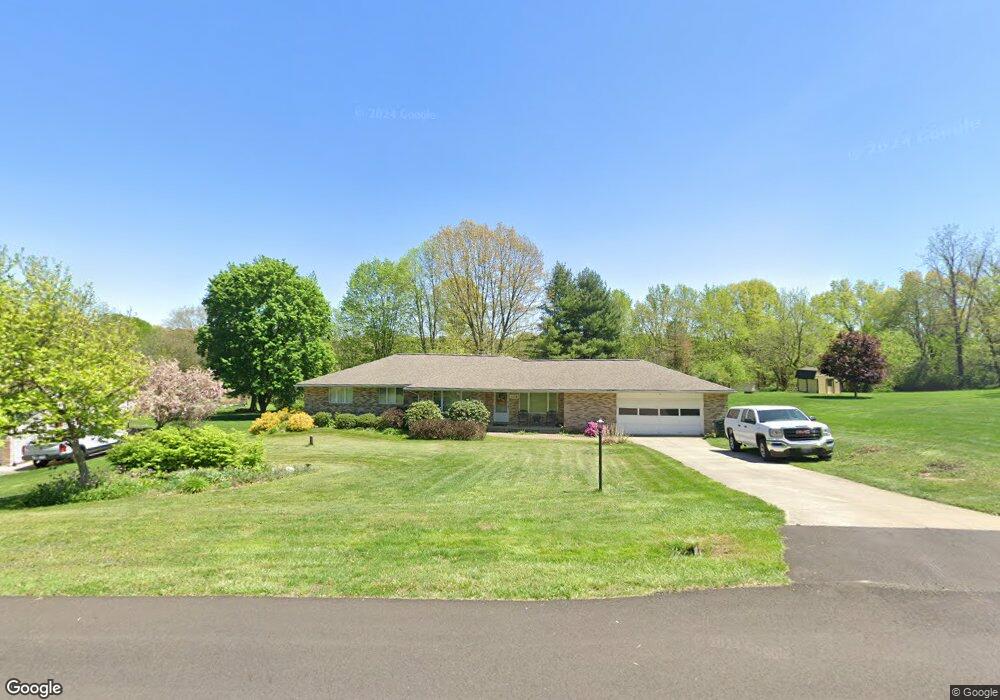
11176 Oasis Ave NE Uniontown, OH 44685
Estimated Value: $279,629 - $362,000
3
Beds
3
Baths
1,878
Sq Ft
$166/Sq Ft
Est. Value
About This Home
This home is located at 11176 Oasis Ave NE, Uniontown, OH 44685 and is currently estimated at $312,157, approximately $166 per square foot. 11176 Oasis Ave NE is a home located in Stark County with nearby schools including Lake Middle/High School and Lake Center Christian School.
Ownership History
Date
Name
Owned For
Owner Type
Purchase Details
Closed on
Mar 2, 2022
Sold by
Mary K Takacs Inv Tr
Bought by
Brown R Michael R and Brown Leah J
Current Estimated Value
Home Financials for this Owner
Home Financials are based on the most recent Mortgage that was taken out on this home.
Original Mortgage
$62,500
Outstanding Balance
$58,242
Interest Rate
3.69%
Mortgage Type
New Conventional
Estimated Equity
$253,915
Purchase Details
Closed on
Nov 26, 2004
Sold by
Takacs Joseph and Takacs Mary K
Bought by
Takacs Joseph and Takacs Mary K
Create a Home Valuation Report for This Property
The Home Valuation Report is an in-depth analysis detailing your home's value as well as a comparison with similar homes in the area
Home Values in the Area
Average Home Value in this Area
Purchase History
| Date | Buyer | Sale Price | Title Company |
|---|---|---|---|
| Brown R Michael R | -- | None Listed On Document | |
| Takacs Joseph | -- | -- |
Source: Public Records
Mortgage History
| Date | Status | Borrower | Loan Amount |
|---|---|---|---|
| Open | Brown R Michael R | $62,500 |
Source: Public Records
Tax History Compared to Growth
Tax History
| Year | Tax Paid | Tax Assessment Tax Assessment Total Assessment is a certain percentage of the fair market value that is determined by local assessors to be the total taxable value of land and additions on the property. | Land | Improvement |
|---|---|---|---|---|
| 2025 | -- | $78,020 | $28,390 | $49,630 |
| 2024 | -- | $78,020 | $28,390 | $49,630 |
| 2023 | $3,128 | $67,030 | $17,710 | $49,320 |
| 2022 | $3,691 | $77,210 | $17,710 | $59,500 |
| 2021 | $3,146 | $77,210 | $17,710 | $59,500 |
| 2020 | $2,960 | $65,700 | $15,260 | $50,440 |
| 2019 | $2,928 | $65,700 | $15,260 | $50,440 |
| 2018 | $2,929 | $65,700 | $15,260 | $50,440 |
| 2017 | $2,758 | $58,000 | $15,260 | $42,740 |
| 2016 | $3,490 | $58,000 | $15,260 | $42,740 |
| 2015 | $2,646 | $58,000 | $15,260 | $42,740 |
| 2014 | $310 | $52,020 | $13,690 | $38,330 |
| 2013 | $1,155 | $52,020 | $13,690 | $38,330 |
Source: Public Records
Map
Nearby Homes
- 11121 Geib Ave NE
- 2084 Hazel St NE
- 425 Tonawanda Trail SW
- 1180 Tessa Trail Unit 1180
- 1037 Canyon St NE
- 1975 Eloise Cir NE
- 747 Grandview Cir
- 11900 Geib Ave NE
- 225 Seneca Trail SW
- 778 Fair Vista Cir SW
- 550 Woodlands Glen Ave
- 786 Fair Vista Cir SW
- 525 Gentlebrook Blvd SW
- 531 Gentlebrook Blvd SW
- 510 Meadow Cir SW Unit 11
- Unit 9 Meadow Trail SW Unit 9
- 330 Belle Ave SW
- 316 S Prospect Ave
- 12055 King Church Ave NW
- 9790 Smithdale Ave NE
- 11176 Oasis Ave NE
- 11176 Oasis Ave NE
- 11154 Oasis Ave NE
- 11198 Oasis Ave NE
- 11198 Oasis Ave NE
- 11216 Oasis Ave NE
- 11181 Oasis Ave NE
- 11136 Oasis Ave NE
- 11153 Oasis Ave NE
- 11234 Oasis Ave NE
- 1608 Canyon St NE
- 11036 Sagebrush Ave NE
- 11131 Oasis Ave NE
- 1580 Canyon St NE
- 11252 Oasis Ave NE
- 1562 Canyon St NE
- 11030 Sagebrush Ave NE
- 11054 Sagebrush Ave NE
- 11041 Sagebrush Ave NE
- V/L Oasis Ave NE