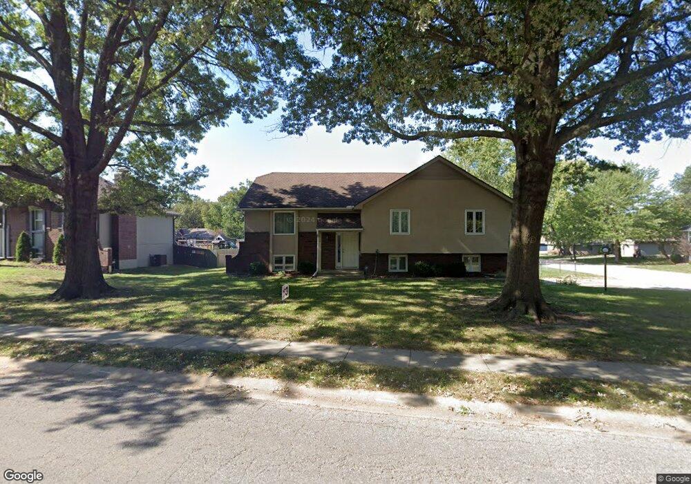
112 N Woodson Dr Raymore, MO 64083
Estimated Value: $307,332 - $332,000
3
Beds
2
Baths
1,528
Sq Ft
$209/Sq Ft
Est. Value
About This Home
This home is located at 112 N Woodson Dr, Raymore, MO 64083 and is currently estimated at $319,833, approximately $209 per square foot. 112 N Woodson Dr is a home located in Cass County with nearby schools including Raymore Elementary School, Raymore-Peculiar East Middle School, and Raymore-Peculiar Senior High School.
Ownership History
Date
Name
Owned For
Owner Type
Purchase Details
Closed on
Feb 28, 2006
Sold by
Mcginnis Michael O and Mcginnis Patricia J
Bought by
Heath Kenneth A and Heath Christy Lynn
Current Estimated Value
Home Financials for this Owner
Home Financials are based on the most recent Mortgage that was taken out on this home.
Original Mortgage
$120,000
Outstanding Balance
$66,568
Interest Rate
6.05%
Mortgage Type
New Conventional
Estimated Equity
$253,265
Purchase Details
Closed on
Sep 1, 2005
Sold by
Skinner Allen W
Bought by
Mcginnis Michael O
Home Financials for this Owner
Home Financials are based on the most recent Mortgage that was taken out on this home.
Original Mortgage
$124,000
Interest Rate
5.8%
Mortgage Type
Future Advance Clause Open End Mortgage
Create a Home Valuation Report for This Property
The Home Valuation Report is an in-depth analysis detailing your home's value as well as a comparison with similar homes in the area
Home Values in the Area
Average Home Value in this Area
Purchase History
| Date | Buyer | Sale Price | Title Company |
|---|---|---|---|
| Heath Kenneth A | -- | -- | |
| Mcginnis Michael O | -- | -- |
Source: Public Records
Mortgage History
| Date | Status | Borrower | Loan Amount |
|---|---|---|---|
| Open | Heath Kenneth A | $120,000 | |
| Previous Owner | Mcginnis Michael O | $124,000 |
Source: Public Records
Tax History Compared to Growth
Tax History
| Year | Tax Paid | Tax Assessment Tax Assessment Total Assessment is a certain percentage of the fair market value that is determined by local assessors to be the total taxable value of land and additions on the property. | Land | Improvement |
|---|---|---|---|---|
| 2025 | $2,694 | $36,880 | $5,860 | $31,020 |
| 2024 | $2,694 | $33,100 | $5,330 | $27,770 |
| 2023 | $2,690 | $33,100 | $5,330 | $27,770 |
| 2022 | $2,399 | $29,320 | $5,330 | $23,990 |
| 2021 | $2,399 | $29,320 | $5,330 | $23,990 |
| 2020 | $2,373 | $28,490 | $5,330 | $23,160 |
| 2019 | $2,291 | $28,490 | $5,330 | $23,160 |
| 2018 | $2,123 | $25,500 | $4,550 | $20,950 |
| 2017 | $1,859 | $25,500 | $4,550 | $20,950 |
| 2016 | $1,859 | $23,170 | $4,550 | $18,620 |
| 2015 | $1,860 | $23,170 | $4,550 | $18,620 |
| 2014 | $1,861 | $23,170 | $4,550 | $18,620 |
| 2013 | -- | $23,170 | $4,550 | $18,620 |
Source: Public Records
Map
Nearby Homes
- 222 N Madison St
- 227 N Woodson Dr
- 105 N Lakeshore Dr
- 308 N Woodson Dr
- 204 N Pointe Ln
- 615 N Conway St
- 112 W Grant Dr
- 221 N Pointe Ln
- 811 Stratford Dr
- 208 N Pacific Ct
- 108 Rainbow Cir
- 205 Johnston Pkwy
- 512 S Washington St
- 507 S Washington St
- 1003 Silver Lake Dr
- 302 E Olive St
- 410 Appaloosa Dr
- 408 N Washington St
- 1017 Johnston Dr
- The Westridge Plan at Madison Valley
- 110 N Woodson Dr
- 503 W Walnut St
- 500 W Walnut St
- 111 N Murphy Dr
- 111 N Woodson Dr
- 0 W Walnut St
- 109 N Woodson Dr
- 504 W Walnut St
- 106 N Woodson Dr
- 109 N Murphy Dr
- 203 N Woodson Dr
- 506 W Walnut St
- 204 N Woodson Dr
- 107 N Murphy Dr
- 507 W Walnut St
- 205 N Woodson Dr
- 508 W Walnut St
- 206 N Woodson Dr
- 203 N Murphy Dr
- 104 N Woodson Dr