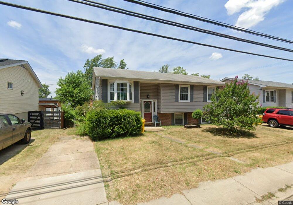
112 Point Pleasant Rd Glen Burnie, MD 21060
Estimated Value: $321,407 - $422,000
--
Bed
2
Baths
1,188
Sq Ft
$328/Sq Ft
Est. Value
About This Home
This home is located at 112 Point Pleasant Rd, Glen Burnie, MD 21060 and is currently estimated at $389,602, approximately $327 per square foot. 112 Point Pleasant Rd is a home located in Anne Arundel County with nearby schools including Point Pleasant Elementary School, Marley Middle School, and Glen Burnie High School.
Ownership History
Date
Name
Owned For
Owner Type
Purchase Details
Closed on
Oct 3, 2014
Sold by
Matusak Victor A and Matusak Sandra C
Bought by
Whitehead William Lawrence
Current Estimated Value
Purchase Details
Closed on
Aug 8, 1989
Sold by
Blizzard Leslie T
Bought by
Matusak Victor A and Matusak Sandra C
Home Financials for this Owner
Home Financials are based on the most recent Mortgage that was taken out on this home.
Original Mortgage
$74,000
Interest Rate
9.68%
Create a Home Valuation Report for This Property
The Home Valuation Report is an in-depth analysis detailing your home's value as well as a comparison with similar homes in the area
Home Values in the Area
Average Home Value in this Area
Purchase History
| Date | Buyer | Sale Price | Title Company |
|---|---|---|---|
| Whitehead William Lawrence | -- | None Available | |
| Matusak Victor A | $109,000 | -- |
Source: Public Records
Mortgage History
| Date | Status | Borrower | Loan Amount |
|---|---|---|---|
| Previous Owner | Matusak Victor A | $74,000 |
Source: Public Records
Tax History Compared to Growth
Tax History
| Year | Tax Paid | Tax Assessment Tax Assessment Total Assessment is a certain percentage of the fair market value that is determined by local assessors to be the total taxable value of land and additions on the property. | Land | Improvement |
|---|---|---|---|---|
| 2025 | $603 | $313,100 | $162,500 | $150,600 |
| 2024 | $603 | $292,533 | $0 | $0 |
| 2023 | $537 | $271,967 | $0 | $0 |
| 2022 | $2,367 | $251,400 | $125,800 | $125,600 |
| 2021 | $416 | $246,767 | $0 | $0 |
| 2020 | $416 | $242,133 | $0 | $0 |
| 2019 | $387 | $237,500 | $115,800 | $121,700 |
| 2018 | $2,276 | $224,500 | $0 | $0 |
| 2017 | $2,077 | $211,500 | $0 | $0 |
| 2016 | -- | $198,500 | $0 | $0 |
| 2015 | -- | $198,500 | $0 | $0 |
| 2014 | -- | $198,500 | $0 | $0 |
Source: Public Records
Map
Nearby Homes
- 210 Hollywood Ct
- 202 Hollywood Ct
- 900 Princeton Terrace
- 116 Juniper Ct
- 136 Margate Dr
- 907 Princeton Terrace
- 906 Silver Maple Ct
- 400 Renfro Dr
- 454 Renfro Ct
- 281 Thompson Ave E
- 933 Andrews Rd
- 36 Elm Dr
- 1319 Meadowvale Rd
- 1022 Bell Ave
- 204 Carroll Rd
- 352 Gatewater Ct Unit A
- 7805 Leymar Rd
- 143 Midland Rd
- 146 Midland Rd
- 1531 Furnace Ave
- 110 Point Pleasant Rd
- 114 Point Pleasant Rd
- 216 Hollywood Ct
- 214 Hollywood Ct
- 108 Point Pleasant Rd
- 218 Hollywood Ct
- 212 Hollywood Ct
- 106 Point Pleasant Rd
- 118 Point Pleasant Rd
- 220 Hollywood Ct
- 901 Sunny Brook Dr
- 113 Point Pleasant Rd
- 100 Inglewood Dr
- 104 Point Pleasant Rd
- 120 Point Pleasant Rd
- 209 Hollywood Ct
- 222 Hollywood Ct
- 111 Point Pleasant Rd
- 207 Hollywood Ct
- 903 Sunny Brook Dr