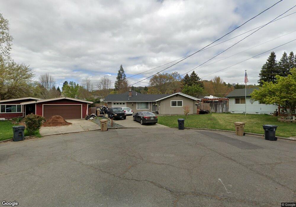
112 SW Diane Grants Pass, OR 97526
Estimated Value: $355,000 - $378,967
3
Beds
2
Baths
1,125
Sq Ft
$326/Sq Ft
Est. Value
About This Home
This home is located at 112 SW Diane, Grants Pass, OR 97526 and is currently estimated at $366,984, approximately $326 per square foot. 112 SW Diane is a home located in Josephine County with nearby schools including Parkside Elementary School, North Middle School, and Grants Pass High School.
Ownership History
Date
Name
Owned For
Owner Type
Purchase Details
Closed on
Jul 31, 2025
Sold by
Clear Recon Corp
Bought by
Batzer John and Tw & Lj 401K Plan
Current Estimated Value
Purchase Details
Closed on
Sep 25, 2018
Sold by
Arnold Paul W and Pell Elizabeth K
Bought by
Andrus Julie4
Home Financials for this Owner
Home Financials are based on the most recent Mortgage that was taken out on this home.
Original Mortgage
$175,000
Interest Rate
4.5%
Mortgage Type
New Conventional
Create a Home Valuation Report for This Property
The Home Valuation Report is an in-depth analysis detailing your home's value as well as a comparison with similar homes in the area
Home Values in the Area
Average Home Value in this Area
Purchase History
| Date | Buyer | Sale Price | Title Company |
|---|---|---|---|
| Batzer John | $226,000 | None Listed On Document | |
| Andrus Julie4 | $275,000 | Ticor Title Co Of Oregon |
Source: Public Records
Mortgage History
| Date | Status | Borrower | Loan Amount |
|---|---|---|---|
| Previous Owner | Andrus Julie4 | $175,000 |
Source: Public Records
Tax History Compared to Growth
Tax History
| Year | Tax Paid | Tax Assessment Tax Assessment Total Assessment is a certain percentage of the fair market value that is determined by local assessors to be the total taxable value of land and additions on the property. | Land | Improvement |
|---|---|---|---|---|
| 2025 | $3,567 | $274,680 | -- | -- |
| 2024 | $3,567 | $266,680 | -- | -- |
| 2023 | $3,464 | $258,920 | $0 | $0 |
| 2022 | $3,376 | $251,380 | -- | -- |
| 2021 | $3,170 | $244,060 | $0 | $0 |
| 2020 | $3,079 | $236,960 | $0 | $0 |
| 2019 | $2,990 | $230,060 | $0 | $0 |
| 2018 | $3,043 | $223,360 | $0 | $0 |
| 2017 | $2,937 | $210,900 | $0 | $0 |
| 2016 | $2,525 | $204,760 | $0 | $0 |
| 2015 | $2,209 | $181,480 | $0 | $0 |
| 2014 | $2,048 | $167,980 | $0 | $0 |
Source: Public Records
Map
Nearby Homes
- 47 SW Eastern Ave Unit 8
- 225 SW Westholm Ave
- 1613 SW I St
- 1535 SW Foundry St
- 3487 SW Leonard St
- 1901 SW G St
- 1634 NW F St
- 1308 NW F St
- 142 NW Crest Dr Unit 403
- 1011 SW I St
- 1019 SW J St
- 207 SW Oak St
- 522 NW Woodson Dr
- 166 NW Native Run Loop
- 1013 SW L St
- 1719 SW Bridge St
- 927 SW L St
- 1858 NW Sunview Place
- 511 NW Woodson Dr
- 1630 NW Olmar Dr
- 112 Diane Dr
- 118 Diane Dr
- 118 SW Diane
- 1525 SW Jordan St
- 1531 SW Jordan St
- 111 Diane Dr
- 1517 SW Jordan St
- 1539 SW Jordan St
- 1522 SW G St
- 1600 SW G St
- 115 Diane Dr
- 124 Diane Dr
- 1545 SW Jordan St
- 1610 SW G St
- 1511 SW Jordan St
- 119 Diane Dr
- 1612 SW G St
- 61 SW Blenda Ct
- 1514 SW Jordan St
- 1512 SW Jordan St