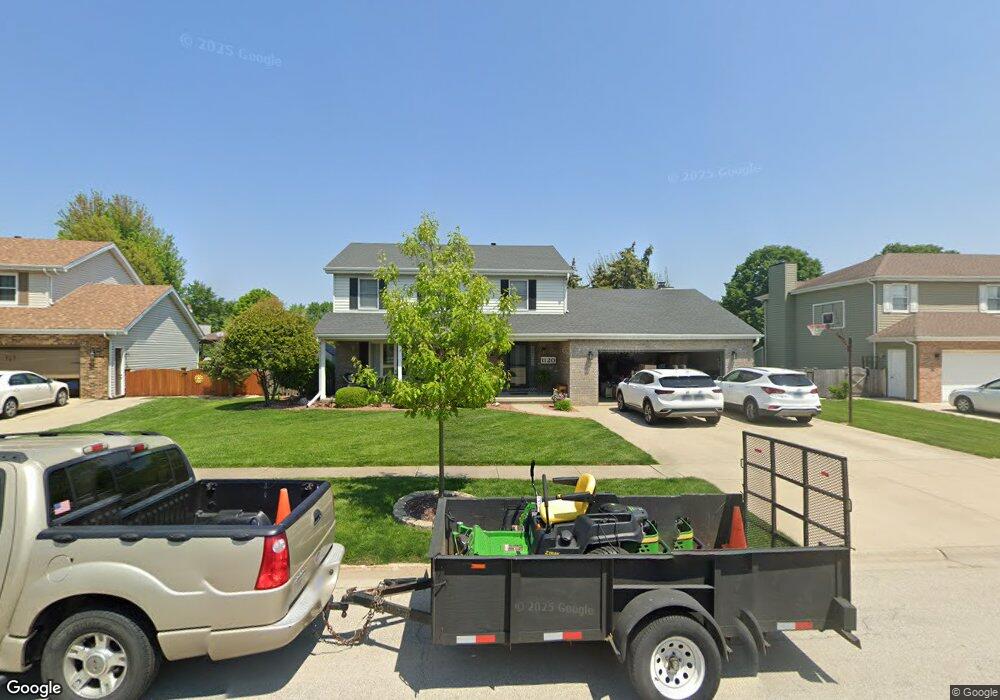
1120 Wheatland Dr Shorewood, IL 60404
Estimated Value: $358,762 - $402,000
--
Bed
1
Bath
2,240
Sq Ft
$166/Sq Ft
Est. Value
About This Home
This home is located at 1120 Wheatland Dr, Shorewood, IL 60404 and is currently estimated at $372,191, approximately $166 per square foot. 1120 Wheatland Dr is a home located in Will County with nearby schools including Shorewood Elementary School, Troy Middle School, and Orenic Intermediate School.
Ownership History
Date
Name
Owned For
Owner Type
Purchase Details
Closed on
Aug 1, 2019
Sold by
Mulligan Gregory P and Mulligan Susan E
Bought by
Mulligan Gregory P and Mulligan Susan E
Current Estimated Value
Purchase Details
Closed on
Jul 30, 1997
Sold by
Solley Richard J and Solley Janine M
Bought by
Mulligan Gregory P and Mulligan Susan E
Home Financials for this Owner
Home Financials are based on the most recent Mortgage that was taken out on this home.
Original Mortgage
$137,600
Outstanding Balance
$20,934
Interest Rate
7.71%
Estimated Equity
$351,257
Purchase Details
Closed on
Aug 5, 1996
Sold by
Brenner Gary S and Brenner Judy A
Bought by
Solley Richard J and Solley Janine M
Home Financials for this Owner
Home Financials are based on the most recent Mortgage that was taken out on this home.
Original Mortgage
$100,000
Interest Rate
8.27%
Create a Home Valuation Report for This Property
The Home Valuation Report is an in-depth analysis detailing your home's value as well as a comparison with similar homes in the area
Home Values in the Area
Average Home Value in this Area
Purchase History
| Date | Buyer | Sale Price | Title Company |
|---|---|---|---|
| Mulligan Gregory P | -- | Attorney | |
| Mulligan Gregory P | $172,000 | -- | |
| Solley Richard J | $165,000 | Chicago Title Insurance Co |
Source: Public Records
Mortgage History
| Date | Status | Borrower | Loan Amount |
|---|---|---|---|
| Open | Mulligan Gregory P | $137,600 | |
| Previous Owner | Solley Richard J | $100,000 |
Source: Public Records
Tax History Compared to Growth
Tax History
| Year | Tax Paid | Tax Assessment Tax Assessment Total Assessment is a certain percentage of the fair market value that is determined by local assessors to be the total taxable value of land and additions on the property. | Land | Improvement |
|---|---|---|---|---|
| 2024 | $8,461 | $110,078 | $18,966 | $91,112 |
| 2023 | $8,461 | $98,902 | $17,040 | $81,862 |
| 2022 | $7,647 | $93,586 | $16,124 | $77,462 |
| 2021 | $7,137 | $88,039 | $15,168 | $72,871 |
| 2020 | $7,153 | $88,039 | $15,168 | $72,871 |
| 2019 | $6,937 | $84,450 | $14,550 | $69,900 |
| 2018 | $7,049 | $83,550 | $14,550 | $69,000 |
| 2017 | $7,085 | $82,550 | $14,550 | $68,000 |
| 2016 | $6,903 | $78,000 | $14,550 | $63,450 |
| 2015 | $6,437 | $73,958 | $13,158 | $60,800 |
| 2014 | $6,437 | $71,393 | $13,158 | $58,235 |
| 2013 | $6,437 | $71,393 | $13,158 | $58,235 |
Source: Public Records
Map
Nearby Homes
- 1204 Glen Mor Dr Unit B
- 1111 Country Dr
- 1228 Conquest Ct
- 312 Honors Dr
- 110 National Ct
- 613 Rollingwood Dr
- 7507 Honeysuckle Ln
- 7513 Honeysuckle Ln
- 7510 Honeysuckle Ln
- 604 Bethany Dr
- 605 Edgebrook Dr
- 00002 Jefferson St
- 1 AC Jefferson St
- 00001 Jefferson St
- 1719 Moran Dr
- 202 Oak Dr
- 612 Edgebrook Dr
- 1728 Parkside Dr Unit 2
- 515 David Dr
- 1808 Wintercrest Ct
- 1118 Wheatland Dr
- 1122 Wheatland Dr
- 1119 Harvest Dr
- 1117 Harvest Dr
- 1116 Wheatland Dr
- 1121 Harvest Dr Unit 4
- 1124 Wheatland Dr
- 1115 Harvest Dr
- 1125 Wheatland Dr
- 1123 Wheatland Dr
- 1121 Wheatland Dr
- 1123 Harvest Dr
- 1126 Wheatland Dr
- 1127 Wheatland Dr
- 1114 Wheatland Dr
- 1113 Harvest Dr
- 1125 Harvest Dr
- 1119 Wheatland Dr
- 1122 Home Ct
- 1112 Wheatland Dr