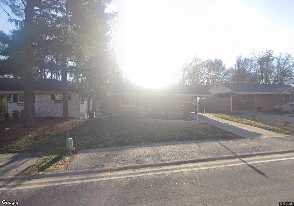
1124 Des Peres Ave Saint Louis, MO 63119
Estimated Value: $320,000 - $339,000
3
Beds
2
Baths
1,308
Sq Ft
$252/Sq Ft
Est. Value
About This Home
This home is located at 1124 Des Peres Ave, Saint Louis, MO 63119 and is currently estimated at $329,553, approximately $251 per square foot. 1124 Des Peres Ave is a home located in St. Louis County with nearby schools including Hudson Elementary School, Hixson Middle School, and Webster Groves High School.
Ownership History
Date
Name
Owned For
Owner Type
Purchase Details
Closed on
Jun 16, 2003
Sold by
Unterreiner Edmund Paul
Bought by
Buchanan Dean E and Buchanan Veronica C
Current Estimated Value
Home Financials for this Owner
Home Financials are based on the most recent Mortgage that was taken out on this home.
Original Mortgage
$93,600
Outstanding Balance
$40,346
Interest Rate
5.56%
Mortgage Type
Purchase Money Mortgage
Estimated Equity
$289,207
Purchase Details
Closed on
Apr 12, 1999
Sold by
Unterreiner Edmund P
Bought by
Buchanan David A and Buchanan Dean E
Create a Home Valuation Report for This Property
The Home Valuation Report is an in-depth analysis detailing your home's value as well as a comparison with similar homes in the area
Home Values in the Area
Average Home Value in this Area
Purchase History
| Date | Buyer | Sale Price | Title Company |
|---|---|---|---|
| Buchanan Dean E | $117,000 | -- | |
| Buchanan David A | -- | -- |
Source: Public Records
Mortgage History
| Date | Status | Borrower | Loan Amount |
|---|---|---|---|
| Open | Buchanan Dean E | $93,600 |
Source: Public Records
Tax History Compared to Growth
Tax History
| Year | Tax Paid | Tax Assessment Tax Assessment Total Assessment is a certain percentage of the fair market value that is determined by local assessors to be the total taxable value of land and additions on the property. | Land | Improvement |
|---|---|---|---|---|
| 2025 | $3,628 | $59,410 | $38,210 | $21,200 |
| 2024 | $3,628 | $50,370 | $26,750 | $23,620 |
| 2023 | $3,670 | $50,370 | $26,750 | $23,620 |
| 2022 | $3,764 | $48,240 | $26,750 | $21,490 |
| 2021 | $3,740 | $48,240 | $26,750 | $21,490 |
| 2020 | $3,565 | $43,950 | $22,270 | $21,680 |
| 2019 | $3,544 | $43,950 | $22,270 | $21,680 |
| 2018 | $3,163 | $34,430 | $13,780 | $20,650 |
| 2017 | $3,147 | $34,430 | $13,780 | $20,650 |
| 2016 | $2,930 | $30,570 | $11,970 | $18,600 |
| 2015 | $2,825 | $30,570 | $11,970 | $18,600 |
| 2014 | $3,350 | $35,360 | $14,500 | $20,860 |
Source: Public Records
Map
Nearby Homes
- 1119 Gilbert Ave
- 9839 Warson Pointe Dr
- 9844 Oak Haven Ave
- 9840 Oak Haven Ave
- 9780 Old Warson Rd
- 1105 Timberlane Dr
- 1146 Kortwright Ave
- 65 Ridge Line Dr
- 1322 Kortwright Ave
- 1048 Martha Ln
- 1509 Andrew Dr
- 9714 Whitestone Terrace
- 9721 Greenwood Terrace
- 1235 Charlane Ct
- 1242 Charlane Ct
- 1306 Glendale Gardens Dr Unit B
- 1306 Glendale Gardens Dr Unit C
- 529 Cyril Dr
- 1025 Glenmoor Ln
- 1095 N Sappington Rd
- 1126 Des Peres Ave
- 1122 Des Peres Ave
- 1118 Des Peres Ave
- 1128 Des Peres Ave
- 1116 Des Peres Ave
- 1130 Des Peres Ave
- 9834 Northbridge Rd
- 1123 Twinbrook Dr
- 1114 Des Peres Ave
- 9828 Northbridge Rd
- 1132 Des Peres Ave
- 1119 Twinbrook Dr
- 9801 Wild Deer Rd
- 1115 Twinbrook Dr
- 9822 Northbridge Rd
- 1110 Des Peres Ave
- 1111 Twinbrook Dr
- 1200 Des Peres Ave
- 9807 Wild Deer Rd
- 1113 Twinbrook Dr