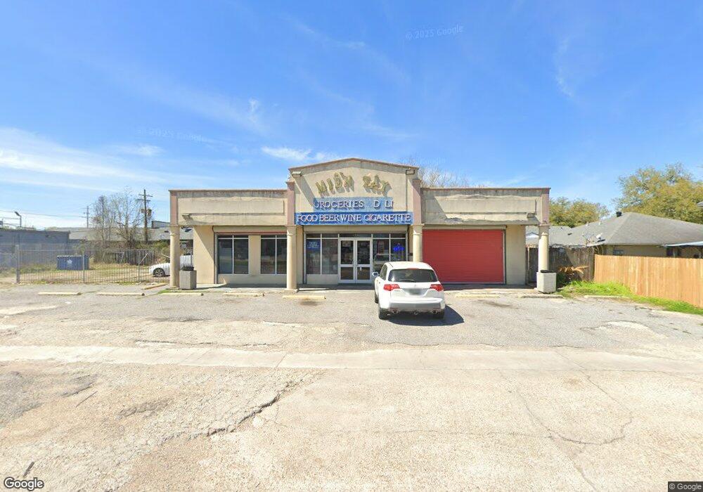
1125 Marque Ann Dr Baton Rouge, LA 70815
Park Forest/LA North NeighborhoodEstimated Value: $1,077,692
--
Bed
2
Baths
6,000
Sq Ft
$180/Sq Ft
Est. Value
About This Home
This home is located at 1125 Marque Ann Dr, Baton Rouge, LA 70815 and is currently estimated at $1,077,692, approximately $179 per square foot. 1125 Marque Ann Dr is a home located in East Baton Rouge Parish with nearby schools including LaBelle Aire Elementary School, Park Forest Middle School, and Belaire High School.
Ownership History
Date
Name
Owned For
Owner Type
Purchase Details
Closed on
Jun 29, 2001
Sold by
Swenson Quida Mae Swenson Revocable Swenson Wayne D and Swenson, Trustee The Wayne D Swenson & By: Wa
Bought by
Mooring Financial Corp 401K Plan
Current Estimated Value
Purchase Details
Closed on
Jun 30, 2000
Sold by
Jackson Jackson Ronald G
Bought by
Laprop Inc
Purchase Details
Closed on
Sep 1, 1999
Sold by
Jackson Jackson Ronald G
Bought by
Swenson Wayne D and Swenson Ouida Mae
Create a Home Valuation Report for This Property
The Home Valuation Report is an in-depth analysis detailing your home's value as well as a comparison with similar homes in the area
Home Values in the Area
Average Home Value in this Area
Purchase History
| Date | Buyer | Sale Price | Title Company |
|---|---|---|---|
| Mooring Financial Corp 401K Plan | $5,303 | -- | |
| Laprop Inc | $1,576 | -- | |
| Swenson Wayne D | $505,000 | -- |
Source: Public Records
Tax History Compared to Growth
Tax History
| Year | Tax Paid | Tax Assessment Tax Assessment Total Assessment is a certain percentage of the fair market value that is determined by local assessors to be the total taxable value of land and additions on the property. | Land | Improvement |
|---|---|---|---|---|
| 2024 | $3,805 | $28,215 | $2,717 | $25,498 |
| 2023 | $3,805 | $25,650 | $2,470 | $23,180 |
| 2022 | $3,563 | $25,650 | $2,470 | $23,180 |
| 2021 | $3,492 | $25,650 | $2,470 | $23,180 |
| 2020 | $3,030 | $25,650 | $2,470 | $23,180 |
| 2019 | $3,076 | $24,900 | $2,400 | $22,500 |
| 2018 | $3,038 | $24,900 | $2,400 | $22,500 |
| 2017 | $3,038 | $24,900 | $2,400 | $22,500 |
| 2016 | $2,965 | $24,900 | $2,400 | $22,500 |
| 2015 | $2,921 | $24,500 | $2,000 | $22,500 |
| 2014 | $2,911 | $24,500 | $2,000 | $22,500 |
| 2013 | -- | $24,500 | $2,000 | $22,500 |
Source: Public Records
Map
Nearby Homes
- 12385&12387 Shay Ave
- 12424 Cate Ave Unit 12426
- 12547 Lorna Ave
- 12875 King John Place
- 1466 Harco Dr
- 12013 Shannon Ave
- 13070 Wallis St
- 305 Woodcliff Dr
- 371 Kay Dr
- 12511 E Robinhood Dr
- 379 Wilton Dr
- 12435 Parnell Dr
- 1734 N Rosedale Dr
- 444 S Locksley Dr
- 12651 Parnell Ave
- 11755 Archery Dr
- 2043 Shady Oaks Dr
- 13243 Avants Ave
- 13212 Avants Ave
- 12069 E Glenhaven Dr
- 12552 Shay Ave
- 12520 Shay Ave
- 12484 Shay Ave
- 12472 Shay Ave
- 12462 Shay Ave
- 12462 Shay Ave
- 12555 Shay Ave
- 12485 Shay Ave
- 12482/74 Shay Ave
- 12472/74 Shay Ave
- 12472/74 Shay Ave Unit 2
- 12444 Shay Ave Unit 12448
- 12473 Shay Ave
- 12473/75 Shay Ave
- 1144 Marque Ann Dr
- 12461 Shay Ave Unit 12463
- 12461 Shay Ave
- 12461 Shay Ave Unit 2
- 12540 Cate Ave
- 12540 Cate Ave Unit 2