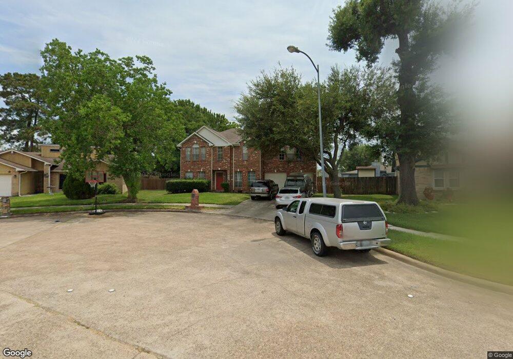
1126 Earlsferry Dr Channelview, TX 77530
Estimated Value: $287,000 - $308,000
4
Beds
3
Baths
2,609
Sq Ft
$113/Sq Ft
Est. Value
About This Home
This home is located at 1126 Earlsferry Dr, Channelview, TX 77530 and is currently estimated at $293,659, approximately $112 per square foot. 1126 Earlsferry Dr is a home located in Harris County with nearby schools including Channelview High School, Family Christian Academy, and Creative Corner.
Ownership History
Date
Name
Owned For
Owner Type
Purchase Details
Closed on
Dec 14, 2006
Sold by
Mueller Larry and Mueller Michelle
Bought by
Fierro Genoveva C
Current Estimated Value
Home Financials for this Owner
Home Financials are based on the most recent Mortgage that was taken out on this home.
Original Mortgage
$83,000
Outstanding Balance
$49,514
Interest Rate
6.27%
Mortgage Type
Seller Take Back
Estimated Equity
$244,145
Purchase Details
Closed on
May 27, 1994
Sold by
Mhi Partnership Ltd
Bought by
Mueller Larry
Create a Home Valuation Report for This Property
The Home Valuation Report is an in-depth analysis detailing your home's value as well as a comparison with similar homes in the area
Home Values in the Area
Average Home Value in this Area
Purchase History
| Date | Buyer | Sale Price | Title Company |
|---|---|---|---|
| Fierro Genoveva C | -- | None Available | |
| Mueller Larry | -- | Heritage Title Company |
Source: Public Records
Mortgage History
| Date | Status | Borrower | Loan Amount |
|---|---|---|---|
| Open | Fierro Genoveva C | $83,000 |
Source: Public Records
Tax History Compared to Growth
Tax History
| Year | Tax Paid | Tax Assessment Tax Assessment Total Assessment is a certain percentage of the fair market value that is determined by local assessors to be the total taxable value of land and additions on the property. | Land | Improvement |
|---|---|---|---|---|
| 2025 | $963 | $303,521 | $34,884 | $268,637 |
| 2024 | $963 | $293,727 | $34,884 | $258,843 |
| 2023 | $963 | $312,708 | $34,884 | $277,824 |
| 2022 | $5,583 | $270,347 | $34,884 | $235,463 |
| 2021 | $5,376 | $248,826 | $34,884 | $213,942 |
| 2020 | $5,341 | $214,831 | $31,628 | $183,203 |
| 2019 | $5,047 | $209,194 | $31,628 | $177,566 |
| 2018 | $796 | $177,364 | $31,356 | $146,008 |
| 2017 | $4,263 | $177,364 | $31,356 | $146,008 |
| 2016 | $3,875 | $161,909 | $25,085 | $136,824 |
| 2015 | $1,643 | $153,162 | $18,814 | $134,348 |
| 2014 | $1,643 | $109,560 | $16,932 | $92,628 |
Source: Public Records
Map
Nearby Homes
- 1102 Heathfield Dr
- 909 Pennygent Ln
- 14951 Scotter Dr
- 14918 Silver Green Dr S
- 1323 Padstow Ln
- 1123 Maclesby Ln
- 1034 Littleport Ln
- 1343 Littleport Ln
- 14835 Scotter Dr
- 15122 Sheffield Terrace
- 14806 Beaconsfield Dr
- 1303 Sterling Green Ct
- 1330 Stevenage Ln
- 1342 Castle Glen Dr
- 1346 Castle Glen Dr
- 827 Dondell St
- 1315 Goswell Ln
- 335 Haymarket Ln
- 331 Haymarket Ln
- 1423 Seafield Dr
- 15027 Dunster Ln
- 1122 Earlsferry Dr
- 1127 Heathfield Dr
- 1123 Heathfield Dr
- 1131 Heathfield Dr
- 15023 Dunster Ln
- 1119 Heathfield Dr
- 1118 Earlsferry Dr
- 15030 Elstree Dr
- 15026 Elstree Dr
- 1123 Earlsferry Dr
- 15038 Elstree Dr
- 1115 Heathfield Dr
- 15019 Dunster Ln
- 15022 Elstree Dr
- 1114 Earlsferry Dr
- 1119 Earlsferry Dr
- 15018 Elstree Dr
- 15015 Dunster Ln
- 1122 Heathfield Dr