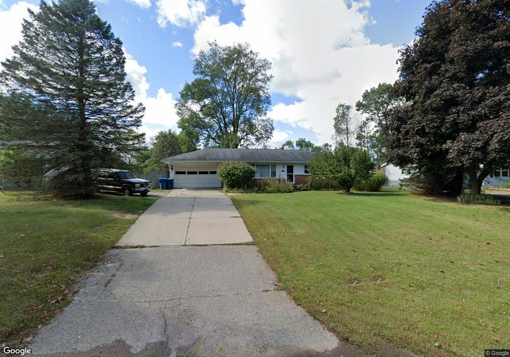
11262 Oakland Dr Schoolcraft, MI 49087
Estimated Value: $202,201 - $273,000
3
Beds
1
Bath
1,060
Sq Ft
$233/Sq Ft
Est. Value
About This Home
This home is located at 11262 Oakland Dr, Schoolcraft, MI 49087 and is currently estimated at $246,800, approximately $232 per square foot. 11262 Oakland Dr is a home located in Kalamazoo County with nearby schools including Clopton Elementary School, Schoolcraft Upper Elementary School, and Schoolcraft Middle School.
Ownership History
Date
Name
Owned For
Owner Type
Purchase Details
Closed on
Oct 16, 2025
Sold by
Kuiper Debra S
Bought by
Kuiper Debra S and Kuiper Rick J
Current Estimated Value
Purchase Details
Closed on
Jun 19, 2009
Sold by
Kuiper Debra S and Roder Debra
Bought by
Kuiper Debra S
Home Financials for this Owner
Home Financials are based on the most recent Mortgage that was taken out on this home.
Original Mortgage
$100,000
Interest Rate
4.92%
Mortgage Type
Stand Alone Refi Refinance Of Original Loan
Create a Home Valuation Report for This Property
The Home Valuation Report is an in-depth analysis detailing your home's value as well as a comparison with similar homes in the area
Home Values in the Area
Average Home Value in this Area
Purchase History
| Date | Buyer | Sale Price | Title Company |
|---|---|---|---|
| Kuiper Debra S | -- | None Listed On Document | |
| Kuiper Debra S | -- | Nations Title |
Source: Public Records
Mortgage History
| Date | Status | Borrower | Loan Amount |
|---|---|---|---|
| Previous Owner | Kuiper Debra S | $100,000 |
Source: Public Records
Tax History Compared to Growth
Tax History
| Year | Tax Paid | Tax Assessment Tax Assessment Total Assessment is a certain percentage of the fair market value that is determined by local assessors to be the total taxable value of land and additions on the property. | Land | Improvement |
|---|---|---|---|---|
| 2025 | $2,056 | $86,700 | $0 | $0 |
| 2024 | $667 | $79,900 | $0 | $0 |
| 2023 | $636 | $72,000 | $0 | $0 |
| 2022 | $1,864 | $68,000 | $0 | $0 |
| 2021 | $1,809 | $63,800 | $0 | $0 |
| 2020 | $1,766 | $60,500 | $0 | $0 |
| 2019 | $1,494 | $59,400 | $0 | $0 |
| 2018 | $1,459 | $59,300 | $0 | $0 |
| 2017 | $0 | $57,500 | $0 | $0 |
| 2016 | -- | $56,300 | $0 | $0 |
| 2015 | -- | $52,100 | $5,800 | $46,300 |
| 2014 | -- | $52,100 | $0 | $0 |
Source: Public Records
Map
Nearby Homes
- 2223 Surry
- 1817 Alder Ave
- 2633 Rolling Hill Ave
- 2950 W U Ave
- 10381 Schrier Ln
- 10382 Pennridge Dr
- 10565 Pierport Dr
- 11025 Higley Cir W
- 821 Janelle Ct
- Integrity 1800 Plan at Pennridge Trail North
- Integrity 2085 Plan at Pennridge Trail North
- Integrity 1910 Plan at Pennridge Trail North
- 10631 Gracie Ln Unit 6
- 560 Sand Pointe Trail
- 705 Briella Ct
- 735 Briella Ct
- 775 Chloe Jane Ave
- 10613 Sharon Lee Ln
- 739 Chloe Jane Ave
- 10545 Sharon Lee Ln
- 11286 Oakland Dr
- 11210 Oakland Dr
- 11257 Oakland Dr
- 11233 Oakland Dr
- 11215 Oakland Dr
- 11300 Oakland Dr
- 11259 Oakland Dr
- 11289 Oakland Dr
- 11215 Oakland Dr
- 11265 Oakland Dr
- 11160 Oakland Dr
- 11190 Oakland Dr
- 11303 Oakland Dr
- 11128 Oakland Dr
- 11406 Oakland Dr
- 11406 Oakland Dr
- 11077 Oakland Dr
- 11077 Oakland Dr
- 11077 Oakland Dr
- 11077 Oakland Dr