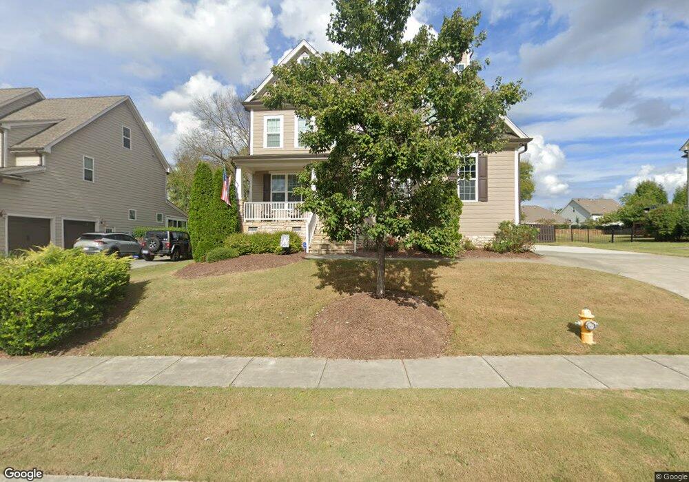
1128 Ambrose Dr Rolesville, NC 27571
Estimated Value: $572,189 - $722,000
4
Beds
3
Baths
2,611
Sq Ft
$242/Sq Ft
Est. Value
About This Home
This home is located at 1128 Ambrose Dr, Rolesville, NC 27571 and is currently estimated at $633,047, approximately $242 per square foot. 1128 Ambrose Dr is a home located in Wake County with nearby schools including Sanford Creek Elementary School, Rolesville Middle School, and Rolesville High School.
Ownership History
Date
Name
Owned For
Owner Type
Purchase Details
Closed on
Aug 19, 2013
Sold by
Capitol City Homes Llc
Bought by
Fiala Paul John and Fiala Kristine A
Current Estimated Value
Home Financials for this Owner
Home Financials are based on the most recent Mortgage that was taken out on this home.
Original Mortgage
$294,192
Outstanding Balance
$217,904
Interest Rate
4.29%
Mortgage Type
New Conventional
Estimated Equity
$415,143
Purchase Details
Closed on
Mar 22, 2013
Sold by
Heritage East Developments Inc
Bought by
Capital City Homes Llc
Create a Home Valuation Report for This Property
The Home Valuation Report is an in-depth analysis detailing your home's value as well as a comparison with similar homes in the area
Home Values in the Area
Average Home Value in this Area
Purchase History
| Date | Buyer | Sale Price | Title Company |
|---|---|---|---|
| Fiala Paul John | $331,000 | None Available | |
| Capital City Homes Llc | $55,000 | None Available |
Source: Public Records
Mortgage History
| Date | Status | Borrower | Loan Amount |
|---|---|---|---|
| Open | Fiala Paul John | $294,192 |
Source: Public Records
Tax History Compared to Growth
Tax History
| Year | Tax Paid | Tax Assessment Tax Assessment Total Assessment is a certain percentage of the fair market value that is determined by local assessors to be the total taxable value of land and additions on the property. | Land | Improvement |
|---|---|---|---|---|
| 2025 | $5,308 | $543,937 | $100,000 | $443,937 |
| 2024 | $5,289 | $543,937 | $100,000 | $443,937 |
| 2023 | $4,317 | $384,668 | $65,000 | $319,668 |
| 2022 | $4,172 | $384,668 | $65,000 | $319,668 |
| 2021 | $4,176 | $367,188 | $65,000 | $302,188 |
| 2020 | $3,912 | $367,188 | $65,000 | $302,188 |
| 2019 | $3,994 | $330,951 | $55,000 | $275,951 |
| 2018 | $3,774 | $330,951 | $55,000 | $275,951 |
| 2017 | $3,644 | $330,951 | $55,000 | $275,951 |
| 2016 | $3,596 | $330,951 | $55,000 | $275,951 |
| 2015 | $3,532 | $333,049 | $70,000 | $263,049 |
| 2014 | $3,410 | $333,049 | $70,000 | $263,049 |
Source: Public Records
Map
Nearby Homes
- 1123 Ambrose Dr
- 4628 Rogers Rd
- 6205 Roles Saddle Dr
- 1001 Kennison Ct
- 11249 Jeffreys Ln
- 3037 Freeman Farm Way
- 536 Adkins Ridge Rd
- 5508 Massey Branch Dr
- 3004 Freeman Farm Way
- 5138 Corner Rock Dr
- 1021 Smoke Willow Way Unit 130
- 459 Granite Creek Dr
- 1036 Smoke Willow Way
- 917 Evening Snow St
- 452 Granite Saddle Dr
- 821 Willow Tower Ct
- 825 Willow Tower Ct
- 615 Misty Willow Way
- 824 Willow Tower Ct
- 4225 Cats Paw Ct
- 1132 Ambrose Dr
- 1124 Ambrose Dr
- 3079 Freeman Farm Way
- 3083 Freeman Farm Way
- 1120 Ambrose Dr
- 1140 Ambrose Dr
- 3075 Freeman Farm Way
- 1127 Ambrose Dr
- 3087 Freeman Farm Way
- 1131 Ambrose Dr
- 3087 Freeman Farm Way
- 1116 Ambrose Dr
- 1119 Ambrose Dr
- 3071 Freeman Farm Way
- 1148 Ambrose Dr Unit 3222
- 1148 Ambrose Dr
- 3088 Freeman Farm Way
- 1139 Ambrose Dr
- 1143 Ambrose Dr
- 1108 Ambrose Dr