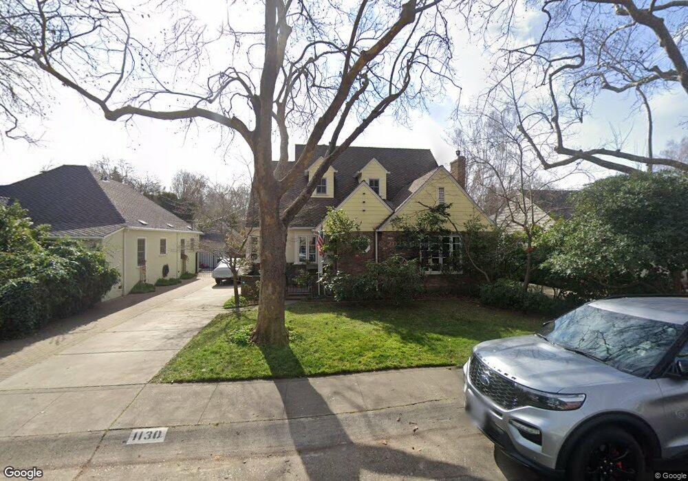
1130 10th Ave Sacramento, CA 95818
Land Park NeighborhoodEstimated Value: $870,000 - $1,699,000
4
Beds
3
Baths
4,252
Sq Ft
$285/Sq Ft
Est. Value
About This Home
This home is located at 1130 10th Ave, Sacramento, CA 95818 and is currently estimated at $1,210,469, approximately $284 per square foot. 1130 10th Ave is a home located in Sacramento County with nearby schools including Crocker/Riverside Elementary School, California Middle, and C. K. McClatchy High.
Ownership History
Date
Name
Owned For
Owner Type
Purchase Details
Closed on
Feb 3, 2022
Sold by
Barnard Thomas R and Barnard Sara J
Bought by
Thomas R Barnard And Sara J Drake Family Trus
Current Estimated Value
Purchase Details
Closed on
Dec 7, 1993
Sold by
Shirley Peggy M and Stevenson Robert J
Bought by
Barnard Thomas R and Drake Sara J
Home Financials for this Owner
Home Financials are based on the most recent Mortgage that was taken out on this home.
Original Mortgage
$203,150
Interest Rate
7.09%
Create a Home Valuation Report for This Property
The Home Valuation Report is an in-depth analysis detailing your home's value as well as a comparison with similar homes in the area
Home Values in the Area
Average Home Value in this Area
Purchase History
| Date | Buyer | Sale Price | Title Company |
|---|---|---|---|
| Thomas R Barnard And Sara J Drake Family Trus | -- | Ellison Law Firm | |
| Barnard Thomas R | $231,000 | North American Title Co Inc |
Source: Public Records
Mortgage History
| Date | Status | Borrower | Loan Amount |
|---|---|---|---|
| Previous Owner | Barnard Thomas R | $203,150 |
Source: Public Records
Tax History Compared to Growth
Tax History
| Year | Tax Paid | Tax Assessment Tax Assessment Total Assessment is a certain percentage of the fair market value that is determined by local assessors to be the total taxable value of land and additions on the property. | Land | Improvement |
|---|---|---|---|---|
| 2025 | $7,051 | $586,223 | $212,444 | $373,779 |
| 2024 | $7,051 | $574,729 | $208,279 | $366,450 |
| 2023 | $6,887 | $563,461 | $204,196 | $359,265 |
| 2022 | $6,771 | $552,414 | $200,193 | $352,221 |
| 2021 | $6,456 | $541,583 | $196,268 | $345,315 |
| 2020 | $6,506 | $536,031 | $194,256 | $341,775 |
| 2019 | $6,368 | $525,522 | $190,448 | $335,074 |
| 2018 | $6,204 | $515,218 | $186,714 | $328,504 |
| 2017 | $6,121 | $505,116 | $183,053 | $322,063 |
| 2016 | $5,944 | $495,213 | $179,464 | $315,749 |
| 2015 | $5,783 | $487,776 | $176,769 | $311,007 |
| 2014 | $5,626 | $478,222 | $173,307 | $304,915 |
Source: Public Records
Map
Nearby Homes
- 1032 10th Ave
- 1432 Teneighth Way
- 849 8th Ave
- 3098 Riverside Blvd
- 710 7th Ave
- 1701 9th Ave
- 625 Robertson Way
- 2750 Moonflower St
- 2825 Elderberry St
- 2726 Moonflower St
- The Argo Plan at The Estates at Newport
- The Baltic Plan at The Estates at Newport
- The Caspian Plan at The Estates at Newport
- The Dawson Plan at The Estates at Newport
- 1831 9th Ave
- 613 Swanston Dr
- 749 3rd Ave Unit 3
- 1615 Vallejo Way
- 808 Fremont Way
- 1725 Vallejo Way