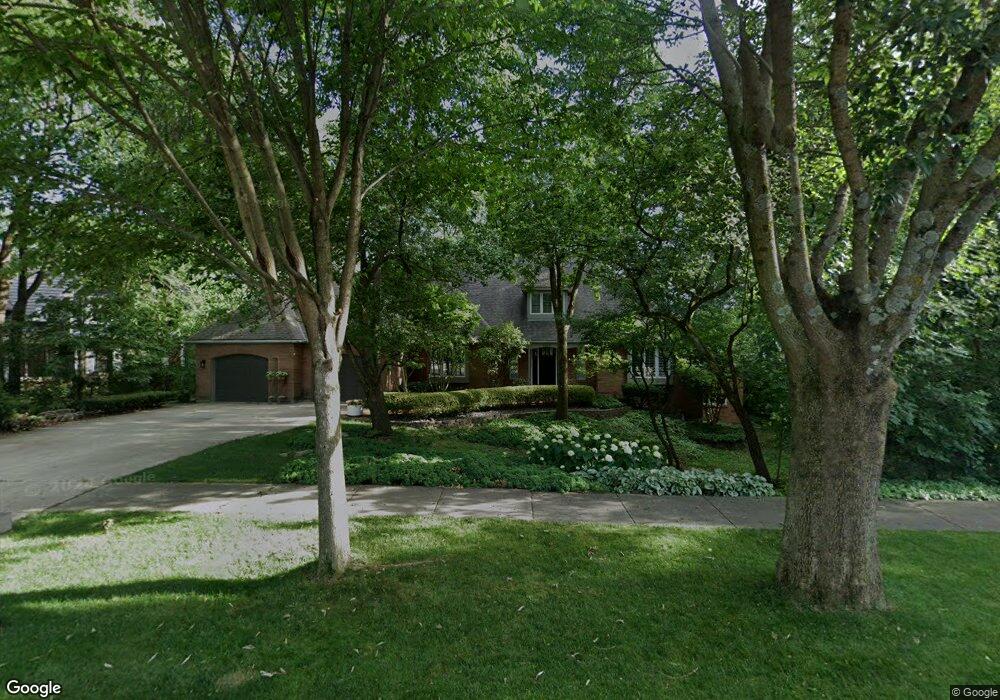
1133 Kinsie Ct Naperville, IL 60540
Hobson Village NeighborhoodEstimated Value: $983,689 - $1,228,000
4
Beds
4
Baths
3,707
Sq Ft
$311/Sq Ft
Est. Value
About This Home
This home is located at 1133 Kinsie Ct, Naperville, IL 60540 and is currently estimated at $1,151,922, approximately $310 per square foot. 1133 Kinsie Ct is a home located in DuPage County with nearby schools including Prairie Elementary School, Admiral Byrd Elementary School, and Washington Jr High School.
Ownership History
Date
Name
Owned For
Owner Type
Purchase Details
Closed on
Nov 17, 2025
Sold by
Taylor Richard A and Taylor Leslie K
Bought by
Richard A And Leslie K Taylor Trust and Taylor
Current Estimated Value
Purchase Details
Closed on
Apr 21, 1999
Sold by
Vanhorne Mary M
Bought by
Taylor Richard A and Taylor Leslie K
Home Financials for this Owner
Home Financials are based on the most recent Mortgage that was taken out on this home.
Original Mortgage
$240,000
Interest Rate
7.05%
Create a Home Valuation Report for This Property
The Home Valuation Report is an in-depth analysis detailing your home's value as well as a comparison with similar homes in the area
Home Values in the Area
Average Home Value in this Area
Purchase History
| Date | Buyer | Sale Price | Title Company |
|---|---|---|---|
| Richard A And Leslie K Taylor Trust | -- | None Listed On Document | |
| Taylor Richard A | $512,500 | -- |
Source: Public Records
Mortgage History
| Date | Status | Borrower | Loan Amount |
|---|---|---|---|
| Previous Owner | Taylor Richard A | $240,000 |
Source: Public Records
Tax History Compared to Growth
Tax History
| Year | Tax Paid | Tax Assessment Tax Assessment Total Assessment is a certain percentage of the fair market value that is determined by local assessors to be the total taxable value of land and additions on the property. | Land | Improvement |
|---|---|---|---|---|
| 2024 | $14,990 | $260,689 | $116,703 | $143,986 |
| 2023 | $14,420 | $237,920 | $106,510 | $131,410 |
| 2022 | $14,384 | $233,250 | $104,420 | $128,830 |
| 2021 | $13,854 | $224,430 | $100,470 | $123,960 |
| 2020 | $13,556 | $220,390 | $98,660 | $121,730 |
| 2019 | $13,155 | $210,860 | $94,390 | $116,470 |
| 2018 | $13,159 | $210,860 | $94,390 | $116,470 |
| 2017 | $13,364 | $210,850 | $94,390 | $116,460 |
| 2016 | $13,612 | $210,840 | $94,390 | $116,450 |
| 2015 | $13,880 | $198,550 | $88,890 | $109,660 |
| 2014 | $14,332 | $198,550 | $88,890 | $109,660 |
| 2013 | $14,115 | $199,020 | $89,100 | $109,920 |
Source: Public Records
Map
Nearby Homes
- 907 Secretariat Dr
- 923 Tim Tam Cir
- 908 Julian Ct
- 165 Tamarack Ave
- 1408 Swallow St
- 616 Driftwood Ct
- 8S452 Bell Dr
- 1105 Johnson Dr
- 821 Wellner Rd
- 625 Edward Rd
- 706 S Loomis St Unit D
- 325 Pine Ct
- 820 Prairie Ave
- 1537 Lighthouse Dr
- 1449 Whitespire Ct Unit 5104
- 488 S Columbia St
- 1443 Meander Dr
- 425 W Gartner Rd
- 31 Golden Larch Ct
- 440 S Columbia St
- 1137 Kinsie Ct
- 1129 Kinsie Ct
- 439 Le Provence Cir
- 435 Le Provence Cir
- 431 Le Provence Cir
- 443 Le Provence Cir
- 1136 Kinsie Ct Unit 2
- 1125 Kinsie Ct
- 1128 Kinsie Ct
- 447 Le Provence Cir
- 1138 Kinsie Ct
- 427 Le Provence Cir
- 436 Le Provence Cir
- 440 Le Provence Cir
- 451 Le Provence Cir
- 423 Le Provence Cir
- 1124 Kinsie Ct
- 1130 Kinsie Ct
- 561 Clarissa Ct
- 472 Le Provence Cir