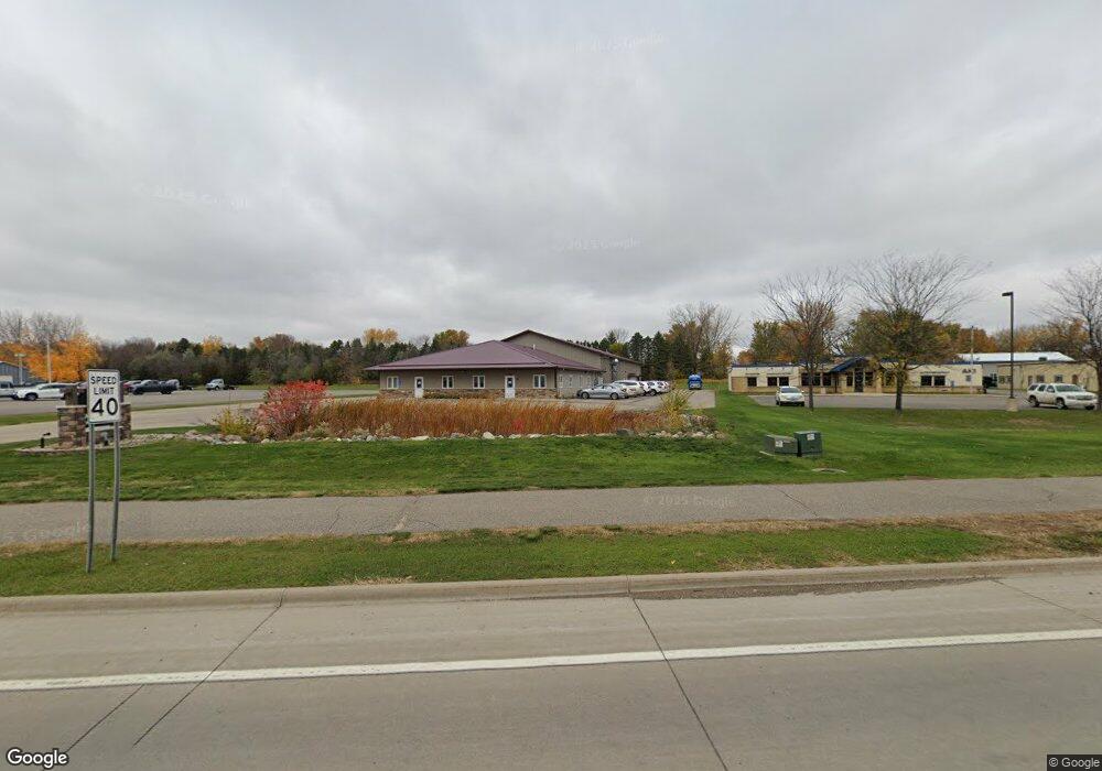
1135 Highway 7 W Hutchinson, MN 55350
Estimated Value: $967,780
--
Bed
--
Bath
10,476
Sq Ft
$92/Sq Ft
Est. Value
About This Home
This home is located at 1135 Highway 7 W, Hutchinson, MN 55350 and is currently estimated at $967,780, approximately $92 per square foot. 1135 Highway 7 W is a home located in McLeod County with nearby schools including Hutchinson West Elementary School, Hutchinson Park Elementary School, and Hutchinson Middle School.
Ownership History
Date
Name
Owned For
Owner Type
Purchase Details
Closed on
Dec 30, 2020
Sold by
Derosa Property Management Llc
Bought by
Rj Decker Properties Llc
Current Estimated Value
Home Financials for this Owner
Home Financials are based on the most recent Mortgage that was taken out on this home.
Original Mortgage
$150,000
Interest Rate
2.71%
Mortgage Type
Commercial
Create a Home Valuation Report for This Property
The Home Valuation Report is an in-depth analysis detailing your home's value as well as a comparison with similar homes in the area
Home Values in the Area
Average Home Value in this Area
Purchase History
| Date | Buyer | Sale Price | Title Company |
|---|---|---|---|
| Rj Decker Properties Llc | $685,000 | Title Mark] | |
| -- | $685,000 | -- |
Source: Public Records
Mortgage History
| Date | Status | Borrower | Loan Amount |
|---|---|---|---|
| Closed | Rj Decker Properties Llc | $150,000 | |
| Open | Rj Decker Properties Llc | $800,000 | |
| Closed | -- | $685,000 |
Source: Public Records
Tax History Compared to Growth
Tax History
| Year | Tax Paid | Tax Assessment Tax Assessment Total Assessment is a certain percentage of the fair market value that is determined by local assessors to be the total taxable value of land and additions on the property. | Land | Improvement |
|---|---|---|---|---|
| 2024 | $26,268 | $848,200 | $259,200 | $589,000 |
| 2023 | $26,758 | $863,900 | $274,900 | $589,000 |
| 2022 | $22,220 | $863,900 | $274,900 | $589,000 |
| 2021 | $23,174 | $615,000 | $274,900 | $340,100 |
| 2020 | $20,230 | $615,000 | $274,900 | $340,100 |
| 2019 | $19,422 | $525,300 | $274,900 | $250,400 |
| 2018 | $19,140 | $0 | $0 | $0 |
| 2017 | $19,756 | $0 | $0 | $0 |
| 2016 | $19,698 | $0 | $0 | $0 |
| 2015 | $19,840 | $0 | $0 | $0 |
| 2014 | -- | $0 | $0 | $0 |
Source: Public Records
Map
Nearby Homes
- 490 California St NW
- 961 Carolina Pkwy NW
- 415 Alan St SW
- 966 Osgood Ave SW
- 1020 Roberts Rd SW
- 530 Lincoln Ave SW
- 126 Lynn Rd SW
- 545 4th Ave SW
- 230 Lynn Rd SW
- 642 Juul Rd SW
- 667 Madson Ave SW
- 702 Southview Ct SW
- 724 Southview Dr SW
- 735 Sunset St SW
- 595 Milwaukee Ave SW
- 310 & 312 4th Ave SW
- 570 Lynn Rd SW
- 1379 Heritage Ave NW
- XXX 196th Rd
- 616 Brown St SW
- 1125 Minnesota 7
- 1115 Highway 7 W
- 494 494 California-Street-nw
- 508 508 California-Street-nw
- 450 California St NW
- 445 California St NW
- 456 California St NW
- 465 California St NW
- 1020 Highway 7 W
- 462 California St NW
- 462 462 California St NW
- 415 School Rd NW Unit 103
- 415 School Rd NW Unit 103
- 485 California St NW
- 478 California St NW
- 421 School Rd NW
- 423 School Rd NW
- 482 California St NW
- 423 School Rd NW
- 423 School Rd NW