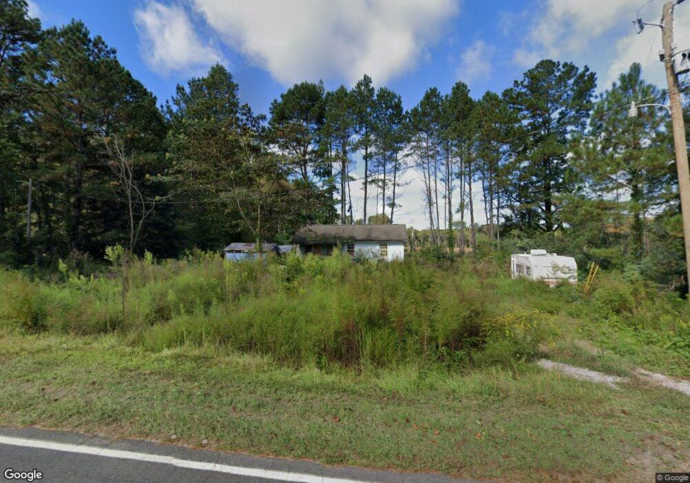
1135 Pete Smith Rd Louisburg, NC 27549
Estimated Value: $70,522 - $228,000
2
Beds
1
Bath
600
Sq Ft
$209/Sq Ft
Est. Value
About This Home
This home is located at 1135 Pete Smith Rd, Louisburg, NC 27549 and is currently estimated at $125,381, approximately $208 per square foot. 1135 Pete Smith Rd is a home located in Franklin County with nearby schools including Laurel Mill Elementary School, Terrell Lane Middle School, and Louisburg High School.
Ownership History
Date
Name
Owned For
Owner Type
Purchase Details
Closed on
Jul 15, 2011
Sold by
Marcell Glynn Wayne and Marcell Mary Ann Homan
Bought by
Allen Amelia P
Current Estimated Value
Purchase Details
Closed on
Apr 27, 2011
Sold by
Valin William
Bought by
Marcell Glynn Wayne and Marcell Mary Ann Homan
Purchase Details
Closed on
Feb 15, 2010
Sold by
Shearin Realty Inc
Bought by
Valin William
Purchase Details
Closed on
May 26, 2006
Sold by
Pharr Percell A and Pharr Gloria Massenburg
Bought by
Franklin County
Create a Home Valuation Report for This Property
The Home Valuation Report is an in-depth analysis detailing your home's value as well as a comparison with similar homes in the area
Home Values in the Area
Average Home Value in this Area
Purchase History
| Date | Buyer | Sale Price | Title Company |
|---|---|---|---|
| Allen Amelia P | $16,500 | None Available | |
| Marcell Glynn Wayne | -- | None Available | |
| Valin William | $10,000 | None Available | |
| Franklin County | -- | None Available |
Source: Public Records
Tax History Compared to Growth
Tax History
| Year | Tax Paid | Tax Assessment Tax Assessment Total Assessment is a certain percentage of the fair market value that is determined by local assessors to be the total taxable value of land and additions on the property. | Land | Improvement |
|---|---|---|---|---|
| 2025 | $298 | $51,940 | $31,500 | $20,440 |
| 2024 | $296 | $51,940 | $31,500 | $20,440 |
| 2023 | $125 | $14,563 | $10,313 | $4,250 |
| 2022 | $125 | $14,563 | $10,313 | $4,250 |
| 2021 | $127 | $14,563 | $10,313 | $4,250 |
| 2020 | $126 | $14,563 | $10,313 | $4,250 |
| 2019 | $128 | $14,563 | $10,313 | $4,250 |
| 2018 | $128 | $14,563 | $10,313 | $4,250 |
| 2017 | $229 | $15,355 | $9,375 | $5,980 |
| 2016 | $234 | $15,355 | $9,375 | $5,980 |
| 2015 | $234 | $15,355 | $9,375 | $5,980 |
| 2014 | $201 | $15,355 | $9,375 | $5,980 |
Source: Public Records
Map
Nearby Homes
- 0 Sutton Rd
- 70 Acres Sutton Rd
- 2253 Pete Smith Rd
- 76 Sutton Rd
- 4224 Us 401 Hwy N
- 0 Alert Rd
- 979 Alert Rd
- 994 Alert Rd
- 09 Tillery Dr
- 11 Tillery Dr
- 00 Alert
- 307 Wilson-Fuller Rd
- 06 Tillery Dr
- 08 Tillery Dr
- 35 Jonesville Ln
- 0 Peg Williams Rd
- 0 Roy Tharrington Rd
- 20.37 Acre Opie Frazier Rd
- 00 Opie Frazier Rd
- 592 Perdues Rd
- 1138 Pete Smith Rd
- 1138 Pete Smith Rd
- 1104 Pete Smith Rd
- 1172 Pete Smith Rd
- 1069 Pete Smith Rd
- 1069 Pete Smith Rd
- 1198 Pete Smith Rd
- 1224 Pete Smith Rd
- 1049 Pete Smith Rd
- 1049 Pete Smith Rd
- 0 Pete Smith Rd Unit 759788
- Off Pete Smith Rd
- 0 Pete Smith Rd Unit 972573
- 0 Pete Smith Rd Unit 821526
- 0 Pete Smith Rd Unit 821678
- Lot 4 Pete Smith Rd
- Lot 6 Pete Smith Rd
- Lot 3 Pete Smith Rd
- Lot 5 Pete Smith Rd
- 0 Pete Smith Rd Unit none TR1940085