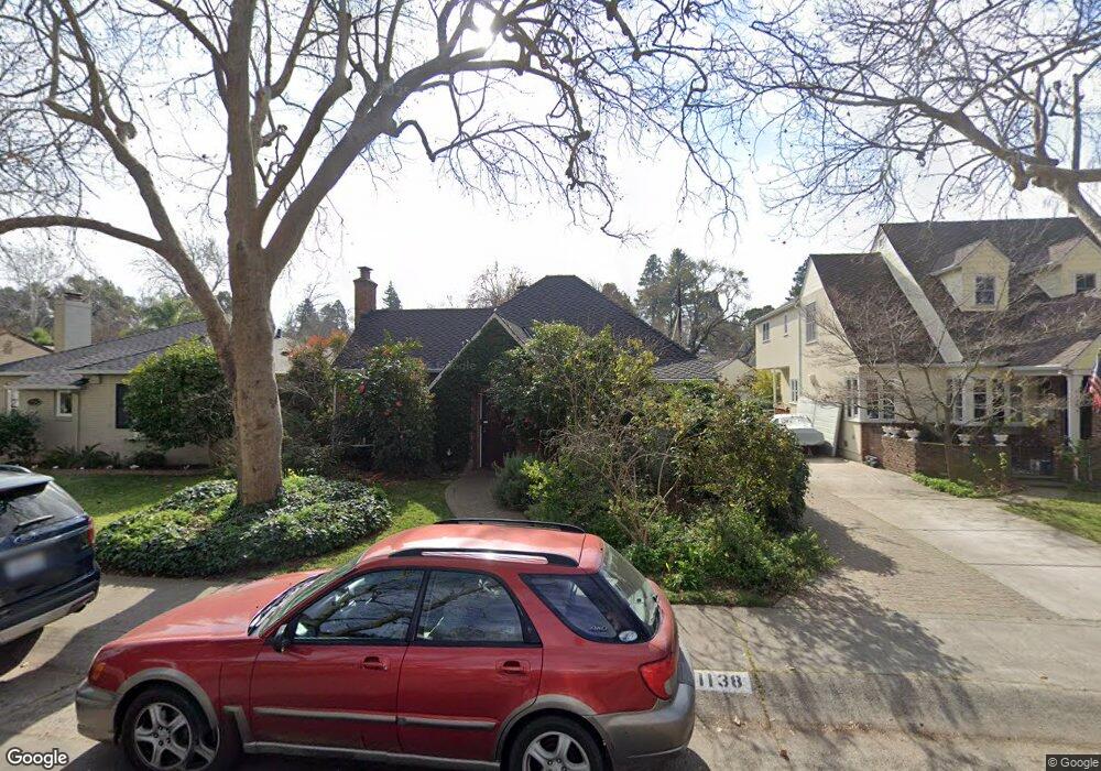
1138 10th Ave Sacramento, CA 95818
Land Park NeighborhoodEstimated Value: $615,000 - $763,000
2
Beds
1
Bath
1,314
Sq Ft
$519/Sq Ft
Est. Value
About This Home
This home is located at 1138 10th Ave, Sacramento, CA 95818 and is currently estimated at $682,082, approximately $519 per square foot. 1138 10th Ave is a home located in Sacramento County with nearby schools including Crocker/Riverside Elementary School, California Middle, and C. K. McClatchy High.
Ownership History
Date
Name
Owned For
Owner Type
Purchase Details
Closed on
Feb 3, 2022
Sold by
Barnard Thomas R and Barnard Sara J
Bought by
Thomas R Barnard And Sara J Drake Family Trus
Current Estimated Value
Purchase Details
Closed on
Apr 23, 2001
Sold by
Merrill Lynch Trust Company Fsb
Bought by
Barnard Thomas R and Drake Sara J
Home Financials for this Owner
Home Financials are based on the most recent Mortgage that was taken out on this home.
Original Mortgage
$115,000
Interest Rate
6.98%
Create a Home Valuation Report for This Property
The Home Valuation Report is an in-depth analysis detailing your home's value as well as a comparison with similar homes in the area
Home Values in the Area
Average Home Value in this Area
Purchase History
| Date | Buyer | Sale Price | Title Company |
|---|---|---|---|
| Thomas R Barnard And Sara J Drake Family Trus | -- | Ellison Law Firm | |
| Barnard Thomas R | $180,000 | Chicago Title Co |
Source: Public Records
Mortgage History
| Date | Status | Borrower | Loan Amount |
|---|---|---|---|
| Previous Owner | Barnard Thomas R | $115,000 |
Source: Public Records
Tax History Compared to Growth
Tax History
| Year | Tax Paid | Tax Assessment Tax Assessment Total Assessment is a certain percentage of the fair market value that is determined by local assessors to be the total taxable value of land and additions on the property. | Land | Improvement |
|---|---|---|---|---|
| 2025 | $3,467 | $277,001 | $150,673 | $126,328 |
| 2024 | $3,467 | $271,570 | $147,719 | $123,851 |
| 2023 | $3,387 | $266,246 | $144,823 | $121,423 |
| 2022 | $3,330 | $261,027 | $141,984 | $119,043 |
| 2021 | $3,179 | $255,909 | $139,200 | $116,709 |
| 2020 | $3,201 | $253,286 | $137,773 | $115,513 |
| 2019 | $3,135 | $248,321 | $135,072 | $113,249 |
| 2018 | $3,055 | $243,453 | $132,424 | $111,029 |
| 2017 | $3,014 | $238,680 | $129,828 | $108,852 |
| 2016 | $2,933 | $234,001 | $127,283 | $106,718 |
| 2015 | $2,888 | $230,487 | $125,372 | $105,115 |
| 2014 | $2,814 | $225,973 | $122,917 | $103,056 |
Source: Public Records
Map
Nearby Homes
- 1032 10th Ave
- 1432 Teneighth Way
- 849 8th Ave
- 3098 Riverside Blvd
- 710 7th Ave
- 1701 9th Ave
- 625 Robertson Way
- 2750 Moonflower St
- 2825 Elderberry St
- 2726 Moonflower St
- The Argo Plan at The Estates at Newport
- The Baltic Plan at The Estates at Newport
- The Caspian Plan at The Estates at Newport
- The Dawson Plan at The Estates at Newport
- 1831 9th Ave
- 613 Swanston Dr
- 749 3rd Ave Unit 3
- 1615 Vallejo Way
- 808 Fremont Way
- 1725 Vallejo Way