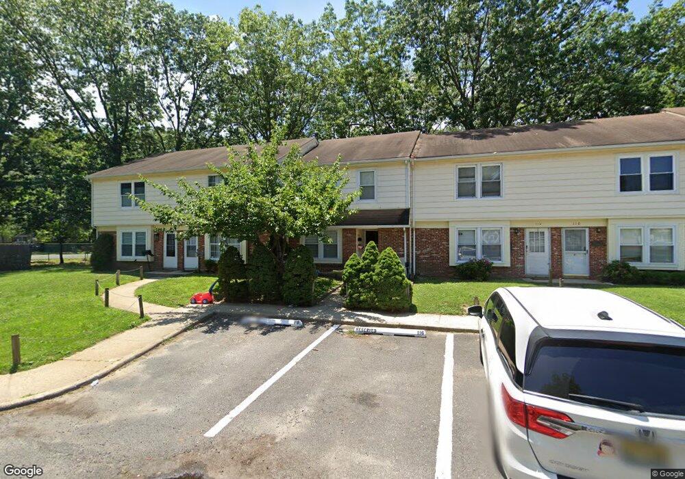
114 Colony Cir Lakewood, NJ 08701
Estimated Value: $379,000 - $481,000
3
Beds
2
Baths
1,408
Sq Ft
$301/Sq Ft
Est. Value
About This Home
This home is located at 114 Colony Cir, Lakewood, NJ 08701 and is currently estimated at $423,563, approximately $300 per square foot. 114 Colony Cir is a home located in Ocean County with nearby schools including Lakewood High School, Yeshiva Masoras Avos, and Bais Faiga School For Girls.
Ownership History
Date
Name
Owned For
Owner Type
Purchase Details
Closed on
Feb 16, 2022
Sold by
Dov Lefkowitz Zev
Bought by
Schleider Robin
Current Estimated Value
Home Financials for this Owner
Home Financials are based on the most recent Mortgage that was taken out on this home.
Original Mortgage
$300,000
Outstanding Balance
$278,573
Interest Rate
3.55%
Mortgage Type
New Conventional
Estimated Equity
$144,990
Purchase Details
Closed on
May 5, 2014
Sold by
Weil Bella
Bought by
Lefkowitz Zev Dov and Tikotsky Prmove Esther
Home Financials for this Owner
Home Financials are based on the most recent Mortgage that was taken out on this home.
Original Mortgage
$190,000
Interest Rate
4.26%
Mortgage Type
New Conventional
Purchase Details
Closed on
Nov 22, 2011
Sold by
Hadley Roy L and Hadley Carol A
Bought by
Weil Bella
Create a Home Valuation Report for This Property
The Home Valuation Report is an in-depth analysis detailing your home's value as well as a comparison with similar homes in the area
Home Values in the Area
Average Home Value in this Area
Purchase History
| Date | Buyer | Sale Price | Title Company |
|---|---|---|---|
| Schleider Robin | $310,000 | Madison Title | |
| Schleider Robin | $310,000 | Madison Title | |
| Schleider Robin | $310,000 | Madison Title | |
| Lefkowitz Zev Dov | $230,000 | Multiple | |
| Weil Bella | $205,000 | Westcor Land Title Ins Co |
Source: Public Records
Mortgage History
| Date | Status | Borrower | Loan Amount |
|---|---|---|---|
| Open | Schleider Robin | $300,000 | |
| Closed | Schleider Robin | $300,000 | |
| Previous Owner | Lefkowitz Zev Dov | $190,000 |
Source: Public Records
Tax History Compared to Growth
Tax History
| Year | Tax Paid | Tax Assessment Tax Assessment Total Assessment is a certain percentage of the fair market value that is determined by local assessors to be the total taxable value of land and additions on the property. | Land | Improvement |
|---|---|---|---|---|
| 2025 | $5,248 | $211,200 | $100,000 | $111,200 |
| 2024 | $4,993 | $211,200 | $100,000 | $111,200 |
| 2023 | $4,820 | $211,200 | $100,000 | $111,200 |
| 2022 | $4,820 | $211,200 | $100,000 | $111,200 |
| 2021 | $2,399 | $211,200 | $100,000 | $111,200 |
| 2020 | $4,798 | $211,200 | $100,000 | $111,200 |
| 2019 | $4,617 | $211,200 | $100,000 | $111,200 |
| 2018 | $4,402 | $211,200 | $100,000 | $111,200 |
| 2017 | $4,988 | $211,200 | $100,000 | $111,200 |
| 2016 | $5,505 | $187,900 | $125,000 | $62,900 |
| 2015 | $5,327 | $187,900 | $125,000 | $62,900 |
| 2014 | $5,053 | $187,900 | $125,000 | $62,900 |
Source: Public Records
Map
Nearby Homes
- 1701 Princeton Ave
- 180 Tudor Ct Unit 10
- 156 Tudor Ct
- 184 Downing St
- 176 Downing St Unit 1
- 32 E 13th St
- 126 14th St
- 0 Appolo Rd
- 114 Carey St
- 6 11th St
- 6 11th St Unit B
- 601 Appolo Rd
- 1013 Lexington Ave
- 52 E 9th St
- 412 15th St
- 402 Twin Oaks Dr
- 0 Maxim Southard Rd Unit 22531504
- 27 7th St Unit 2
- 1418 Forest Ave
- 574 W Kennedy Blvd
- 112 Colony Cir Unit 4
- 116 Colony Cir
- 118 Colony Cir Unit 10
- 110 Colony Cir Unit 5
- 108 Colony Cir Unit 6
- 106 Colony Cir
- 120 Colony Cir
- 104 Colony Cir
- 122 Colony Cir
- 102 Colony Cir
- 124 Colony Cir
- 126 Colony Cir Unit 7
- 100 Colony Cir
- 128 Colony Cir Unit 6
- 103 Colony Cir
- 101 Colony Cir
- 105 Colony Cir
- 107 Colony Cir
- 109 Colony Cir
- 111 Colony Cir Unit 6