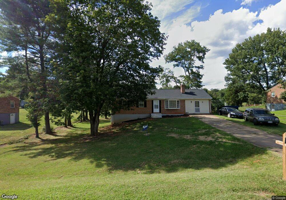
114 Lancaster Dr Madison Heights, VA 24572
Estimated Value: $220,000 - $274,000
5
Beds
1
Bath
1,779
Sq Ft
$139/Sq Ft
Est. Value
About This Home
This home is located at 114 Lancaster Dr, Madison Heights, VA 24572 and is currently estimated at $246,613, approximately $138 per square foot. 114 Lancaster Dr is a home located in Amherst County with nearby schools including Amelon Elementary School, Monelison Middle School, and Amherst County High School.
Ownership History
Date
Name
Owned For
Owner Type
Purchase Details
Closed on
Jul 21, 2017
Sold by
Spinner Stephen A and Spinner Rashanda D
Bought by
Spinner Stephen A
Current Estimated Value
Home Financials for this Owner
Home Financials are based on the most recent Mortgage that was taken out on this home.
Original Mortgage
$102,000
Outstanding Balance
$84,581
Interest Rate
3.82%
Mortgage Type
New Conventional
Estimated Equity
$162,032
Purchase Details
Closed on
Jun 23, 2009
Sold by
Hsbc Mortgage Services Inc
Bought by
Spinner Stephen A and Spinner Rashanda D
Home Financials for this Owner
Home Financials are based on the most recent Mortgage that was taken out on this home.
Original Mortgage
$112,143
Interest Rate
5.5%
Mortgage Type
New Conventional
Purchase Details
Closed on
Jan 8, 2009
Sold by
Muncy Johnie R
Bought by
Hsbc Mortgage Services Inc
Create a Home Valuation Report for This Property
The Home Valuation Report is an in-depth analysis detailing your home's value as well as a comparison with similar homes in the area
Home Values in the Area
Average Home Value in this Area
Purchase History
| Date | Buyer | Sale Price | Title Company |
|---|---|---|---|
| Spinner Stephen A | -- | None Available | |
| Spinner Stephen A | -- | None Available | |
| Hsbc Mortgage Services Inc | $101,920 | Colonial Title & Abstracting |
Source: Public Records
Mortgage History
| Date | Status | Borrower | Loan Amount |
|---|---|---|---|
| Open | Spinner Stephen A | $102,000 | |
| Previous Owner | Spinner Stephen A | $112,143 |
Source: Public Records
Tax History Compared to Growth
Tax History
| Year | Tax Paid | Tax Assessment Tax Assessment Total Assessment is a certain percentage of the fair market value that is determined by local assessors to be the total taxable value of land and additions on the property. | Land | Improvement |
|---|---|---|---|---|
| 2025 | $733 | $120,200 | $27,500 | $92,700 |
| 2024 | $733 | $120,200 | $27,500 | $92,700 |
| 2023 | $733 | $120,200 | $27,500 | $92,700 |
| 2022 | $733 | $120,200 | $27,500 | $92,700 |
| 2021 | $733 | $120,200 | $27,500 | $92,700 |
| 2020 | $733 | $120,200 | $27,500 | $92,700 |
| 2019 | $738 | $121,000 | $33,500 | $87,500 |
| 2018 | $738 | $121,000 | $33,500 | $87,500 |
| 2017 | $738 | $121,000 | $33,500 | $87,500 |
| 2016 | $738 | $121,000 | $33,500 | $87,500 |
| 2015 | $678 | $121,000 | $33,500 | $87,500 |
| 2014 | $678 | $121,000 | $33,500 | $87,500 |
Source: Public Records
Map
Nearby Homes
- 150 Glenwood Dr
- 327 Dixie Airport Rd
- 272 Dixie Airport Rd
- 505 Royal Gardens Ct
- 51 Patrick Ct
- 571 Dixie Airport Rd
- 4123 S Amherst Hwy
- 250 S Wood Duck Dr
- 379 Winesap Rd
- 115 Morgan Rd
- 0 S Amherst Hwy Unit 362100
- 0 S Amherst Hwy Unit 336267
- 0 McIvor Ln
- 289 Todd Ln
- TBD Stratford Place Unit 39
- 151 Stratford Place
- 193 Daniels Dr
- 124-138 Cedar Gate Rd
- 561 Oak Grove Dr
- 1358 S Coolwell Rd
- 106 Lancaster Dr
- 128 Lancaster Dr
- 143 Glenwood Dr
- 113 Lancaster Dr
- 134 Lancaster Dr
- 121 Lancaster Dr
- 105 Lancaster Dr
- 133 Lancaster Dr
- 151 Glenwood Dr
- 130 Glenwood Dr
- 142 Glenwood Dr
- 139 Lancaster Dr
- 144 Lancaster Dr
- 122 Glenwood Dr
- 157 Glenwood Dr
- 160 Lancaster Dr
- 149 Hillcrest Cir
- 147 Hillcrest Cir
- 109 Glenwood Dr
- 166 Lancaster Dr