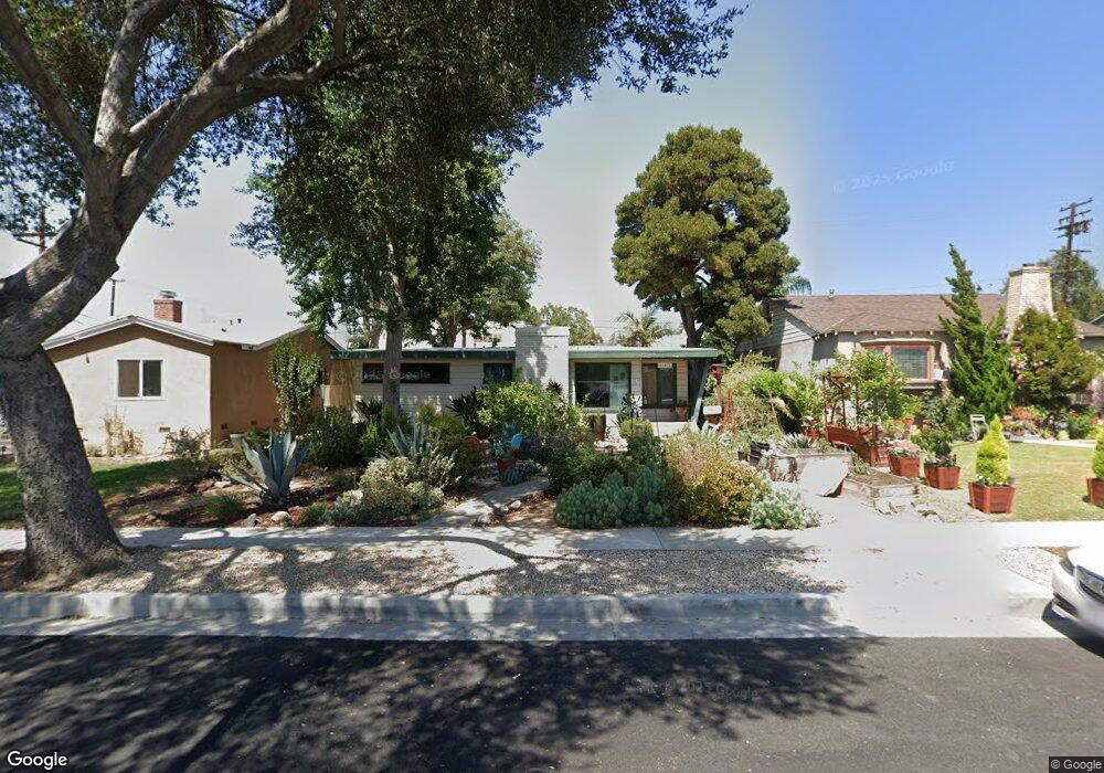
11421 See Dr Whittier, CA 90606
West Whittier-Los Nietos NeighborhoodEstimated Value: $799,296 - $876,000
3
Beds
2
Baths
1,520
Sq Ft
$550/Sq Ft
Est. Value
About This Home
This home is located at 11421 See Dr, Whittier, CA 90606 and is currently estimated at $836,574, approximately $550 per square foot. 11421 See Dr is a home located in Los Angeles County with nearby schools including Sorensen Science Academy, Katherine Edwards Middle School, and Whittier High School.
Ownership History
Date
Name
Owned For
Owner Type
Purchase Details
Closed on
May 21, 2014
Sold by
Keniston Ruth E
Bought by
Keniston Hess Living Trust
Current Estimated Value
Purchase Details
Closed on
Jun 24, 2013
Sold by
Keniston Ruth E
Bought by
Keniston Ruth E and Hess Teresa M
Home Financials for this Owner
Home Financials are based on the most recent Mortgage that was taken out on this home.
Original Mortgage
$110,500
Interest Rate
3.48%
Mortgage Type
New Conventional
Purchase Details
Closed on
Mar 22, 1996
Sold by
Keniston Ruth
Bought by
Keniston Ruth and Whiddon Teresa M
Create a Home Valuation Report for This Property
The Home Valuation Report is an in-depth analysis detailing your home's value as well as a comparison with similar homes in the area
Home Values in the Area
Average Home Value in this Area
Purchase History
| Date | Buyer | Sale Price | Title Company |
|---|---|---|---|
| Keniston Hess Living Trust | -- | None Available | |
| Keniston Ruth E | -- | North American Title Co Inc | |
| Keniston Ruth | -- | -- |
Source: Public Records
Mortgage History
| Date | Status | Borrower | Loan Amount |
|---|---|---|---|
| Closed | Keniston Ruth E | $110,500 |
Source: Public Records
Tax History Compared to Growth
Tax History
| Year | Tax Paid | Tax Assessment Tax Assessment Total Assessment is a certain percentage of the fair market value that is determined by local assessors to be the total taxable value of land and additions on the property. | Land | Improvement |
|---|---|---|---|---|
| 2025 | $3,778 | $291,397 | $186,181 | $105,216 |
| 2024 | $3,778 | $285,684 | $182,531 | $103,153 |
| 2023 | $3,711 | $280,083 | $178,952 | $101,131 |
| 2022 | $3,635 | $274,593 | $175,444 | $99,149 |
| 2021 | $3,557 | $269,209 | $172,004 | $97,205 |
| 2019 | $3,494 | $261,226 | $166,903 | $94,323 |
| 2018 | $3,362 | $256,105 | $163,631 | $92,474 |
| 2016 | $3,218 | $246,162 | $157,278 | $88,884 |
| 2015 | $3,152 | $242,465 | $154,916 | $87,549 |
| 2014 | $3,108 | $237,717 | $151,882 | $85,835 |
Source: Public Records
Map
Nearby Homes
- 6266 Western Ave
- 6225 Gretna Ave
- 11447 Broadway Ave
- 11232 Dorland Dr
- 11273 Dorland Dr
- 6240 Gretna Ave
- 11567 Keith Dr
- 11730 Whittier Blvd Unit 27
- 11730 Whittier Blvd Unit 39
- 11730 Whittier Blvd Unit 54
- 11730 Whittier Blvd Unit 55
- 6222 Magnolia Ave
- 10943 Loch Lomond Dr
- 11402 Rose Hedge Dr
- 11409 Bradhurst St
- 10825 Loch Avon Dr
- 11905 Mendenhall Ln
- 12031 Beverly Blvd Unit 1D
- 11302 Maple St
- 11840 Nixon Ln