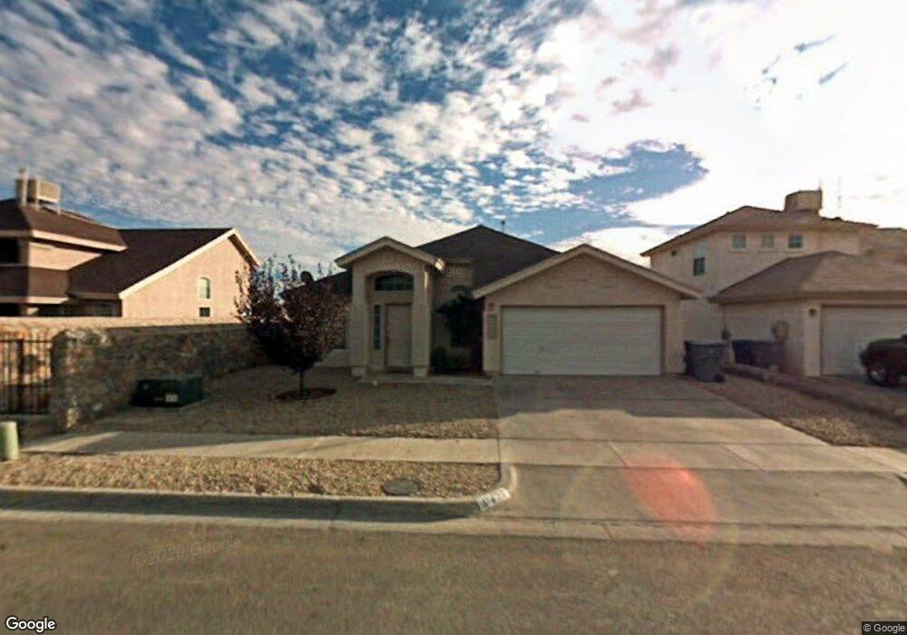
11436 Arrow Rock Dr Unit 10 El Paso, TX 79936
Indian Ridge NeighborhoodEstimated Value: $230,000 - $249,000
4
Beds
2
Baths
1,570
Sq Ft
$152/Sq Ft
Est. Value
About This Home
This home is located at 11436 Arrow Rock Dr Unit 10, El Paso, TX 79936 and is currently estimated at $238,914, approximately $152 per square foot. 11436 Arrow Rock Dr Unit 10 is a home located in El Paso County with nearby schools including Bill Sybert School, Montwood High School, and EL PASO LEADERSHIP ACADEMY - MIDDLE EAST.
Ownership History
Date
Name
Owned For
Owner Type
Purchase Details
Closed on
May 20, 2016
Sold by
Navar Adalberto M
Bought by
Duran Ricardo and Duran Lydia Lorraine Puentes
Current Estimated Value
Home Financials for this Owner
Home Financials are based on the most recent Mortgage that was taken out on this home.
Original Mortgage
$127,939
Outstanding Balance
$104,232
Interest Rate
4.4%
Mortgage Type
FHA
Estimated Equity
$134,682
Purchase Details
Closed on
Jan 5, 2016
Sold by
Arruti Mike Andony and Arruti Nancy E
Bought by
Navar Adalberto M
Purchase Details
Closed on
Mar 16, 2006
Sold by
Pelech Terry J and Pelech Kimberly J
Bought by
Arruti Mike Andony and Arruti Nancy E
Home Financials for this Owner
Home Financials are based on the most recent Mortgage that was taken out on this home.
Original Mortgage
$117,900
Interest Rate
10.15%
Mortgage Type
Fannie Mae Freddie Mac
Create a Home Valuation Report for This Property
The Home Valuation Report is an in-depth analysis detailing your home's value as well as a comparison with similar homes in the area
Home Values in the Area
Average Home Value in this Area
Purchase History
| Date | Buyer | Sale Price | Title Company |
|---|---|---|---|
| Duran Ricardo | -- | None Available | |
| Navar Adalberto M | $83,000 | None Available | |
| Arruti Mike Andony | -- | None Available |
Source: Public Records
Mortgage History
| Date | Status | Borrower | Loan Amount |
|---|---|---|---|
| Open | Duran Ricardo | $127,939 | |
| Previous Owner | Arruti Mike Andony | $117,900 |
Source: Public Records
Tax History Compared to Growth
Tax History
| Year | Tax Paid | Tax Assessment Tax Assessment Total Assessment is a certain percentage of the fair market value that is determined by local assessors to be the total taxable value of land and additions on the property. | Land | Improvement |
|---|---|---|---|---|
| 2025 | $3,969 | $217,413 | -- | -- |
| 2024 | $3,969 | $197,648 | -- | -- |
| 2023 | $3,859 | $179,680 | $0 | $0 |
| 2022 | $4,731 | $163,345 | $0 | $0 |
| 2021 | $4,674 | $172,783 | $22,427 | $150,356 |
| 2020 | $4,285 | $134,995 | $16,980 | $118,015 |
| 2018 | $3,916 | $133,899 | $16,980 | $116,919 |
| 2017 | $3,657 | $128,038 | $16,980 | $111,058 |
| 2016 | $3,657 | $128,038 | $16,980 | $111,058 |
| 2015 | $3,526 | $128,038 | $16,980 | $111,058 |
| 2014 | $3,526 | $127,029 | $16,980 | $110,049 |
Source: Public Records
Map
Nearby Homes
- 3309 Broken Bow St
- 3352 Broken Bow St
- 11345 Ardelle Ave
- 11346 Jasso Ct
- 11338 Jasso
- 11341 Ardelle Ave
- 11334 Jasso Ct
- 11342 Jasso
- 11337 Ardelle Ave
- 3197 Lonesome Dove Cir
- 3304 Martina Place
- 11349 Patricia Ave
- 11345 Patricia Ave
- 11312 Ardelle Ave
- 3117 Crazy Horse Dr
- 11513 Cree Ct
- 11316 Menlo Ave
- 3209 Black Elk Place
- 11508 Crazy Horse Dr
- 3408 Jan de Roos Place
- 11436 Arrow Rock Dr
- 11432 Arrow Rock Dr
- 11440 Arrow Rock Dr
- 11428 Arrow Rock Dr
- 11428 Arrow Rock Dr Unit 10
- 11444 Arrow Rock Dr
- 11424 Arrow Rock Dr
- 11424 Arrow Rock Dr Unit 10
- 11448 Arrow Rock Dr Unit 1
- 3301 Chickasaw Dr
- 3300 Chickasaw Dr
- 11452 Arrow Rock Dr
- 11424 Ardelle Ave
- 11420 Ardelle Ave
- 11420 Arrow Rock Dr
- 11420 Arrow Rock Dr Unit 1
- 3305 Chickasaw Dr
- 3304 Chickasaw Dr
- 3304 Chickasaw Dr Unit 10
- 3300 Broken Bow St
