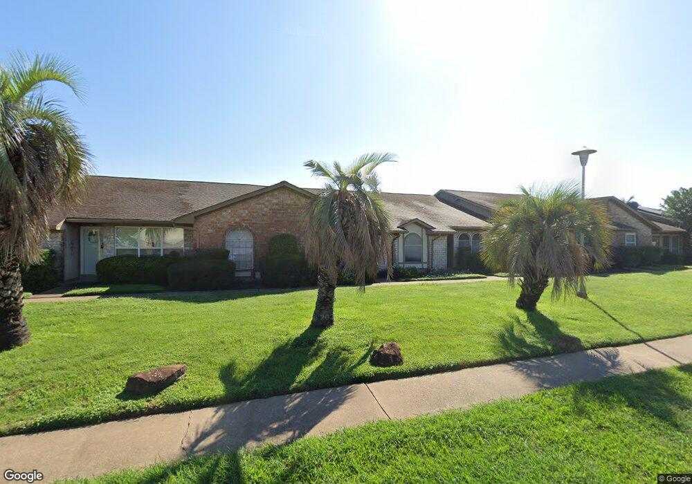
11473 Sabo Rd Houston, TX 77089
Southbelt-Ellington NeighborhoodEstimated Value: $172,937 - $179,000
3
Beds
3
Baths
1,840
Sq Ft
$95/Sq Ft
Est. Value
About This Home
This home is located at 11473 Sabo Rd, Houston, TX 77089 and is currently estimated at $174,734, approximately $94 per square foot. 11473 Sabo Rd is a home located in Harris County with nearby schools including Meador Elementary School, Morris Middle School, and Beverly Hill Intermediate School.
Ownership History
Date
Name
Owned For
Owner Type
Purchase Details
Closed on
Jun 16, 2015
Sold by
Munsch Jerry F
Bought by
Stump Jra Leonard L
Current Estimated Value
Home Financials for this Owner
Home Financials are based on the most recent Mortgage that was taken out on this home.
Original Mortgage
$84,932
Outstanding Balance
$67,494
Interest Rate
4.5%
Mortgage Type
FHA
Estimated Equity
$107,240
Create a Home Valuation Report for This Property
The Home Valuation Report is an in-depth analysis detailing your home's value as well as a comparison with similar homes in the area
Home Values in the Area
Average Home Value in this Area
Purchase History
| Date | Buyer | Sale Price | Title Company |
|---|---|---|---|
| Stump Jra Leonard L | -- | South Land Title Llc |
Source: Public Records
Mortgage History
| Date | Status | Borrower | Loan Amount |
|---|---|---|---|
| Open | Stump Jra Leonard L | $84,932 |
Source: Public Records
Tax History Compared to Growth
Tax History
| Year | Tax Paid | Tax Assessment Tax Assessment Total Assessment is a certain percentage of the fair market value that is determined by local assessors to be the total taxable value of land and additions on the property. | Land | Improvement |
|---|---|---|---|---|
| 2025 | -- | $140,466 | $27,720 | $112,746 |
| 2024 | -- | $142,168 | $27,720 | $114,448 |
| 2023 | $2,763 | $137,731 | $27,720 | $110,011 |
| 2022 | $2,750 | $126,700 | $27,720 | $98,980 |
| 2021 | $3,137 | $116,764 | $26,334 | $90,430 |
| 2020 | $2,914 | $116,764 | $26,334 | $90,430 |
| 2019 | $2,786 | $96,649 | $19,800 | $76,849 |
| 2018 | $1,356 | $96,649 | $19,800 | $76,849 |
| 2017 | $2,662 | $96,649 | $19,800 | $76,849 |
| 2016 | $2,298 | $83,456 | $11,000 | $72,456 |
| 2015 | $188 | $80,631 | $11,000 | $69,631 |
| 2014 | $188 | $75,039 | $11,000 | $64,039 |
Source: Public Records
Map
Nearby Homes
- 11433 Sabo Rd
- 10507 Kirkhill Dr
- 10614 Sabo Rd
- 10442 Southport Dr
- 10906 Green Arbor Dr
- 10823 Overlea Dr
- 12023 Sagecliff Dr
- 10815 Ritow St
- 10619 Wheaton Dr
- 11930 Kirkway Dr
- 10207 Rambling Trail
- 10906 Keese Dr
- 10214 Buena Park Dr
- 11311 Caribbean Ln
- 11303 Caribbean Ln
- 10211 Glenmawr Dr
- 11328 Palmsprings Dr
- 9743 Santa Monica Blvd
- 11107 Kirkpark Dr
- 11610 Palmsprings Dr
- 11471 Sabo Rd
- 11471 Sabo Rd Unit E
- 11469 Sabo Rd
- 11469 Sabo Rd Unit F
- 11475 Sabo Rd
- 11467 Sabo Rd
- 11477 Sabo Rd
- 11479 Sabo Rd
- 11445 Sabo Rd
- 11443 Sabo Rd
- 11447 Sabo Rd
- 11481 Sabo Rd
- 11441 Sabo Rd
- 11449 Sabo Rd
- 11439 Sabo Rd
- 11461 Sabo Rd
- 11459 Sabo Rd Unit E
- 11483 Sabo Rd
- 11457 Sabo Rd
- 11463 Sabo Rd