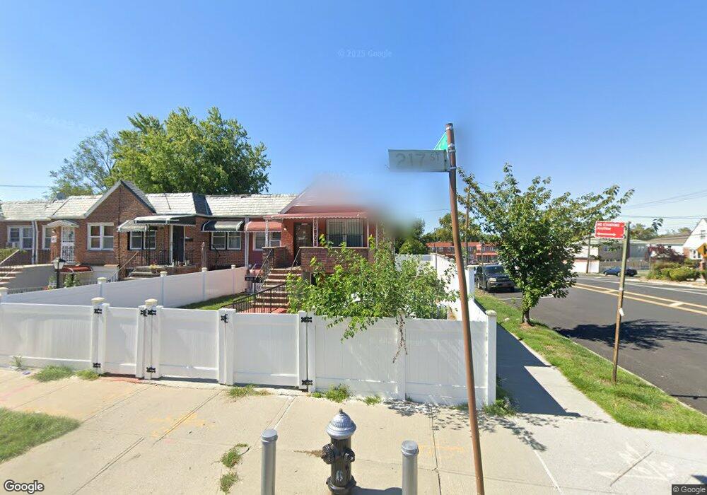
115-02 217th St Cambria Heights, NY 11411
Cambria Heights NeighborhoodEstimated Value: $654,000 - $773,000
--
Bed
2
Baths
1,554
Sq Ft
$456/Sq Ft
Est. Value
About This Home
This home is located at 115-02 217th St, Cambria Heights, NY 11411 and is currently estimated at $708,947, approximately $456 per square foot. 115-02 217th St is a home located in Queens County with nearby schools including P.S./M.S. 147 Ronald Mcnair, I.S. 192 The Linden, and Ss Joachim & Anne School.
Ownership History
Date
Name
Owned For
Owner Type
Purchase Details
Closed on
Aug 15, 2018
Sold by
Estate Of Seymour Sterling
Bought by
Menier Herold M and Menier Linda
Current Estimated Value
Home Financials for this Owner
Home Financials are based on the most recent Mortgage that was taken out on this home.
Original Mortgage
$441,849
Outstanding Balance
$383,728
Interest Rate
4.5%
Mortgage Type
Purchase Money Mortgage
Estimated Equity
$325,219
Purchase Details
Closed on
Aug 11, 2003
Sold by
Gibbs Anna Bell
Bought by
Malibu Corp
Create a Home Valuation Report for This Property
The Home Valuation Report is an in-depth analysis detailing your home's value as well as a comparison with similar homes in the area
Home Values in the Area
Average Home Value in this Area
Purchase History
| Date | Buyer | Sale Price | Title Company |
|---|---|---|---|
| Menier Herold M | $450,000 | -- | |
| Malibu Corp | $180,000 | -- |
Source: Public Records
Mortgage History
| Date | Status | Borrower | Loan Amount |
|---|---|---|---|
| Open | Menier Herold M | $441,849 |
Source: Public Records
Tax History Compared to Growth
Tax History
| Year | Tax Paid | Tax Assessment Tax Assessment Total Assessment is a certain percentage of the fair market value that is determined by local assessors to be the total taxable value of land and additions on the property. | Land | Improvement |
|---|---|---|---|---|
| 2025 | $5,670 | $29,860 | $8,087 | $21,773 |
| 2024 | $5,952 | $29,632 | $8,497 | $21,135 |
| 2023 | $5,334 | $27,955 | $8,612 | $19,343 |
| 2022 | $4,978 | $39,540 | $11,700 | $27,840 |
| 2021 | $4,941 | $34,320 | $11,700 | $22,620 |
| 2020 | $4,971 | $33,180 | $11,700 | $21,480 |
| 2019 | $4,873 | $29,700 | $11,700 | $18,000 |
| 2018 | $4,451 | $23,296 | $10,371 | $12,925 |
| 2017 | $4,181 | $21,979 | $10,961 | $11,018 |
| 2016 | $3,835 | $21,979 | $10,961 | $11,018 |
| 2015 | $2,281 | $20,736 | $12,893 | $7,843 |
| 2014 | $2,281 | $20,578 | $12,795 | $7,783 |
Source: Public Records
Map
Nearby Homes
- 115-20 217th St
- 21610 115th Ct
- 216-04 115th Terrace
- 113-66 Springfield Blvd
- 217-39 114th Rd
- 21739 114th Rd
- 216-08 115th Rd
- 21608 115th Rd
- 114-54 212th St
- 114-36 220th St
- 114-42 211th St
- 21531 Murdock Ave
- 115-100 Springfield Blvd
- 214-38 113th Ave
- 115-87 219th St
- 11419 210th St
- 214-10 113th Ave
- 115-99 219th St
- 11583 220th St
- 21438 112th Rd
- 115-04 217th St
- 11502 217th St
- 11502 217th St
- 115 217 St
- 11504 217th St
- 115-06 217th St
- 11506 217th St
- 21624 115th Ave
- 115-01 217th St
- 11508 217th St
- 115-08 217th St
- 115-05 217th St
- 21624 115th Ave
- 21622 115th Ave
- 11510 217th St
- 115-03 217th St
- 11501 217th St
- 21620 115th Ave
- 11512 217th St
- 11503 217th St