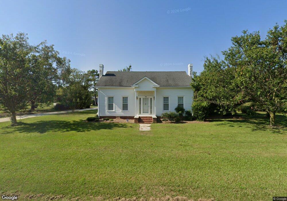
11561 N Us 421 Hwy Clinton, NC 28328
Estimated Value: $262,000 - $823,859
3
Beds
2
Baths
1,740
Sq Ft
$259/Sq Ft
Est. Value
About This Home
This home is located at 11561 N Us 421 Hwy, Clinton, NC 28328 and is currently estimated at $450,953, approximately $259 per square foot. 11561 N Us 421 Hwy is a home located in Sampson County with nearby schools including Midway Elementary School, Midway Middle School, and Midway High School.
Ownership History
Date
Name
Owned For
Owner Type
Purchase Details
Closed on
Mar 18, 2025
Sold by
Herring Jeffrey Alan and Herring Carolyn Howard
Bought by
Herring Jeffrey Alan
Current Estimated Value
Purchase Details
Closed on
Feb 19, 1987
Bought by
Herring Helen Naylor
Create a Home Valuation Report for This Property
The Home Valuation Report is an in-depth analysis detailing your home's value as well as a comparison with similar homes in the area
Home Values in the Area
Average Home Value in this Area
Purchase History
| Date | Buyer | Sale Price | Title Company |
|---|---|---|---|
| Herring Jeffrey Alan | -- | None Listed On Document | |
| Herring Jeffrey Alan | -- | None Listed On Document | |
| Herring David Bryant | -- | None Listed On Document | |
| Herring David Bryant | -- | None Listed On Document | |
| Herring David Bryant | -- | None Listed On Document | |
| Herring David Bryant | -- | None Listed On Document | |
| Howington Revocable Trust | -- | None Listed On Document | |
| Howington Revocable Trust | -- | None Listed On Document | |
| Herring Helen Naylor | -- | -- |
Source: Public Records
Tax History Compared to Growth
Tax History
| Year | Tax Paid | Tax Assessment Tax Assessment Total Assessment is a certain percentage of the fair market value that is determined by local assessors to be the total taxable value of land and additions on the property. | Land | Improvement |
|---|---|---|---|---|
| 2025 | $2,780 | $356,422 | $0 | $0 |
| 2024 | $2,513 | $356,422 | $0 | $0 |
| 2023 | $2,291 | $251,775 | $0 | $0 |
| 2022 | $2,291 | $251,775 | $0 | $0 |
| 2021 | $2,291 | $251,775 | $0 | $0 |
| 2020 | $2,291 | $251,775 | $0 | $0 |
| 2019 | $2,291 | $251,775 | $0 | $0 |
| 2018 | $1,674 | $183,904 | $0 | $0 |
| 2017 | $1,674 | $183,904 | $0 | $0 |
| 2016 | $1,683 | $183,904 | $0 | $0 |
| 2015 | $1,683 | $183,904 | $0 | $0 |
| 2014 | $1,683 | $183,904 | $0 | $0 |
Source: Public Records
Map
Nearby Homes
- 260 Naylor School Rd
- 267 Ed Collins Ln
- 1509 Sampson Acres Dr
- 2546 Parker Memorial Rd
- 2534 Parker Memorial Rd
- 2506 Parker Memorial Rd
- 381 Royal Rd
- 3570 Penny Tew Mill Rd
- 340 Jones Rd
- 00 Trail End Ln
- 00 Trail End Ln Unit LotWP001
- 770 Simmons Rd
- 243 Sandhole Rd
- 1000 High House Rd
- 1249 Fann School Rd
- Lot 5 Crumpler Lake Ln
- 3014 Basstown Rd
- 4627 Bearskin Rd
- 178 Westbrook Rd
- 212 Hickory Grove Rd
- 11341 N Us 421 Hwy
- 216 Moore Herring Ln
- 260 Moore Herring Ln
- 11136 N Us 421 Hwy
- 484 Hickory Grove Rd
- 10893 N Us 421 Hwy
- 1119 Wrye Branch Rd
- 1089 Wrye Branch Rd
- 1086 Wrye Branch Rd
- 0 Wyre Branch Rd Unit TR1971318
- 0 Wyre Branch Rd
- 291 Newton Ln
- 1375 Wrye Branch Rd
- 1346 Wrye Branch Rd
- 414 Wrye Branch Rd
- 210 Newton Ln
- 215 Newton Ln
- 3183 Bud Johnson Rd
- 3211 Bud Johnson Rd