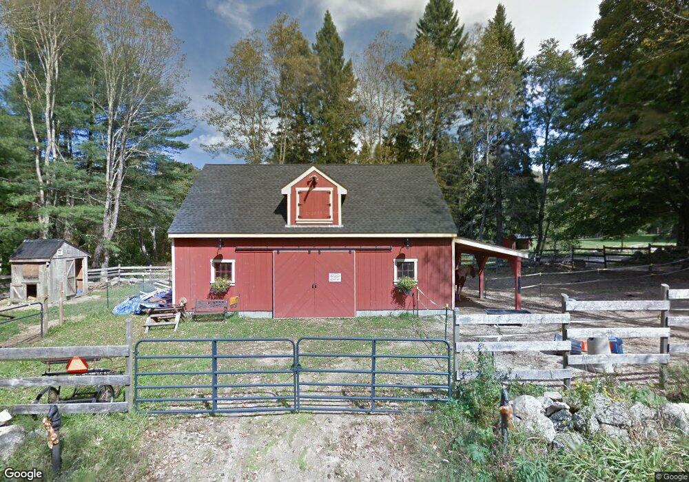
116 Barbs Hill Rd Greene, RI 02827
Greene NeighborhoodEstimated Value: $395,000 - $599,000
3
Beds
3
Baths
1,739
Sq Ft
$300/Sq Ft
Est. Value
About This Home
This home is located at 116 Barbs Hill Rd, Greene, RI 02827 and is currently estimated at $521,592, approximately $299 per square foot. 116 Barbs Hill Rd is a home located in Kent County with nearby schools including Alan Shawn Feinstein Ms Of Cov and Coventry High School.
Ownership History
Date
Name
Owned For
Owner Type
Purchase Details
Closed on
Mar 12, 2007
Sold by
Uhlinger Kevin R and Uhlinger Eleanor S
Bought by
Allen Ronald G and Allen Carol A
Current Estimated Value
Home Financials for this Owner
Home Financials are based on the most recent Mortgage that was taken out on this home.
Original Mortgage
$252,000
Interest Rate
6.3%
Mortgage Type
Purchase Money Mortgage
Purchase Details
Closed on
Jun 10, 1998
Sold by
Mann Anthony B and Mann Jean
Bought by
Uhlinger Eleanor S and Uhlinger Kevin
Create a Home Valuation Report for This Property
The Home Valuation Report is an in-depth analysis detailing your home's value as well as a comparison with similar homes in the area
Home Values in the Area
Average Home Value in this Area
Purchase History
| Date | Buyer | Sale Price | Title Company |
|---|---|---|---|
| Allen Ronald G | $336,100 | -- | |
| Uhlinger Eleanor S | $212,000 | -- |
Source: Public Records
Mortgage History
| Date | Status | Borrower | Loan Amount |
|---|---|---|---|
| Open | Uhlinger Eleanor S | $253,125 | |
| Closed | Uhlinger Eleanor S | $252,000 | |
| Closed | Uhlinger Eleanor S | $79,000 | |
| Previous Owner | Uhlinger Eleanor S | $170,000 |
Source: Public Records
Tax History Compared to Growth
Tax History
| Year | Tax Paid | Tax Assessment Tax Assessment Total Assessment is a certain percentage of the fair market value that is determined by local assessors to be the total taxable value of land and additions on the property. | Land | Improvement |
|---|---|---|---|---|
| 2024 | $6,889 | $434,900 | $187,200 | $247,700 |
| 2023 | $6,667 | $434,900 | $187,200 | $247,700 |
| 2022 | $7,090 | $362,300 | $159,100 | $203,200 |
| 2021 | $7,029 | $362,300 | $159,100 | $203,200 |
| 2020 | $8,058 | $362,300 | $159,100 | $203,200 |
| 2019 | $7,350 | $330,500 | $155,300 | $175,200 |
| 2018 | $7,142 | $330,500 | $155,300 | $175,200 |
| 2017 | $6,934 | $330,500 | $155,300 | $175,200 |
| 2016 | $6,340 | $296,100 | $146,300 | $149,800 |
| 2015 | $6,168 | $296,100 | $146,300 | $149,800 |
| 2014 | $6,040 | $296,100 | $146,300 | $149,800 |
| 2013 | $5,204 | $278,900 | $131,300 | $147,600 |
Source: Public Records
Map
Nearby Homes
- 0 Rice City Rd
- 0 Moosup Valley Rd Unit 1384828
- 93 Moosup Valley Rd
- 6356 Flat River Rd
- 176 Hopkins Hollow Rd
- 201 Plainfield Pike
- 532 Lewis Farm Rd
- 145 Waterman Hill Rd
- 38 Deerfield Dr
- 29 Luther Rd
- 20 Biscuit Hill Rd
- 11 Briggs Rd
- 3 Victory Falls Rd
- 1 Bowen Hill Rd
- 79 Cucumber Hill Rd
- 581 Sterling Rd
- 35 River Rd
- 1 Johns Cir
- 5 John's Cir Unit Lot 35
- 1 John's Cir Unit Lot 37
- 314 Vaughn Hollow Rd
- 315 Vaughn Hollow Rd
- 55 Barbs Hill Rd
- 160 Potter Rd
- 128 Barbs Hill Rd
- 150 Potter Rd
- 75 Potter Rd
- 100 Potter Rd
- 230 Barbs Hill Rd
- 81 Vaughn Hollow Rd
- 79 Vaughn Hollow Rd
- 45 Potter Rd
- 77 Vaughn Hollow Rd
- 101 Vaughn Hollow Rd
- 83 Vaughn Hollow Rd
- 85 Vaughn Hollow Rd
- 161 Lionel Pierson Rd
- 84 Vaughn Hollow Rd
- 23 Vaughn Hollow Rd
- 20 Potter Rd