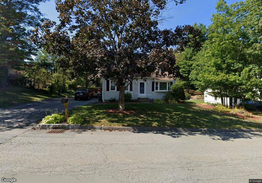
116 Dogwood Rd Leominster, MA 01453
Estimated Value: $549,576 - $568,000
3
Beds
2
Baths
1,666
Sq Ft
$335/Sq Ft
Est. Value
About This Home
This home is located at 116 Dogwood Rd, Leominster, MA 01453 and is currently estimated at $558,144, approximately $335 per square foot. 116 Dogwood Rd is a home with nearby schools including Leominster High School, St. Anna Catholic School, and St. Leo School.
Ownership History
Date
Name
Owned For
Owner Type
Purchase Details
Closed on
Jul 14, 2020
Sold by
Schofield Brian S and Schofield Samira B
Bought by
Schofield Patrick
Current Estimated Value
Home Financials for this Owner
Home Financials are based on the most recent Mortgage that was taken out on this home.
Original Mortgage
$257,000
Outstanding Balance
$227,891
Interest Rate
3.1%
Mortgage Type
New Conventional
Estimated Equity
$330,253
Purchase Details
Closed on
Jun 24, 2016
Sold by
Schofield Brian S and Schofield Samira B
Bought by
Schofield Nt
Create a Home Valuation Report for This Property
The Home Valuation Report is an in-depth analysis detailing your home's value as well as a comparison with similar homes in the area
Home Values in the Area
Average Home Value in this Area
Purchase History
| Date | Buyer | Sale Price | Title Company |
|---|---|---|---|
| Schofield Patrick | $321,000 | None Available | |
| Schofield Brian S | -- | None Available | |
| Schofield Nt | -- | -- |
Source: Public Records
Mortgage History
| Date | Status | Borrower | Loan Amount |
|---|---|---|---|
| Open | Schofield Patrick | $257,000 |
Source: Public Records
Tax History Compared to Growth
Tax History
| Year | Tax Paid | Tax Assessment Tax Assessment Total Assessment is a certain percentage of the fair market value that is determined by local assessors to be the total taxable value of land and additions on the property. | Land | Improvement |
|---|---|---|---|---|
| 2025 | $6,430 | $458,300 | $147,200 | $311,100 |
| 2024 | $6,162 | $424,700 | $140,300 | $284,400 |
| 2023 | $6,000 | $386,100 | $121,900 | $264,200 |
| 2022 | $5,705 | $344,500 | $106,000 | $238,500 |
| 2021 | $5,201 | $286,900 | $82,600 | $204,300 |
| 2020 | $4,833 | $268,800 | $82,600 | $186,200 |
| 2019 | $4,744 | $255,900 | $78,700 | $177,200 |
| 2018 | $4,659 | $241,000 | $76,400 | $164,600 |
| 2017 | $4,408 | $223,400 | $71,400 | $152,000 |
| 2016 | $4,304 | $219,800 | $71,400 | $148,400 |
| 2015 | $4,201 | $216,100 | $71,400 | $144,700 |
| 2014 | $4,173 | $220,900 | $78,700 | $142,200 |
Source: Public Records
Map
Nearby Homes
- 93 Chapman Place Unit 93
- 57 Chapman Place
- 177 Chapman Place
- 197 Chapman Place Unit 197
- 315 Grant St
- 30 Abbey Rd Unit 207
- 10 Abbey Rd Unit 108
- 30 Abbey Rd Unit 202
- 10 Abbey Rd Unit 205
- 36 Meadow Pond Dr Unit I
- 740 Central St Unit R24
- 740 Central St Unit L22
- 399 Union St
- 23 Lantern Ln
- 556 Central St Unit 43
- 556 Central St Unit 39
- 29 Wedgewood Ln
- 1237 Central St Unit 15
- 39 Legate Hill Rd
- 675 Willard St
- 128 Dogwood Rd
- 108 Dogwood Rd
- 123 Dogwood Rd
- 113 Dogwood Rd
- 136 Dogwood Rd
- 131 Dogwood Rd
- 98 Dogwood Rd
- 105 Dogwood Rd
- 139 Dogwood Rd
- 95 Dogwood Rd
- 146 Dogwood Rd
- 67 Lynnhaven Rd
- 83 Lynnhaven Rd
- 147 Dogwood Rd
- 89 Lynnhaven Rd
- 61 Lynnhaven Rd
- 80 Dogwood Rd
- 55 Lynnhaven Rd
- 66 Lynnhaven Rd
- 72 Lynnhaven Rd