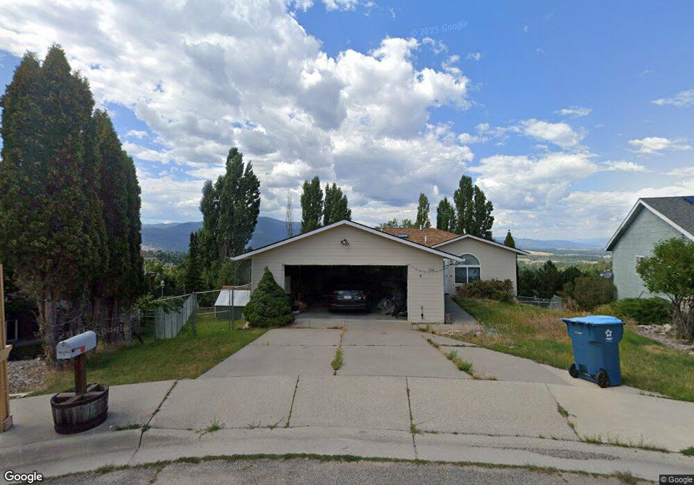
116 Erika Ct Missoula, MT 59803
Moose Can Gully NeighborhoodEstimated Value: $526,000 - $552,834
3
Beds
2
Baths
2,296
Sq Ft
$235/Sq Ft
Est. Value
About This Home
This home is located at 116 Erika Ct, Missoula, MT 59803 and is currently estimated at $538,959, approximately $234 per square foot. 116 Erika Ct is a home located in Missoula County with nearby schools including Chief Charlo School, Meadow Hill Middle School, and Sentinel High School.
Ownership History
Date
Name
Owned For
Owner Type
Purchase Details
Closed on
Jun 30, 2011
Sold by
Nichols Janelle N
Bought by
Haddad Nabil and Haddad Rebecca
Current Estimated Value
Home Financials for this Owner
Home Financials are based on the most recent Mortgage that was taken out on this home.
Original Mortgage
$179,250
Outstanding Balance
$123,551
Interest Rate
4.55%
Mortgage Type
New Conventional
Estimated Equity
$415,408
Purchase Details
Closed on
Oct 19, 2005
Sold by
Lazerte Greg A and Lazerte Kathleen D
Bought by
Nichols Janelle N
Purchase Details
Closed on
Nov 27, 2001
Sold by
Colyer Michael J and Colyer Susan E
Bought by
Lazerte Greg A and Lazerte Kathleen D
Home Financials for this Owner
Home Financials are based on the most recent Mortgage that was taken out on this home.
Original Mortgage
$143,840
Interest Rate
6.63%
Create a Home Valuation Report for This Property
The Home Valuation Report is an in-depth analysis detailing your home's value as well as a comparison with similar homes in the area
Home Values in the Area
Average Home Value in this Area
Purchase History
| Date | Buyer | Sale Price | Title Company |
|---|---|---|---|
| Haddad Nabil | -- | First American Title Company | |
| Nichols Janelle N | -- | First American Title Company | |
| Lazerte Greg A | -- | -- |
Source: Public Records
Mortgage History
| Date | Status | Borrower | Loan Amount |
|---|---|---|---|
| Open | Haddad Nabil | $179,250 | |
| Previous Owner | Lazerte Greg A | $143,840 |
Source: Public Records
Tax History Compared to Growth
Tax History
| Year | Tax Paid | Tax Assessment Tax Assessment Total Assessment is a certain percentage of the fair market value that is determined by local assessors to be the total taxable value of land and additions on the property. | Land | Improvement |
|---|---|---|---|---|
| 2025 | $5,278 | $532,400 | $221,845 | $310,555 |
| 2024 | $4,918 | $431,700 | $151,545 | $280,155 |
| 2023 | $4,874 | $431,700 | $151,545 | $280,155 |
| 2022 | $4,227 | $321,500 | $0 | $0 |
| 2021 | $3,739 | $321,500 | $0 | $0 |
| 2020 | $3,529 | $270,100 | $0 | $0 |
| 2019 | $3,523 | $270,100 | $0 | $0 |
| 2018 | $3,294 | $244,200 | $0 | $0 |
| 2017 | $3,243 | $244,200 | $0 | $0 |
| 2016 | $3,062 | $241,400 | $0 | $0 |
| 2015 | $2,690 | $241,400 | $0 | $0 |
| 2014 | $2,726 | $136,952 | $0 | $0 |
Source: Public Records
Map
Nearby Homes
- 6109 Mainview Dr
- 6121 Hillview Way
- 106 Willow Ridge Ct
- 6350 S Meadowwood Ln
- 121 Southridge Dr
- 6308 Hillview Way
- 2404 56th St
- 5605 Ebb Way
- 2340 55th St Unit 7
- 2424 55th St
- Lot 3 Miller Creek Rd
- 112 Meadowlark Ct
- 6222 Hillview Way
- 2227 E Crescent Dr
- 5105 Village View Way Unit 7
- 2615 Gharrett St
- 127 Meadowlark Ct
- 5121 Clearview Way
- 6275 Marias St
- LOT 4 Miller Creek Rd